
active units: miles km °C °F
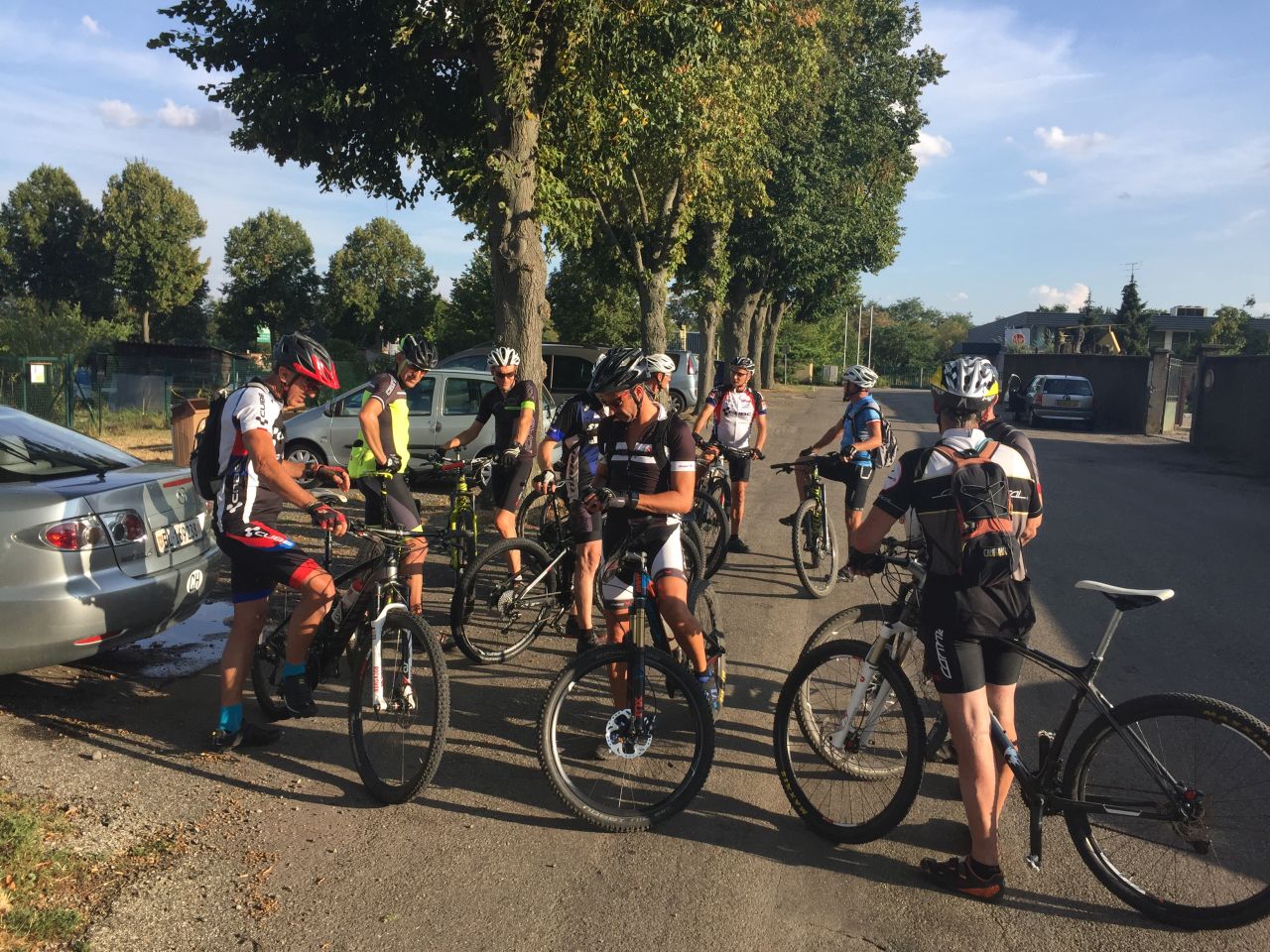
August 30, 2018
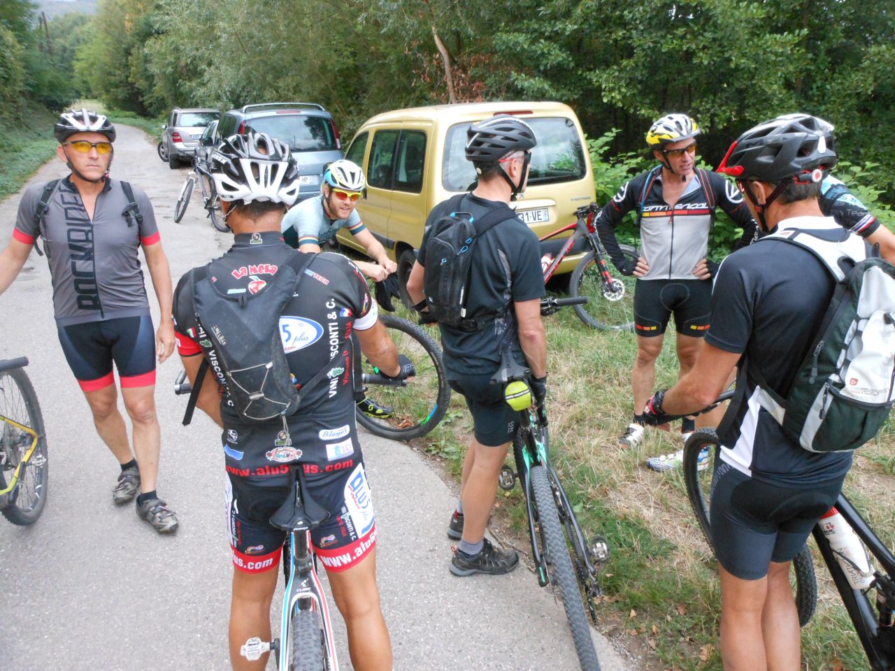
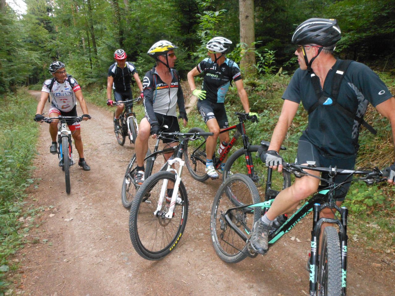
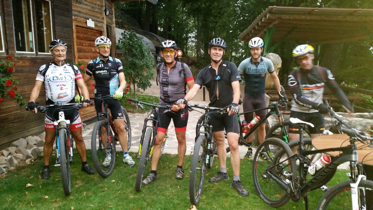
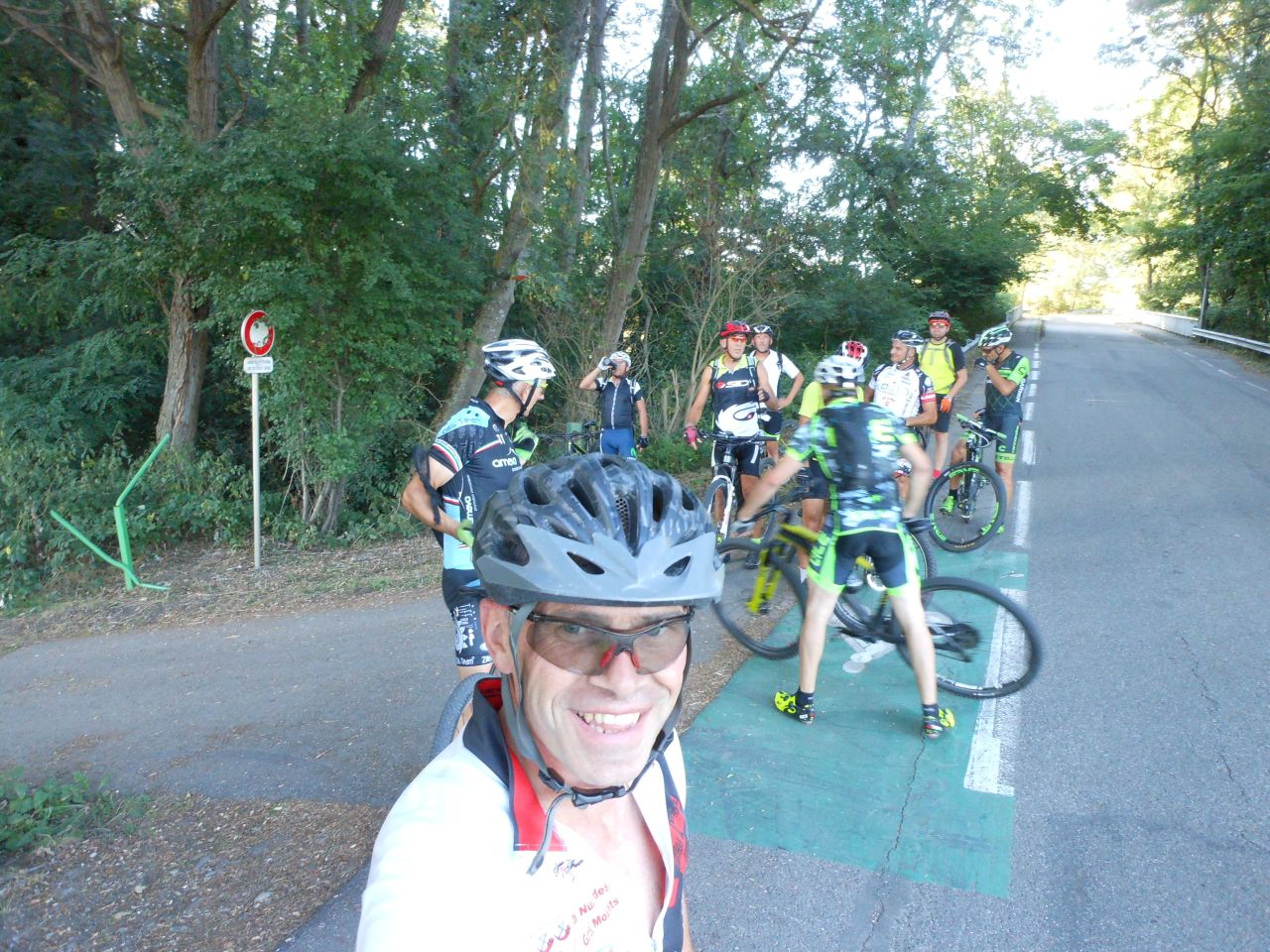
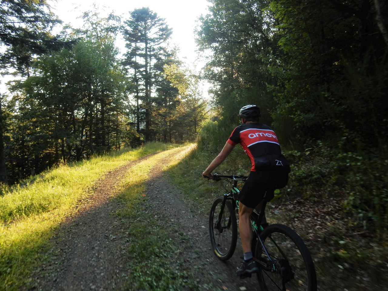
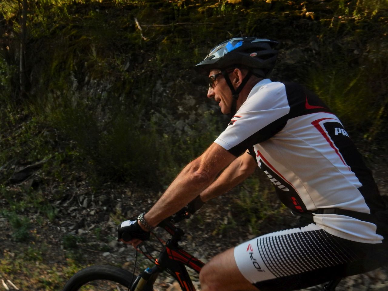
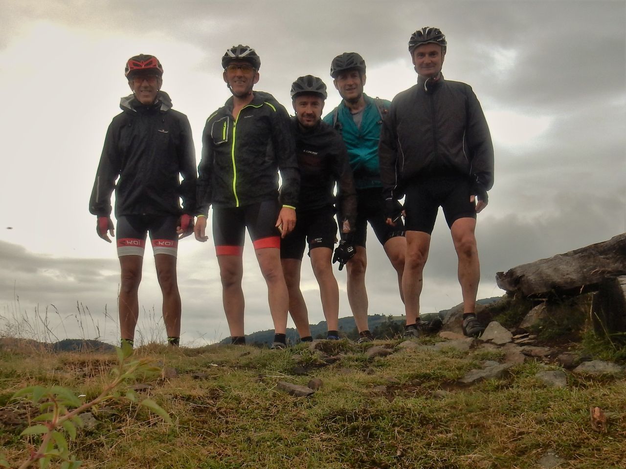
"Cantine Zeller"
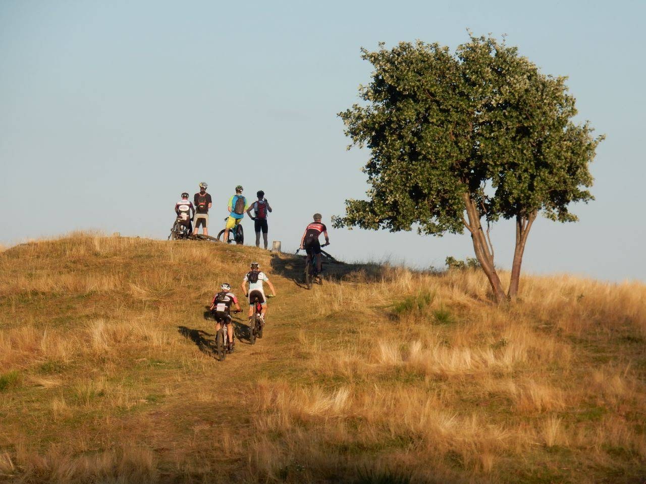
 21-17°C 70-63°F
23 km 14 miles Elev.Gain 800 m 2620 feet


8 MTB (Christophe, Claude, Jean, Jean-Claude, Julien (2), Laurent, Michel, Thierry)
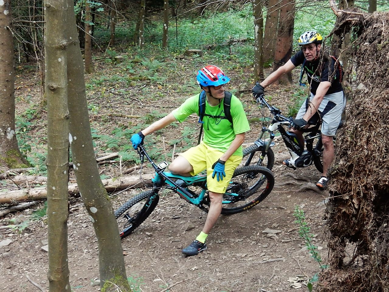
Hartmannswiller, ... croix Zimmermann, cantine Zeller, Hartmannswiller
Beautiful course, beautiful singles ... but really fast.
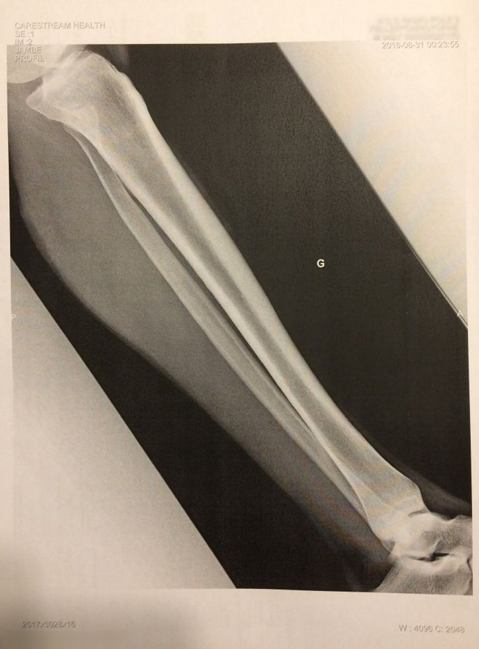
Fall .... Christophe will go to the hospital to make a Xray to check if anything is broken
no, it's OK!
but for his new bike, it's another story
The carbon stay is broken. Shit!
 11 pictures (G Photo)
pictures are from Chris and Thierry.
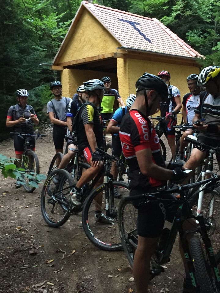
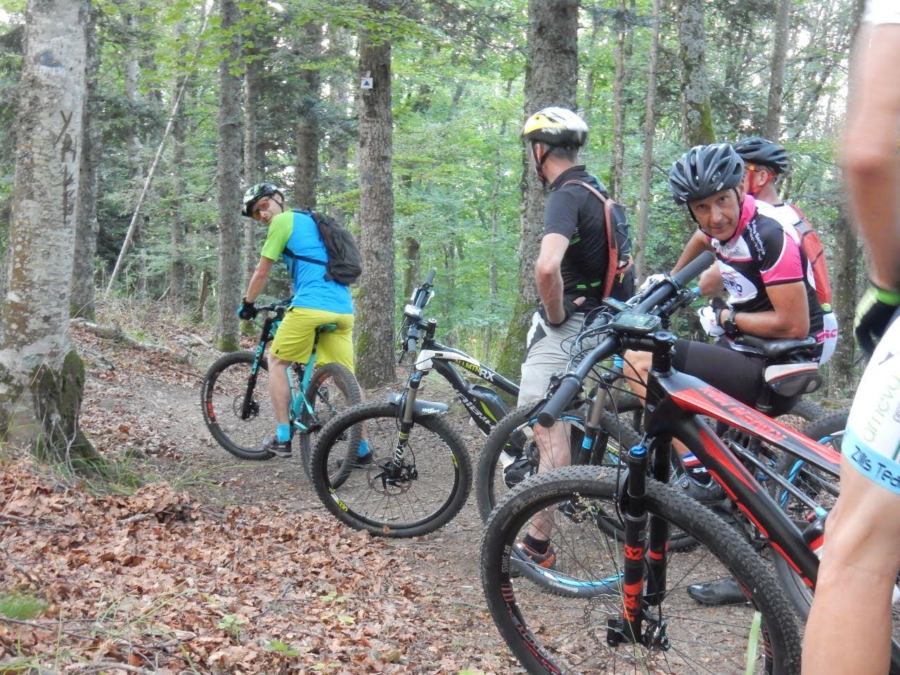
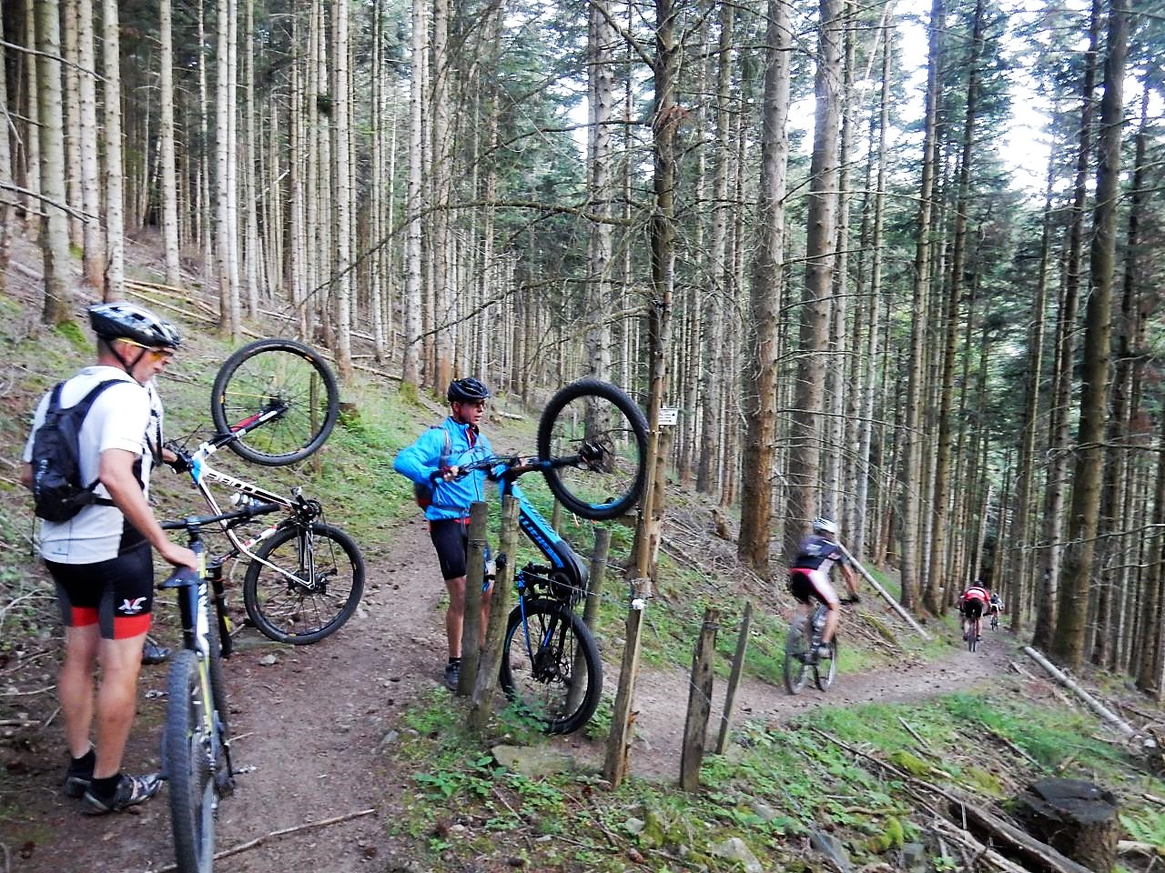
August 23, 2018
"no eBIKE"
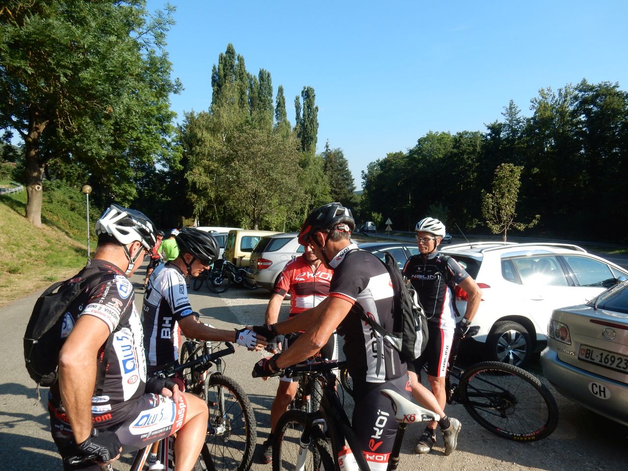
 28-21°C 82-70°F
17 km 10 miles, 1h10 Elev.Gain 350 m 1100 feet
13 MTB (2 Christophe, Claude, Denis, Georges, Gilles, Jean, Jean-Claude, Laurent, Luc, Michel, Thierry, Yves)
Guebwiller, Val du Patre, Orschwihr, Bergholtz Zell, Bergholtz, Guebwiller
Tonight, the weather is not terrible: a storm is coming.
13 people at the start
- Well, you have to stay here, because 13 it's not a good number
;-)
Val du Patre: the "olds" decide not to face the storm (which starts above Osenbach) and we take the direction of Orschwihr
We see the first drops falling and Laurent is victim of a puncture. No tweezers - no problem: Christophe operates: extraction of the spine from the tire with the teeth !!
The group is waiting in Orschwihr in front of a wine cellar. Strange, would they be thirsty?
For Laurent it's not better, now it's the rear tire that makes problem.
With Jean, we get dumped ... we find ourselves ... it's gone again. In the vineyards, I test a few bunches of grapes, thinking that the trip is over. Well no, the "olds" ;-) go back to the Mission Cross.
20h45 arrival (30mn later) of the group that have made a few more km miles. Congrats!

 15 pictures (G Photo)
 August 16, 2018
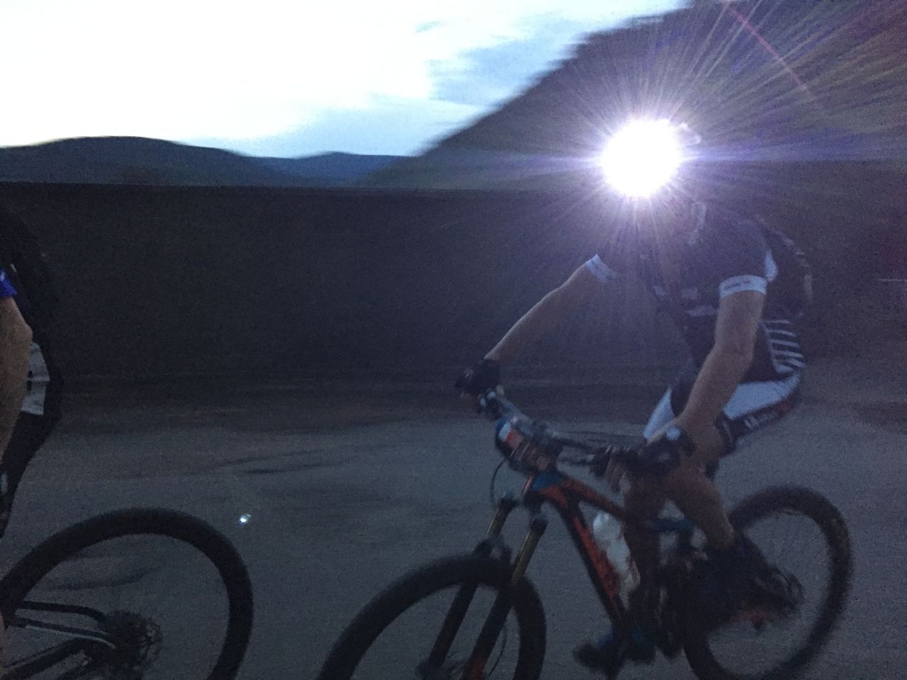
"alone or Lutterbach"
 31-22°C 88-72°F
45 km 28 miles, 2h35 Elev.Gain 200 m 650 feet
1 MTB (solo = Christophe)
or 10 ? MTB (team = Chris2, Claude, Denis, Fred, Georges, Jean-Claude, Laurent, Michel, Thierry,...)
I decide to go to the appointment without my car. It's a good idea, if you do not a puncture after 5 minutes. The tube that I bought is too small ... I go back home, running, to repair it!
I still try to reach the place of departure (Lutterbach) but I see that I would be too late.
I give up!
But I will do a - more or less - identical ride :-) with stops and shortcuts in addition, but that is not enough to find the rest of my group
vs
 solo = 8 pictures (G Photo) and
team = 15 pictures (G Photo)
solo = 8 pictures (G Photo) and
team = 15 pictures (G Photo) Remarks:
- thanks to my namesake for the "group" pictures
- for the group trip: sorry, no info for the moment
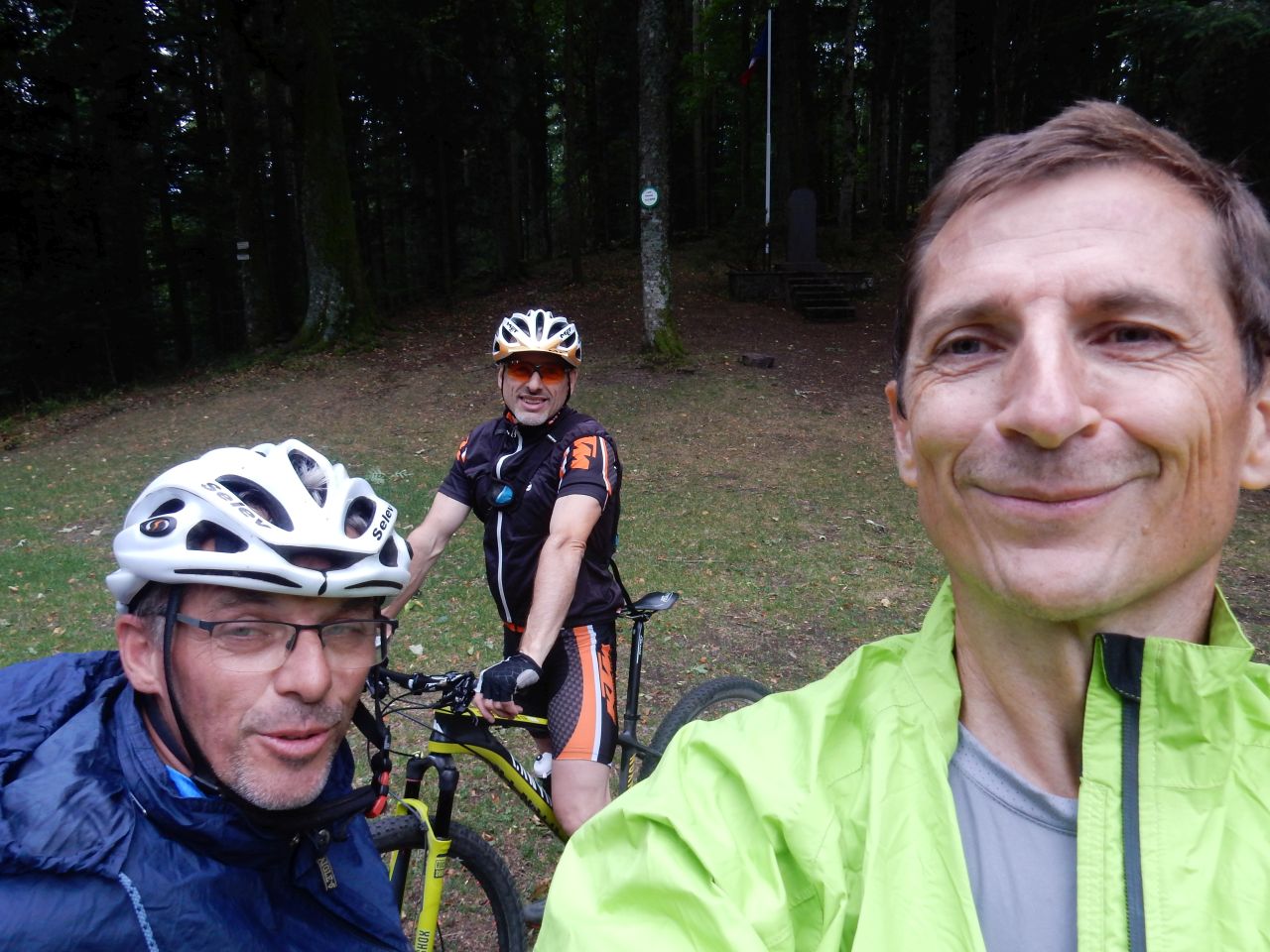
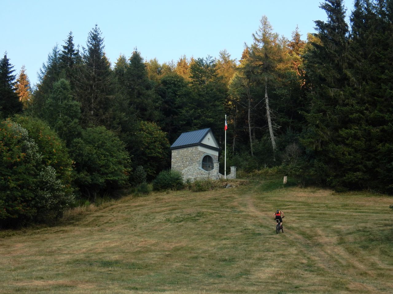
August 09, 2018
"Camp Turenne"
24-21°C 75-70°F21 km 13 miles, 2h25 Elev.Gain 680 m 2200 feet
3 MTB (Christophe, Denis, Georges)
Vieux-Thann, Roche Albert, place des Canaris, Camp des Pyramides, Camp Turenne, Baecherkopf Hisla, Waldkapelle, Croix du Rangen, chateau d'Engelbourg (castel), St Urbain (chapel), Thann
But what's going on tonight? there is only Georges and Denis !!
Could it be because of those big clouds?
It is well black on Rossberg's side: we will avoid this side.
Georges organizes the evening: direction to the Roche Albert.
I do not recognize this path (however I've done it once, in the reverse direction.)
'l'insegnante spiega la storia del castello di Thann'
the teacher explains the history of the castle of Thann
A new game (for tonight): do not dismount ... between the Place des Canaris and Camp Turenne.
Result: I skid once on a root, Georges stuck a second time his chain (before the delicate passage); so we can not try and the winner is (of course): Denis
he had to activate a gadget on his 007-bike ;-)
We meet deer twice
20h05 a jacket before the descent, except for Denis ... he's a man
Stop at the shelter of Baecherkopf Hisla.
- Are you thirsty George? Not yet.
Really magic this descent .... I love it!
20:30 Rangen cross - it's too early to return
We will go to the castle of Thann. While riding, another deer
Unbelievable.
At the end, no bike path; we go back through the vineyard to pass the chapel St Urbain.
Finally a lot of wind, but no rain.
Yes !! a great (autumnal) evening.

 25 pictures (G Photo)
 August 02, 2018
"Firstacker"
30-24°C 86-75°F25 km 16 miles, 2h20 Elev.Gain 850 m 2800 feet
7 MTB (Bernard, Christophe, Denis, Georges, Jean, Laurent, Michel)
Hartmannswiller, Col Amic, Firstacker, Hartmannswiller
It's realy hot today, so I start the tour with 2 bottles.
It will be a little quieter until the shooting range of Wuenheim. We go up to the "Carrefour de l'Heure", where a hunter prepares himself and then disappears in the woods! be careful
It goes up again well for a few km miles ...
finally, we come to the road that goes up to the Kohlschlag Farm.
Here is the small path that goes down to the Kaltenbach (river).
But no! not immediately ... another 1.5 km mile on the road and we arrive at Col Amic.
And now a new proposal: continue towards the Sudel?
OK! it's the road, but at least I'm in front of everybody :-)
Arrival at the Firstacker (955m) (3133 feet), we take the GR5 for the descent (return to Col Amic): extra!
From there, again the road to find the small path that tempted us before.
In the spring so noisy, the river is very quiet, now. And at the waterfall, it's worse: no water!
As I do not remember the name of the waterfall, I search it on an IGN map. Nothing!
Finally an info from 1912: "Wasserfall Ruchthal ... Kapuzinerthal" see a copy of the "Club Vosgien" map (.fr)
No, there must be something more recent! I will still search.
The group is waiting at the cross Zimmermann .... and bing! Here we go again.
I make a stop at the hives; there is a queen outside. But no way to photograph it. Grrr
George waited for me; we try the path on the left. No one! Jean will find us :-( (no way to be quiet)
Finally we go through the Domain of Ollwiller, where we see a roe deer.
We will end the evening on the terrace of "Chez Michel"
- Gsundheit (= "cheers" in Alsatian)

 14 pictures (G Photo)
 July 26, 2018
"Murbach ride"
30-28°C 86-82°F24 km 15 miles, 2h30 Elev.Gain 730 m 2400 feet
8 MTB (Christophe, Dominique, Eric, Jean, Jean-Claude, Laurent, Michel, Romuald)
Guebwiller, Buhl, Murbach, Wolfsgrube, Lieserwasen, Judenhut, Ebeneck, Gueb
6:30 pm: the van of the "A-Team" arrives thoroughly ... 2 guys come out: "Hannibal" Smith and Templeton "Faceman" ? no, but one with a big wallet, the other has a much smaller :-)
But both have eBike. Oughh!
Romuald manages the tour. Perfect.
We go up through the Wolfsgrube then Lieserwasen to arrive at Judenhut.
You have to fill the can which is already empty. We sweat well with these temperatures, even if we still lost a few degrees in the mountains.
And now the descent: direction Birkenfelsen and Rocher St Pirmin.
A short detour to the Ebeneck and its cows.
Right after, Romuald shows us a "top level" track that he did with Jérôme Clementz. What? difficult! No. wait, I show you the rest of it .... actually, the level is serious!
So I push the bike and try to follow the trail ;-)
A little later it will be JC who will suffer a puncture
We go to Peternit, and there, we leave aside the Rehbrunnenkopf (it is late) to go down. Great!
Some more pedaling to get to the car park. But! we miss 2 guys. Eric and Dominique !! Jean draws his phone: they made a stop at the pizzeria.
No! you don't believe it. No face-to-face lunch .... so we land (almost) all over there to finish the evening at the lakeside terrace.
Excellent! (and thank you again for the invitation)
 33 pictures (G Photo)
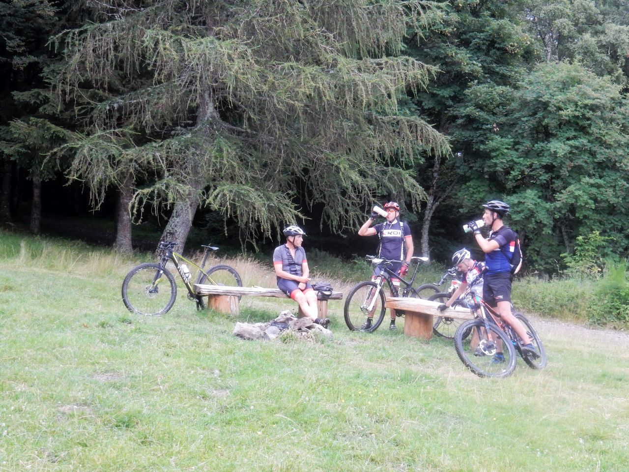
 July 19, 2018
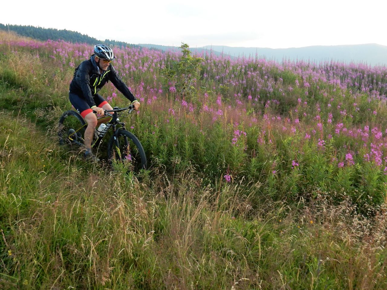
"lac du Ballon"
28-23°C 82-73°F31 km 19 miles, 2h50 Elev.Gain 975 m 3200 feet
11 MTB (Bernard, Christophe, Claude, Dominique, Eric, Gilles, Jean, Jean-Claude, Michel, Romuald, Thierry)
Guebwiller, Lautenbach-Zell, Gustiberg, lac du Ballon, Gustiberg, Sengern, Buhl, Guebwiller
The "lac du Ballon" is a lake near the Grand Ballon mountain.

 23 pictures (G Photo)
 July 12, 2018
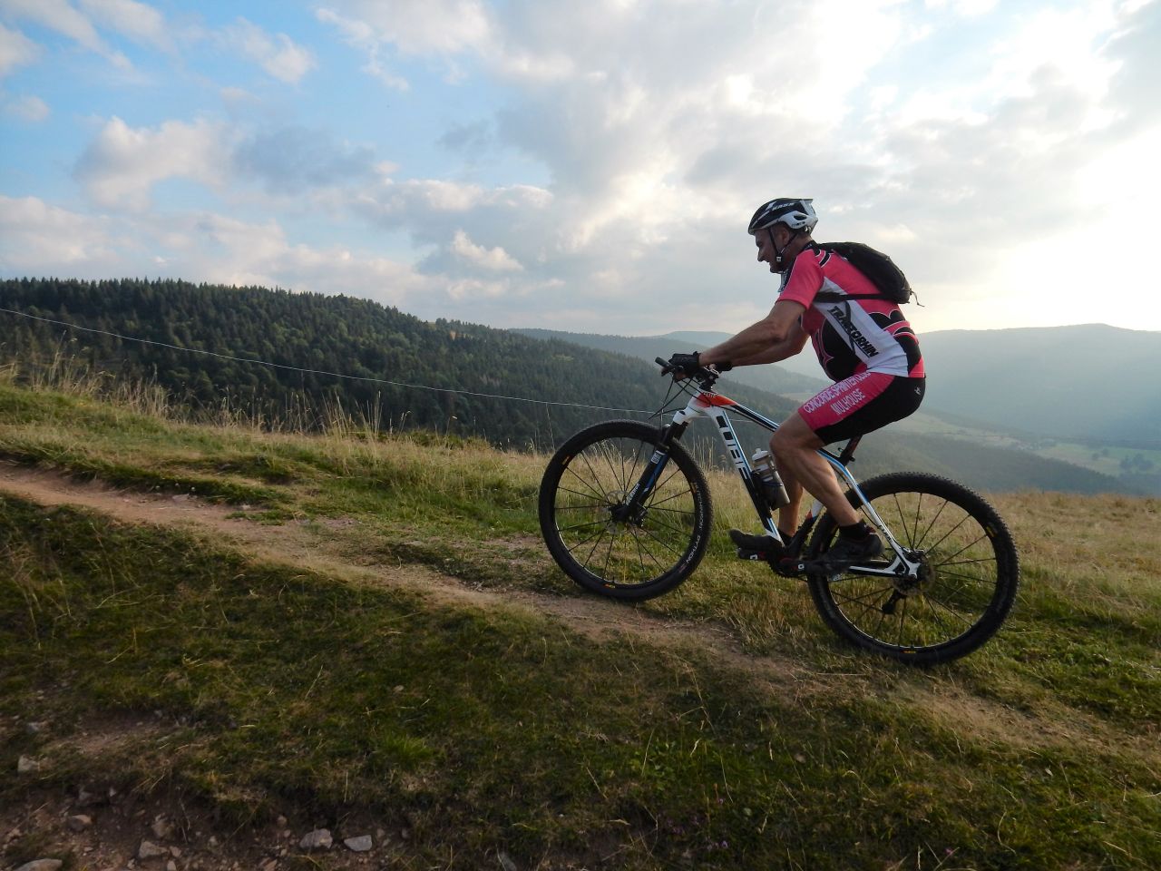
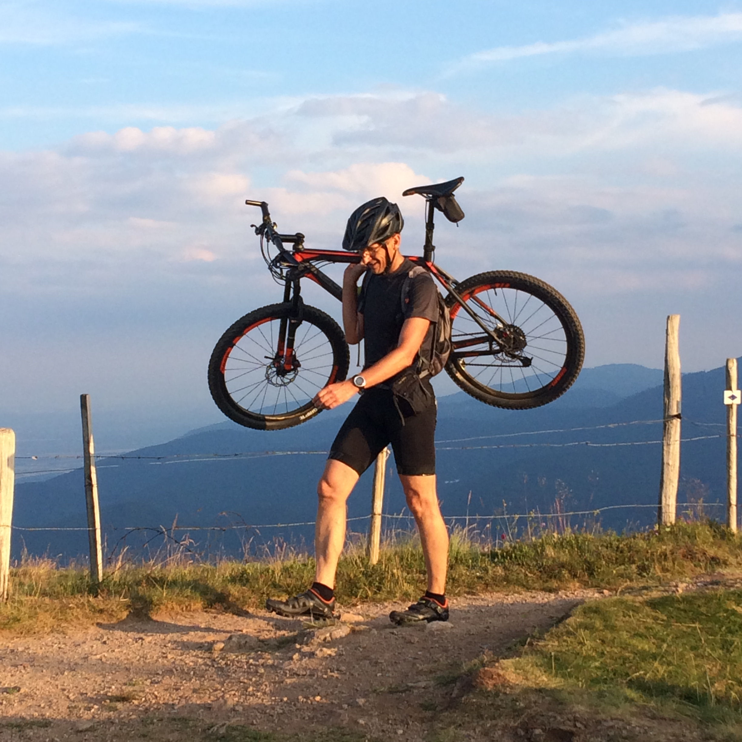
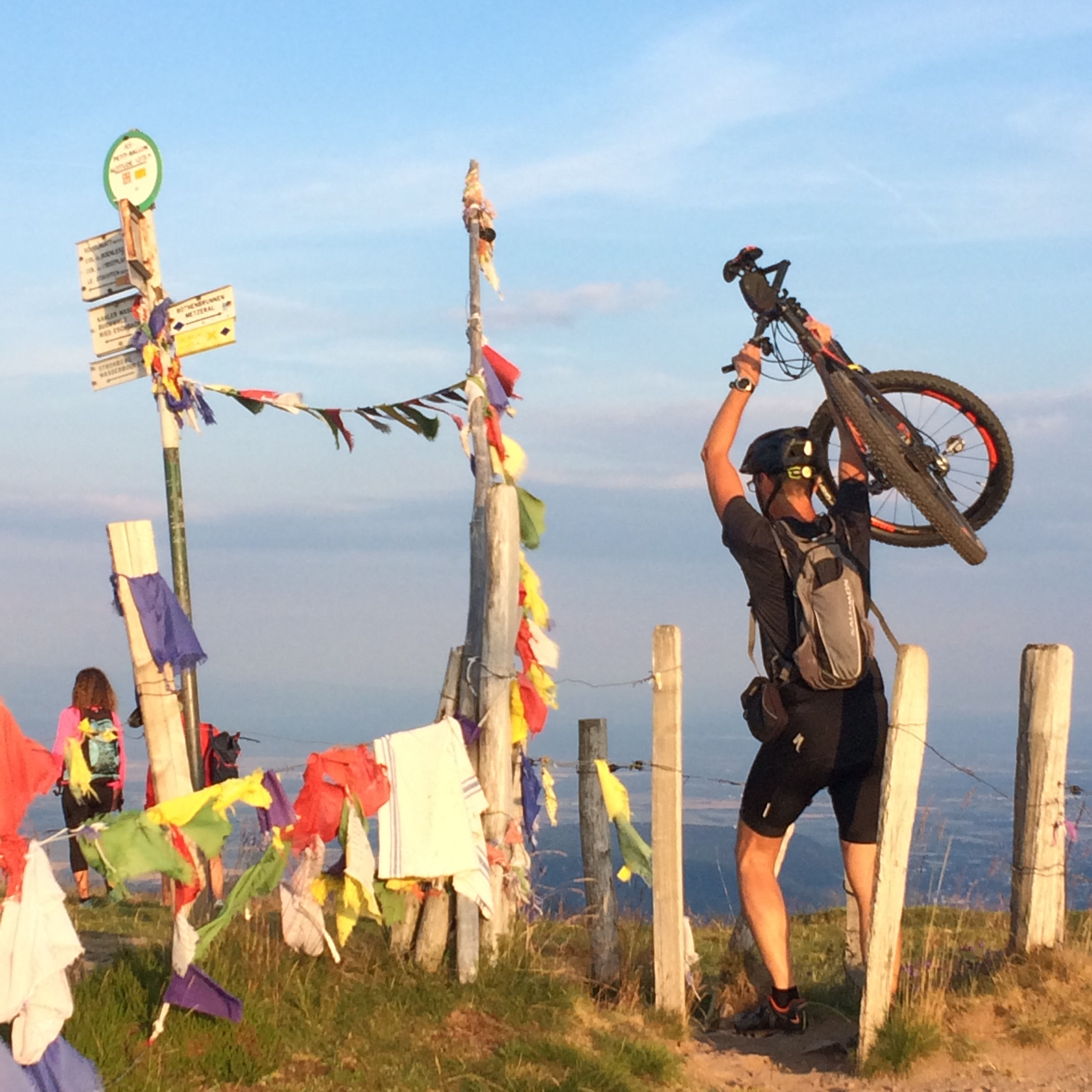
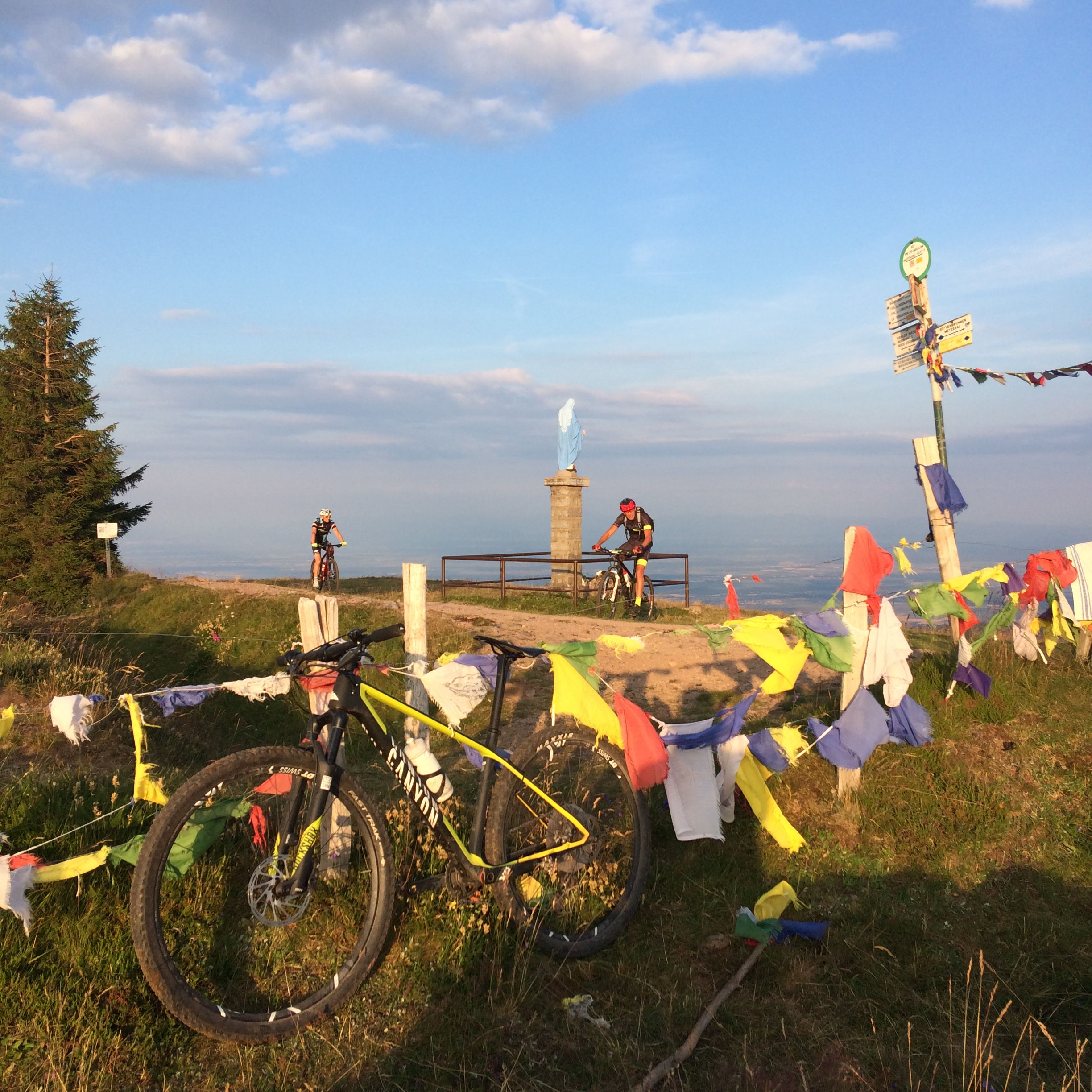
"Petit Ballon"
24-18°C 75-64°F31 km 19 miles, 3h Elev.Gain 1050 m 3450 feet
7 MTB (Christophe, Claude, Jean-Claude, Luc, Michel, Pascal, Thierry)
Guebwiller, Lautenbach, Boenlesgrab, Strohberg, Petit Ballon, Drei Schoepf, Boenlesgrab, Bannstein, Guebwiller
The Petit Ballon is a peak of the Vosges Mountains. Its height is 1272 m 4173 feet


from Chris

from Claude
40 pictures (G Photo) July 05, 2018
"Judenhut and Ebeneck"
 20°C 68°F
28 km 17 miles, 2h10 Elev.Gain 820 m 2700 feet
5 MTB (Christophe, Claude, Jean-Claude, Luc, Thierry)
Guebwiller, Heidenbuckel, Peternit, Munsteraeckerle, Judenhut, Ebeneck, Murbach, Gueb.


 30 pictures (G Photo)
  and before ?