
September 01, 2011
"Camp Turenne"
 28-24°C 82-75°F
17 km 10 miles - 1h30
Elev.Gain 600 m 2000 feet
28-24°C 82-75°F
17 km 10 miles - 1h30
Elev.Gain 600 m 2000 feet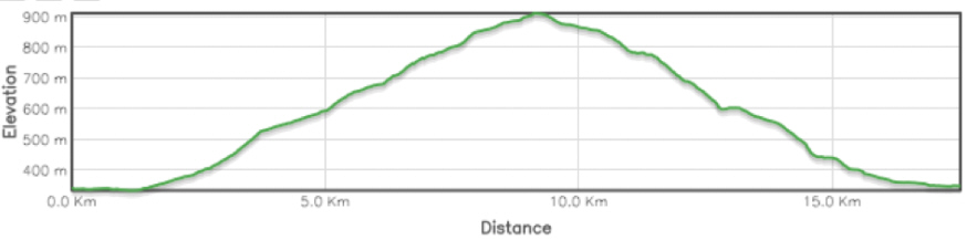

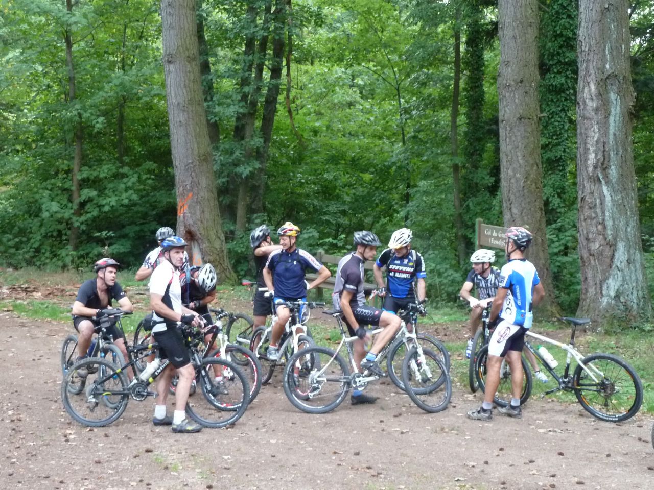
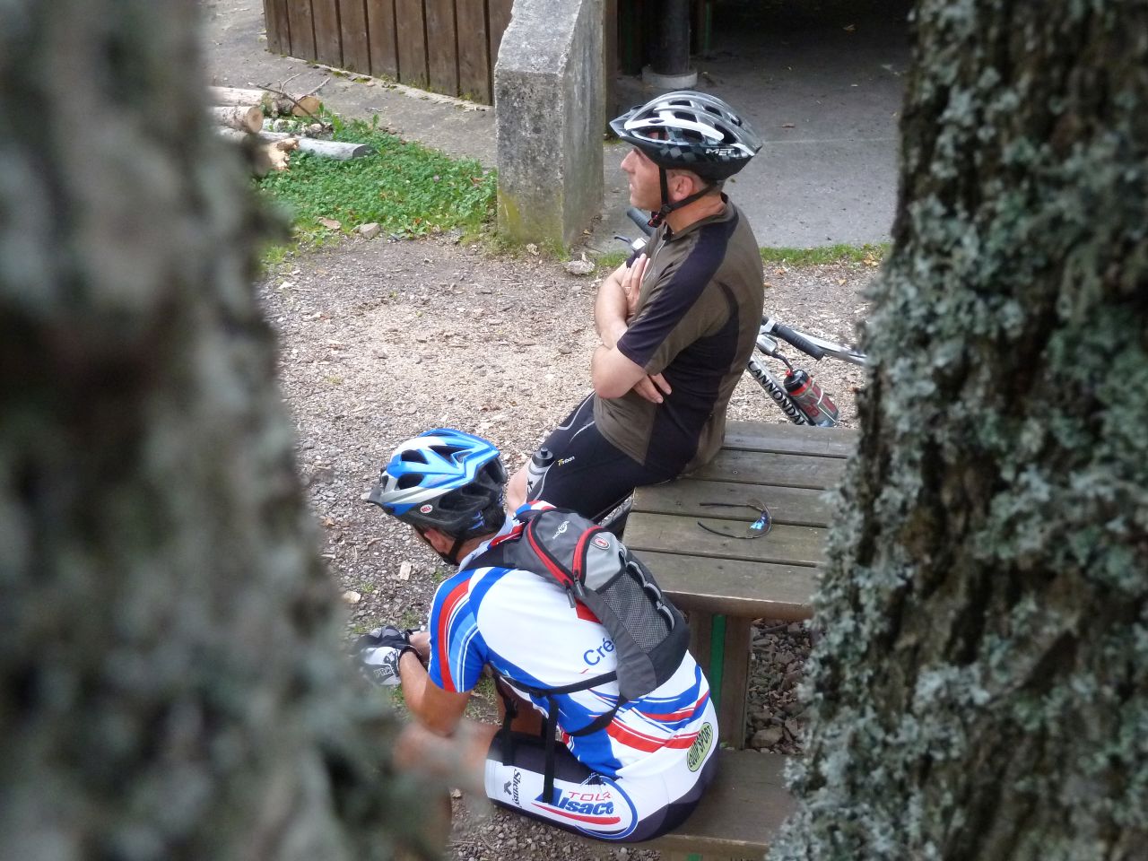
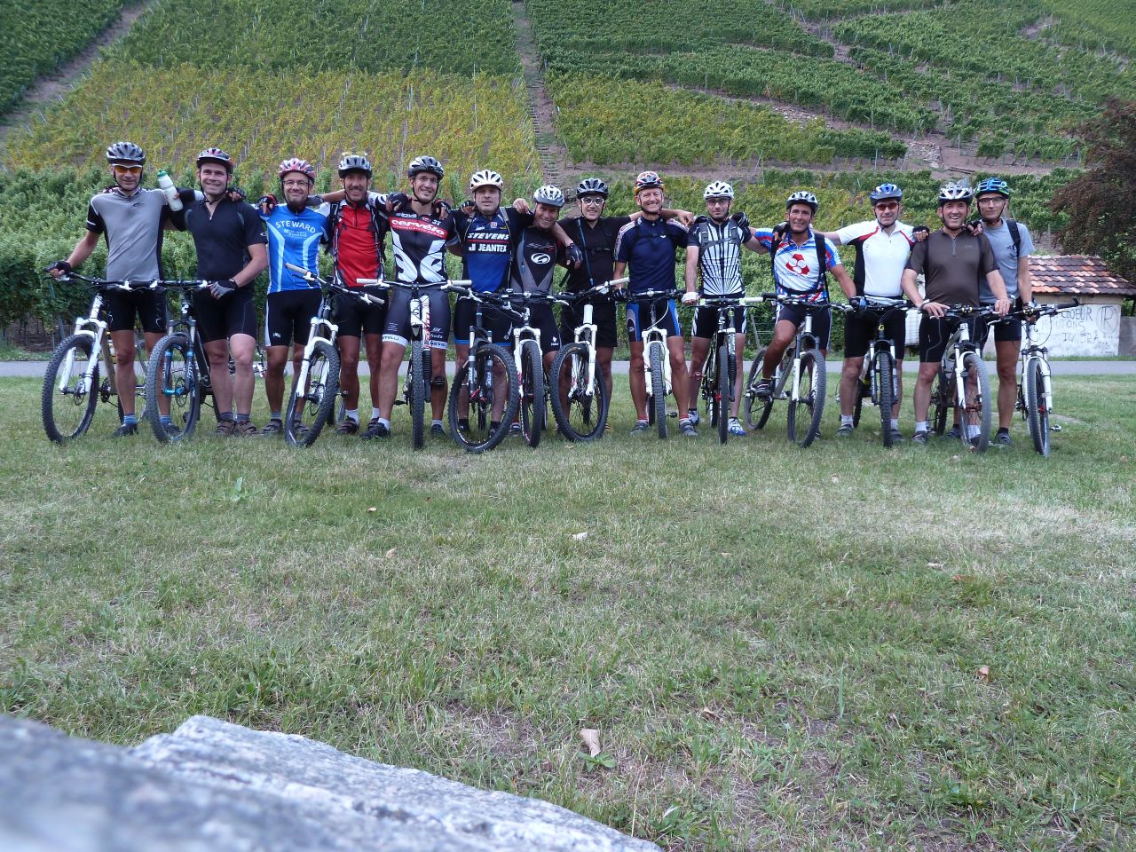
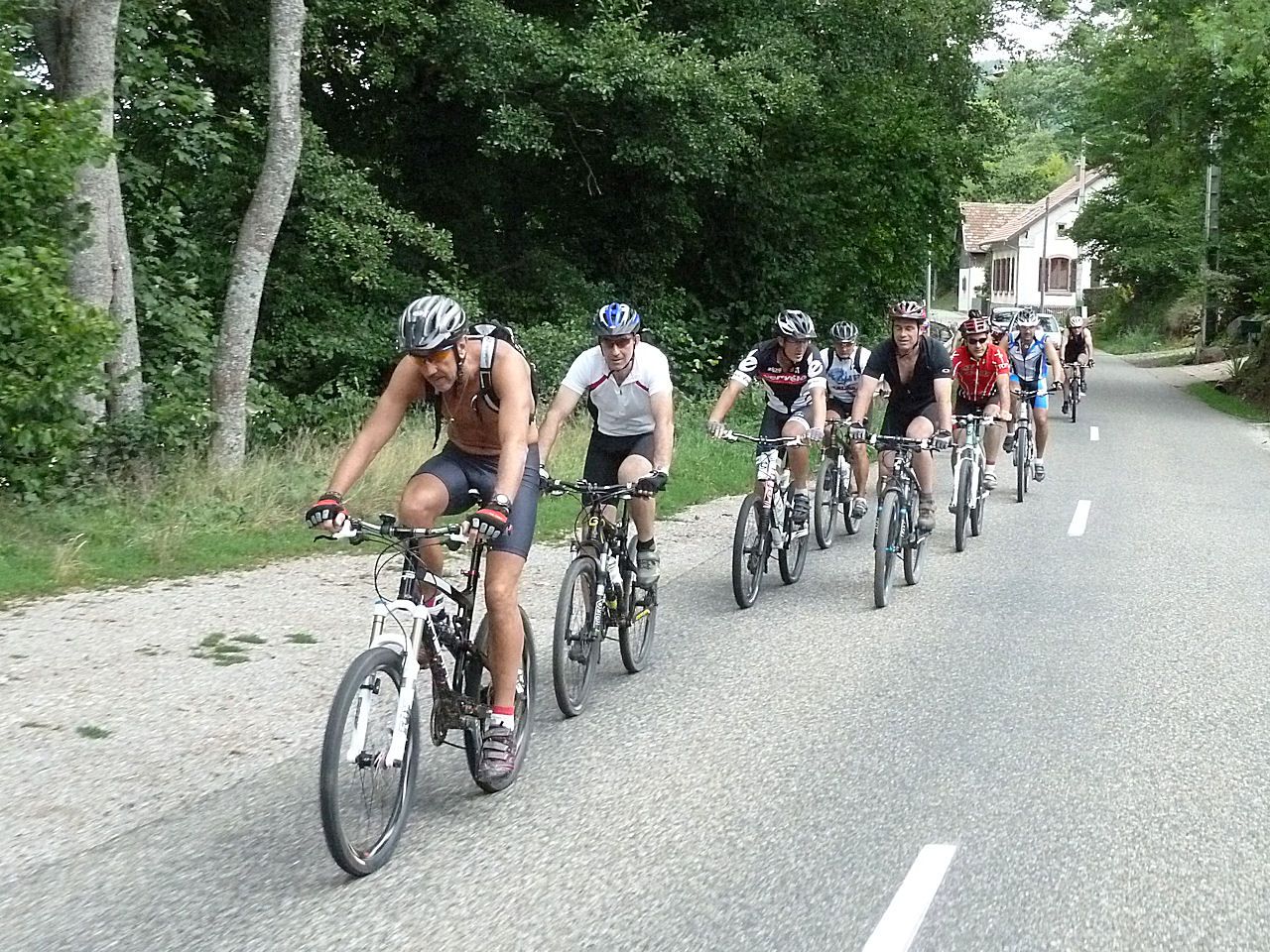
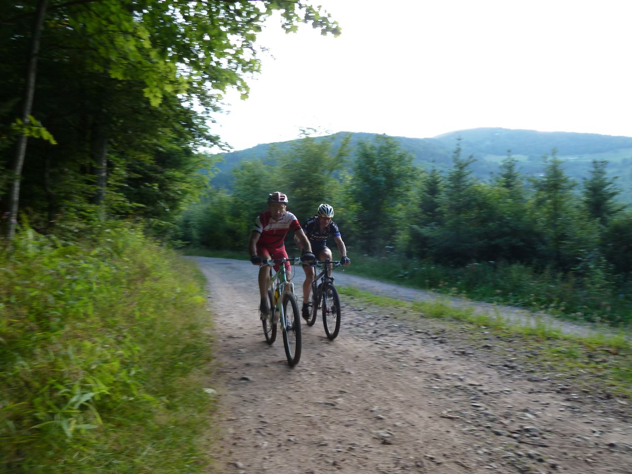
14 MTB (Alain, Bernard, Christian, Christophe, Claude, Denis, Franck, Gilles, Julien, Laurent, Michel, Sylvain, Thierry, Yves)
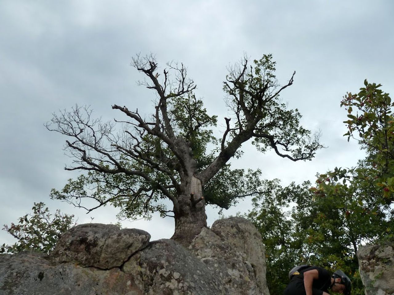
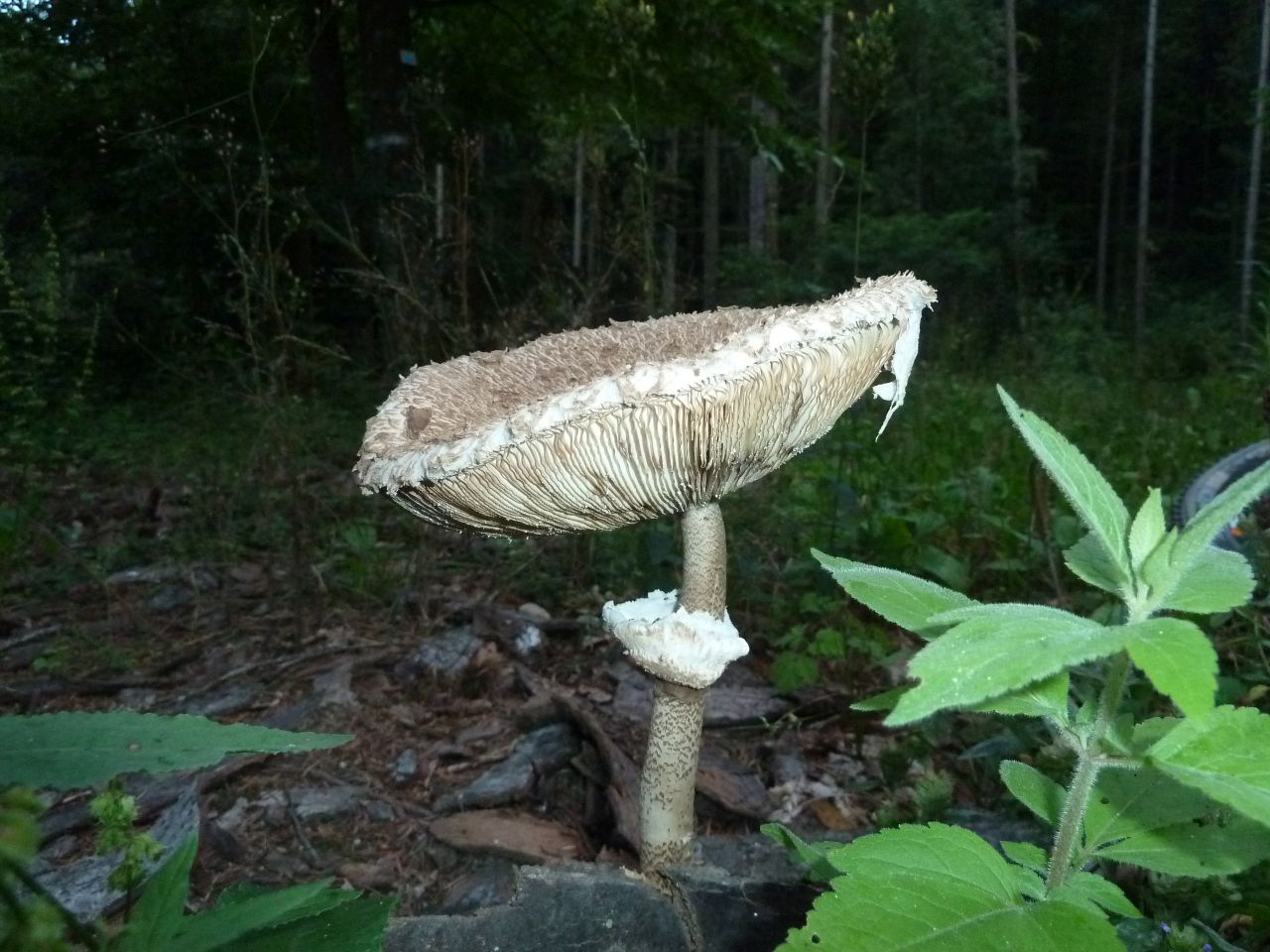
Vieux Thann - Katenbachrunz - col du Grumbach (580m) - Rehbrunnel (chêne Wotan) - Pastetenplatz - camp Turenne (908m) - Camp des Pyramides (782m) - col du Grumbach - Oeil de la Sorcière - Vieux Thann
 |
 |
 |
 |
 23 pictures (G Photo)
August 25, 2011
"Schauenberg"
31-25°C 88-77°F
35 km 22 miles - 2h10
Elev.Gain 800 m 2600 feet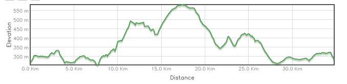
11 MTB (Alain, Christophe, Claude, Denis, Eric, Georges, Gilles, Laurent, Michel, Thierry, Yves)
Guebwiller - Orschwihr - Soultzmatt - ND du Hubel - Notre Dame de Schauenberg - couvent St Marc - Schauenberg - chataignier de Pfaffenheim - cerisier (Strangenberg) - Westhalten - Orschwihr - Bergholtz Zell
 |
 |
 |
 |
29 pictures (G Photo) August 18, 2011
"Attaque no 3"

 31-25°C 88-77°F
20 km 12 miles - 1h40
Elev.Gain 560 m 1800 feet
31-25°C 88-77°F
20 km 12 miles - 1h40
Elev.Gain 560 m 1800 feet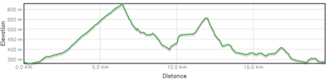
15 MTB (Alain, Belmiro, Bernard, Christophe, Claude, Denis, Jean-Claude, Jean-Luc, Julien, Laurent, Luc, Michel, Romuald, Stephane, Thierry)
Guebwiller - Murbach - col du Schrangen - St Barnabé - col du Schrangen - étangs du Geffenthal - Schweighouse - Guebwiller
 |
 |
 |
 |
29 pictures (G Photo) August 11, 2011
"Dreimarkstein"
27-21°C 80-70°F
34 km 21 miles - 2h20
Elev.Gain 660 m 2200 feet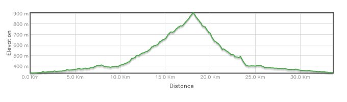
13 MTB (Belmiro, Bernard, 2 Christophe, Claude, Denis, Fabien, Gilles, Marco, Michel, Olivier, Thierry, Yves)
Vieux Thann - Bitschwiller - Willer-sur-Thur - Moosch - col des Dreimarkstein ...
 |
 |
 |
 |
31 pictures (G Photo) 
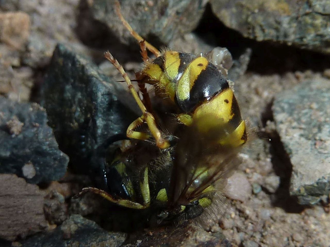
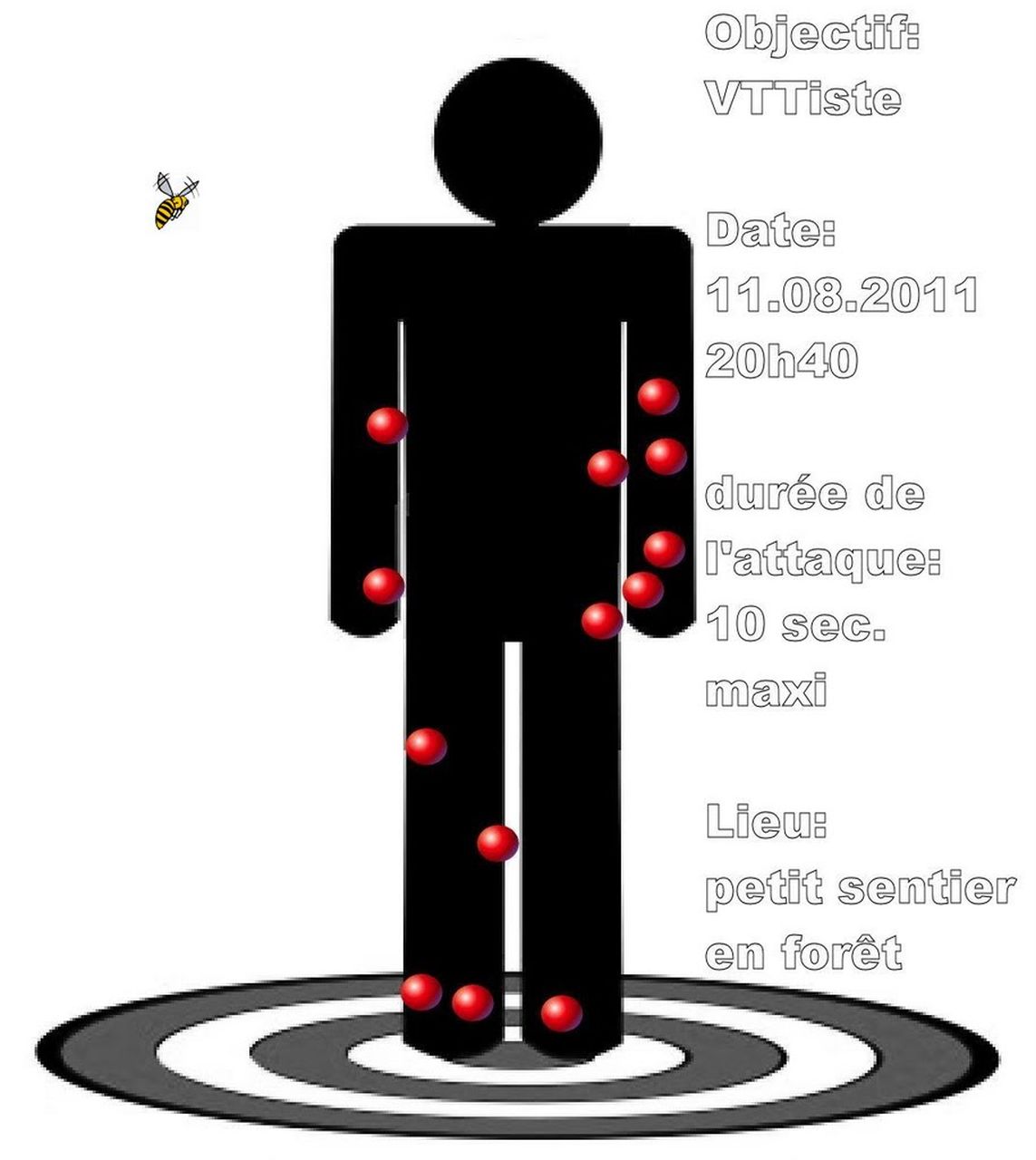
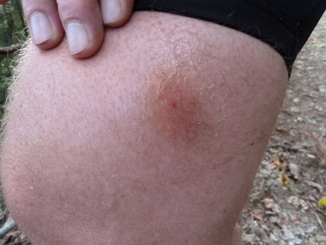
- 13 wasp stings for Christophe.
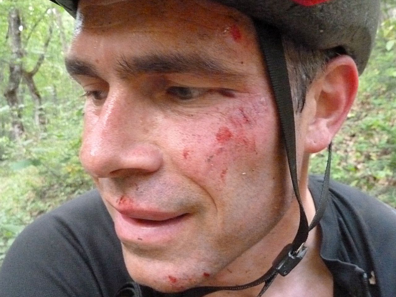
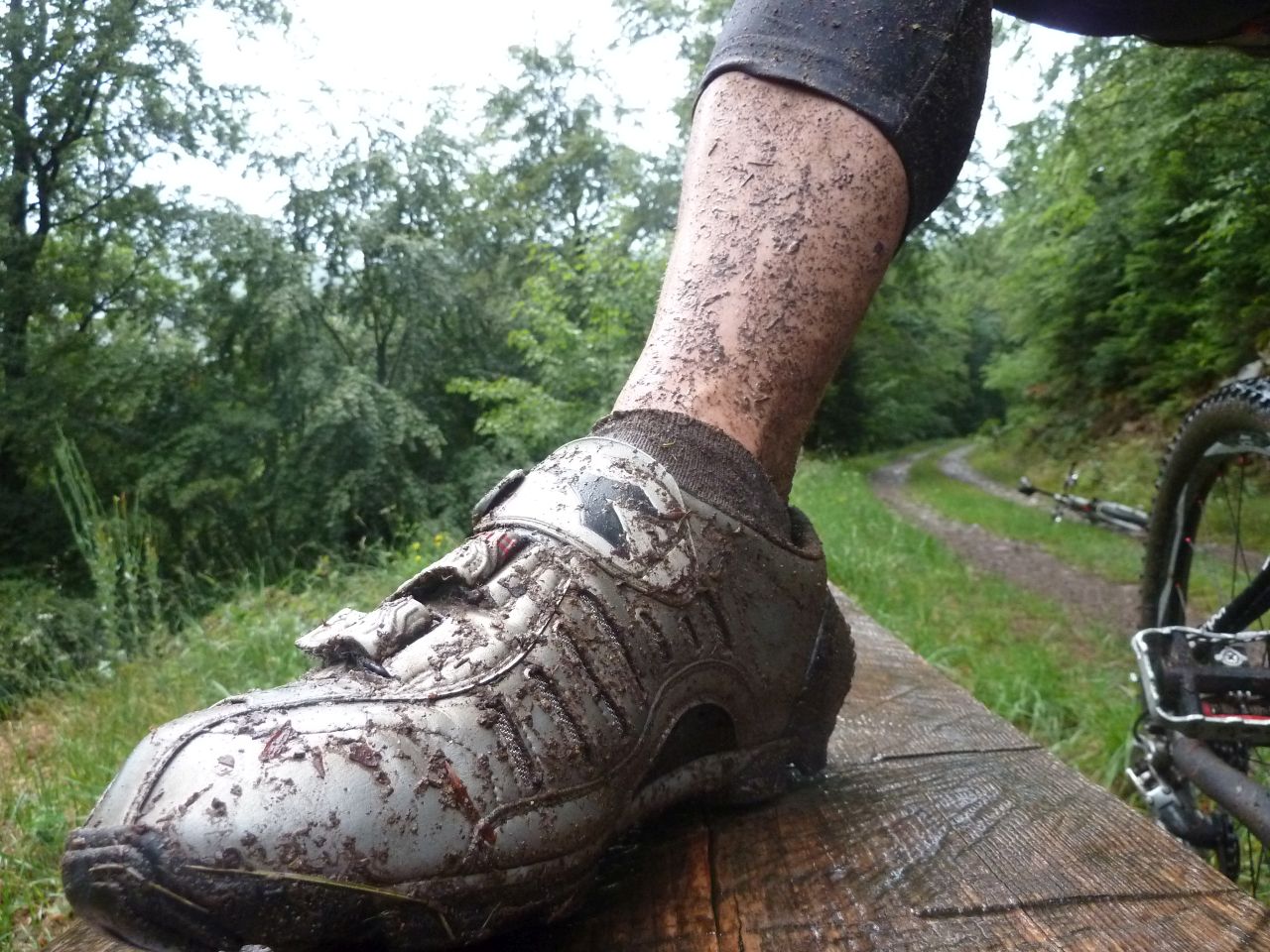
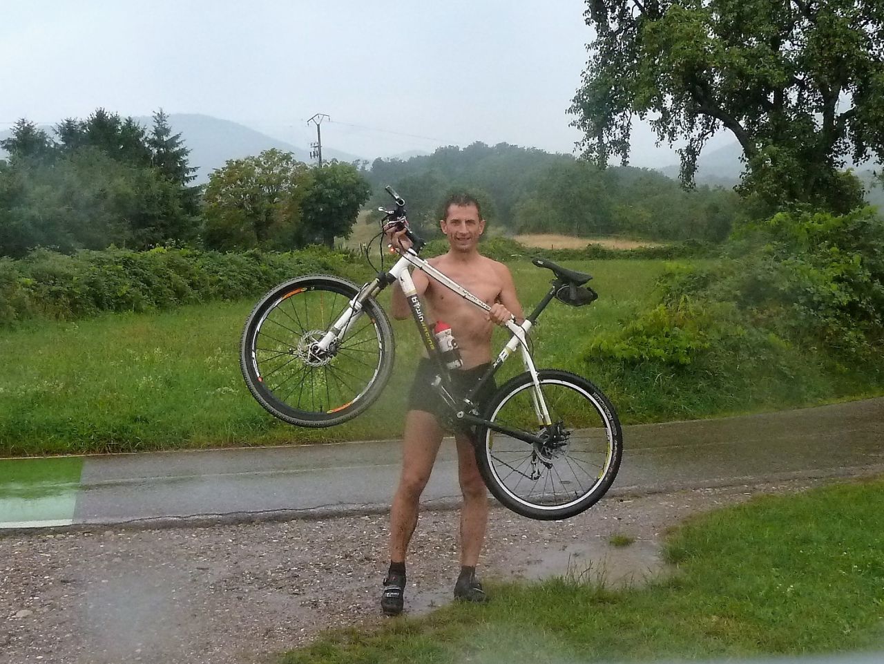
August 4, 2011
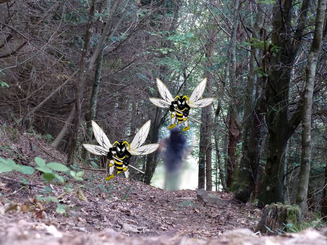
"L'attaque des guêpes"
30-23°C 86-73°F
22 km 14 miles - 2h00
Elev.Gain 740 m 2400 feet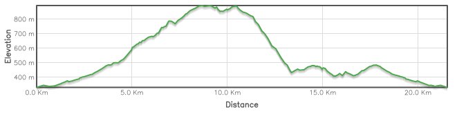
11 MTB (Belmiro, Bernard, Christophe, Denis, Fabien, Franck, Julien, 2 Thierry, Thomas, Yves)
Guebwiller - col du Bannstein - Boenlesgrab - Plaine de Rouffach - Rehfelsen - Bannstein - Guebwiller
 |
 |
 |
 |
 |
28 pictures (G Photo) the injuries....
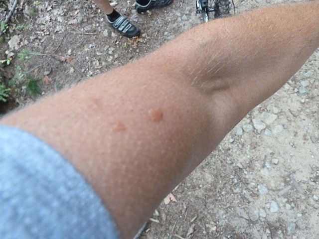 Christophe |
 Thierry M |
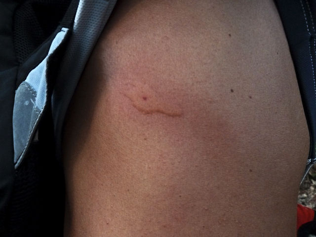 Thierry Z |
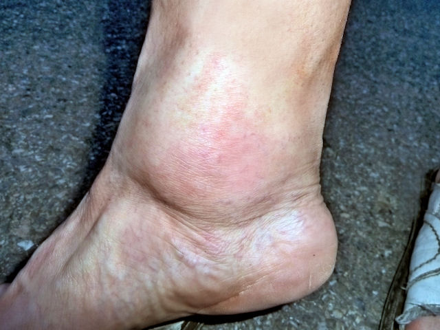 Denis |
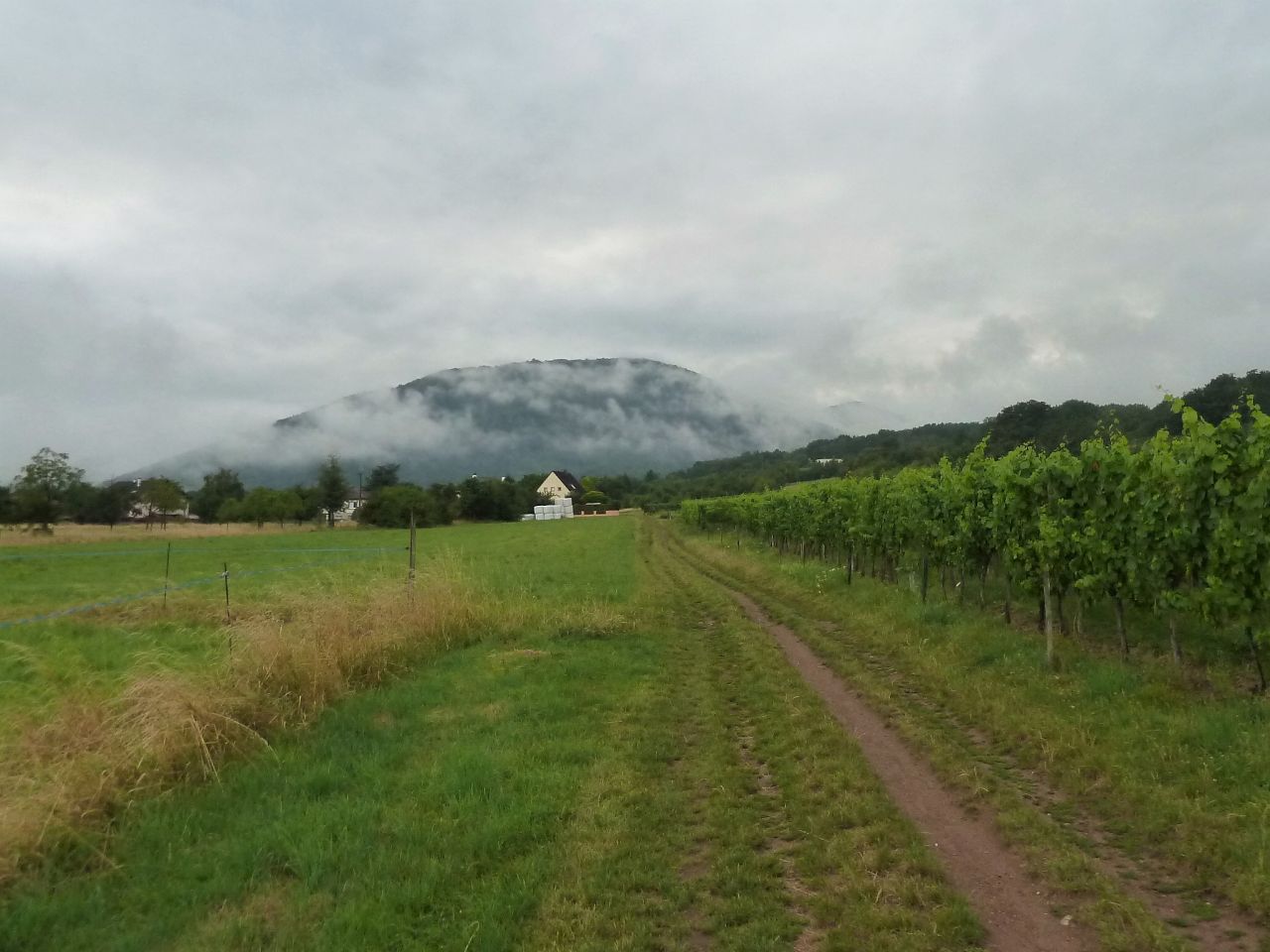
July 07, 2011
"aquabike"
 20-16°C 68-61°F
22 km 14 miles - 1h50
Elev.Gain 800 m 2600 feet
20-16°C 68-61°F
22 km 14 miles - 1h50
Elev.Gain 800 m 2600 feet
2 MTB (Christophe, Jean G.)
Soultz - Ehrenfriedhof - cantine Zeller - Hartfelsen - Ste-Anne - Thierenbach - Jungholtz
 |
 |
 |
 |
17 photos (G Photo)  and before?