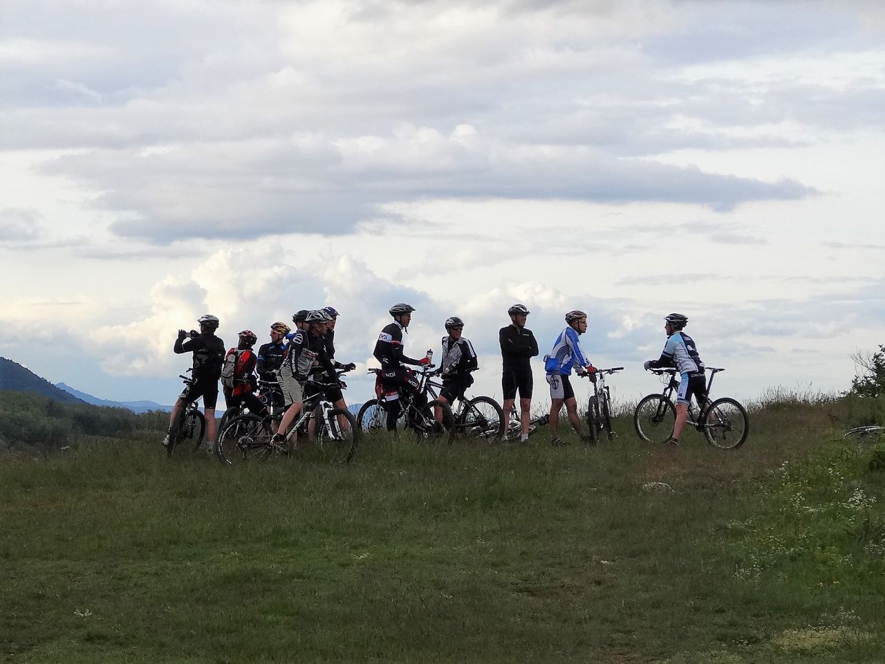
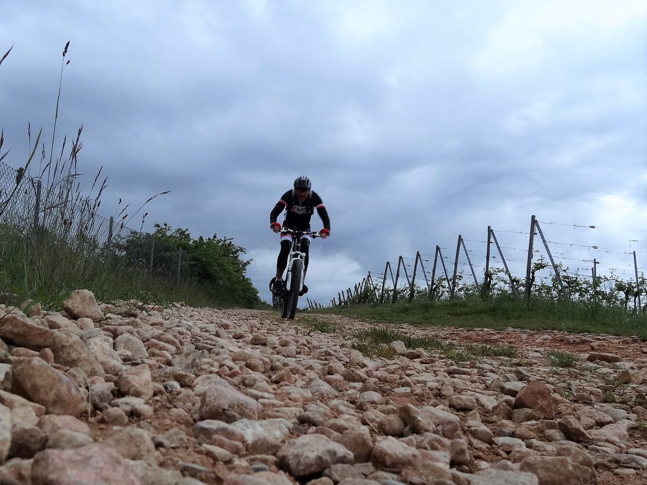
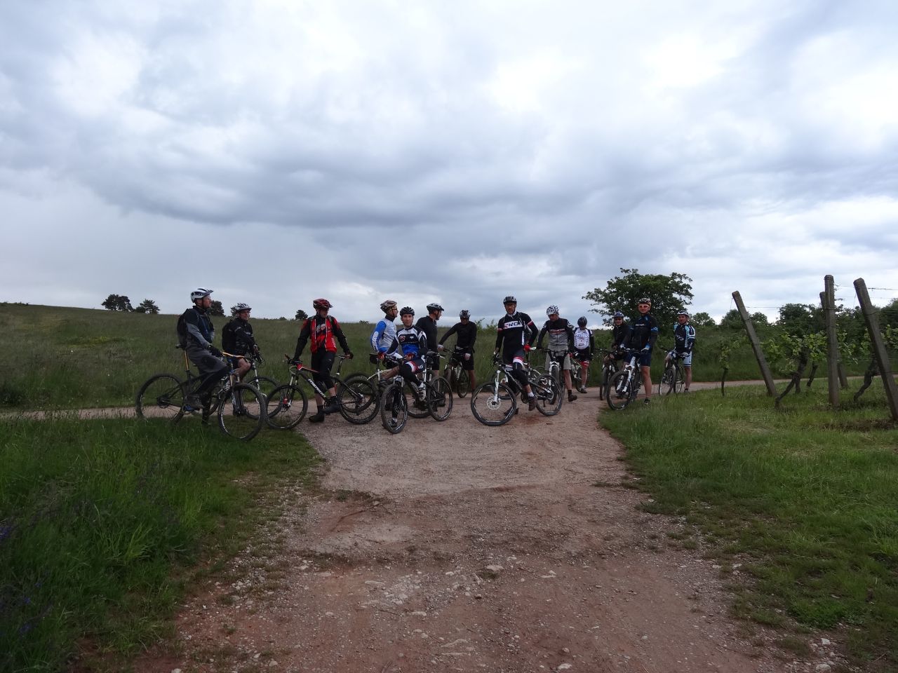
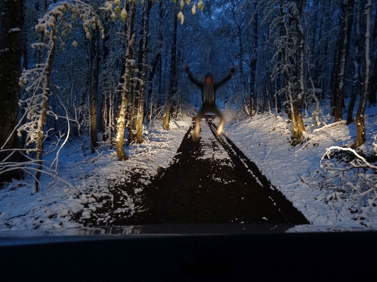
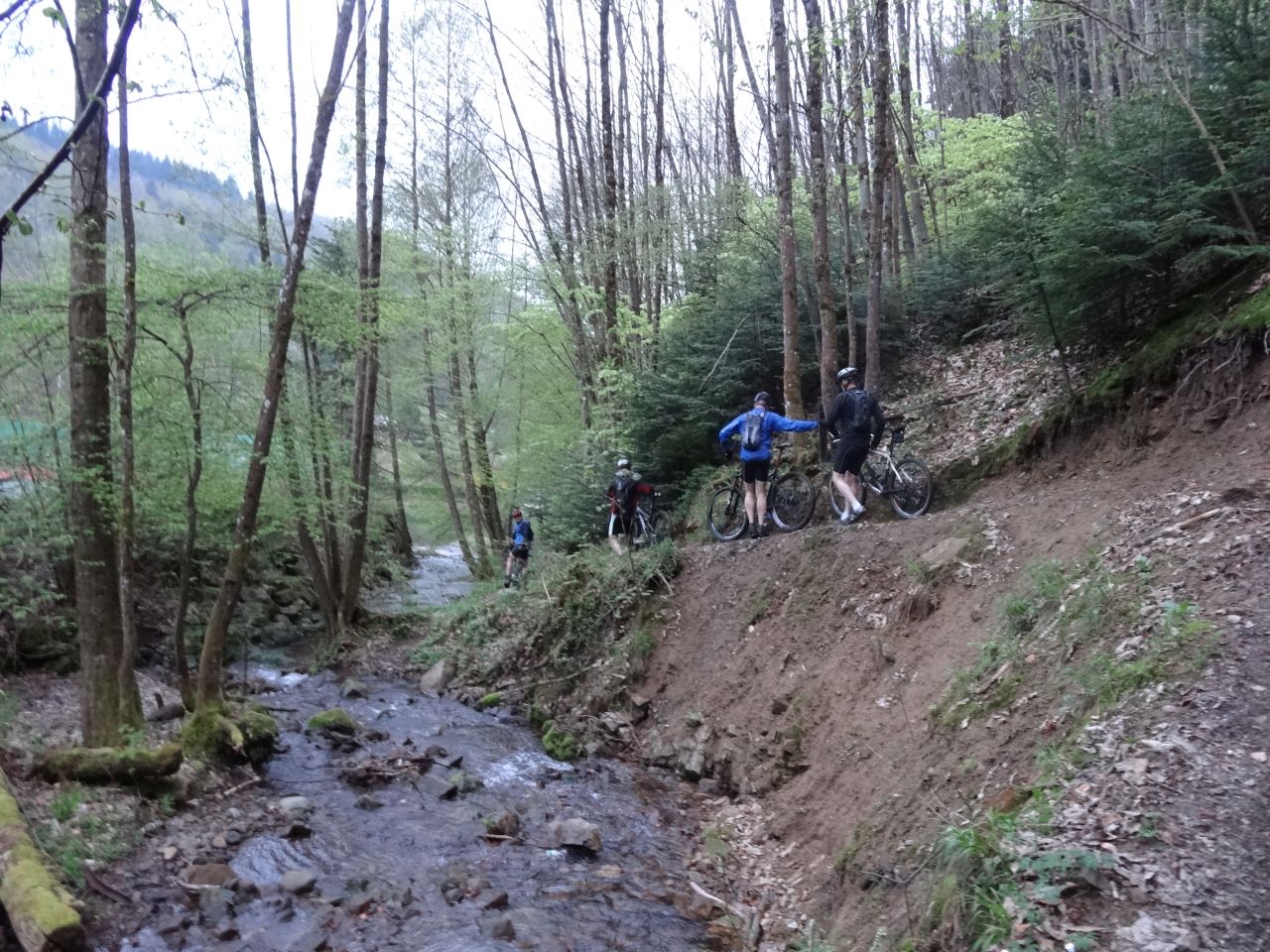
active units: miles km °C °F

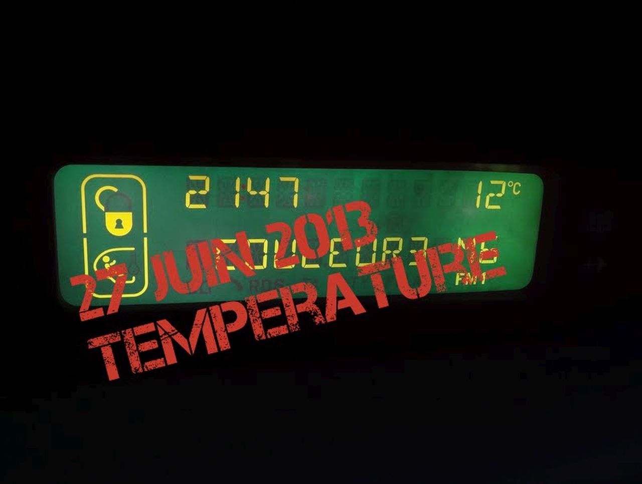
June 27, 2013
"HWK"
 (5mn)
(5mn)  15-12°C 59-53°F
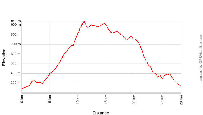
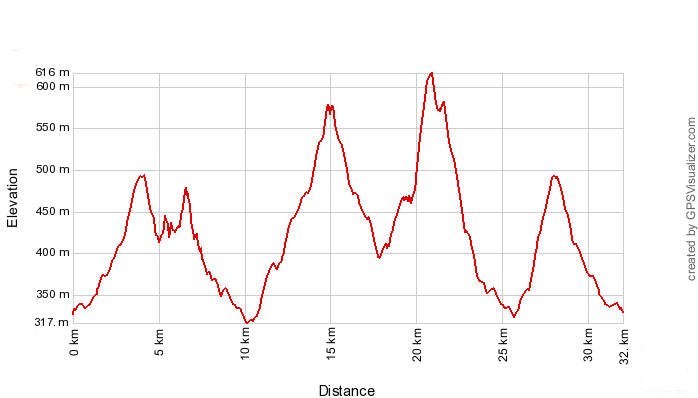
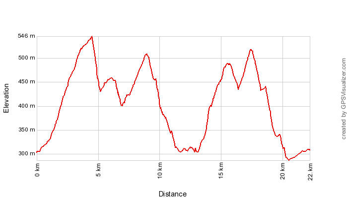
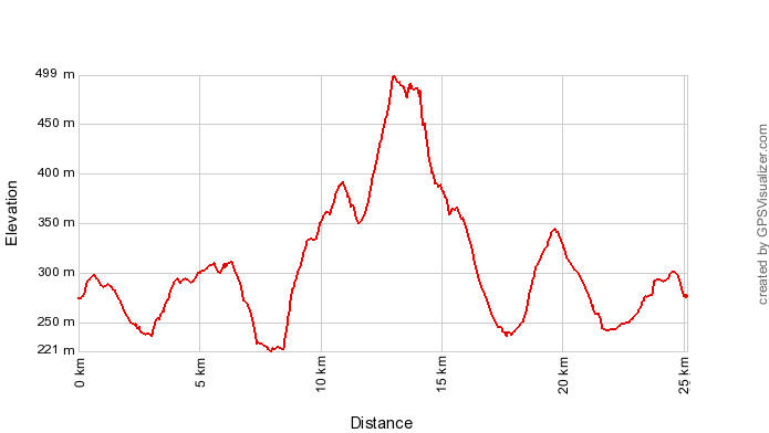
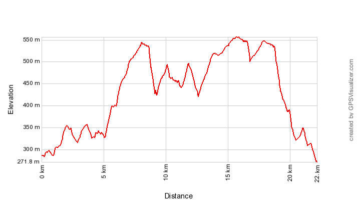
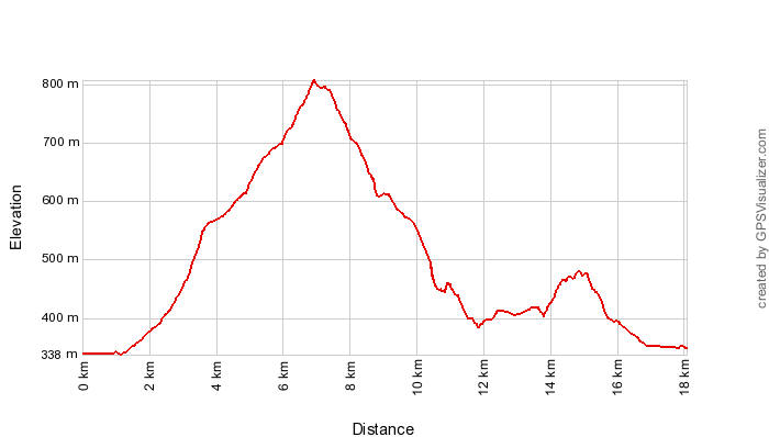
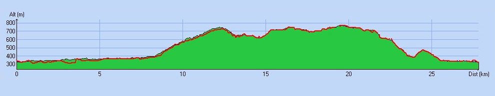
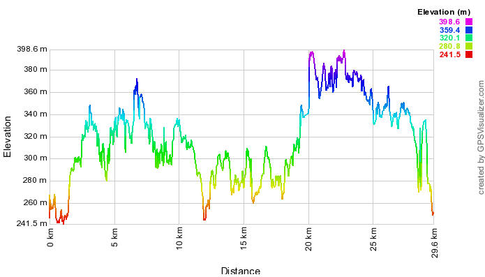
28 km 17 miles, 3h00 Elev.Gain 800 m 2600 feet


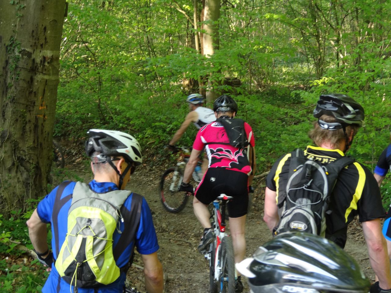
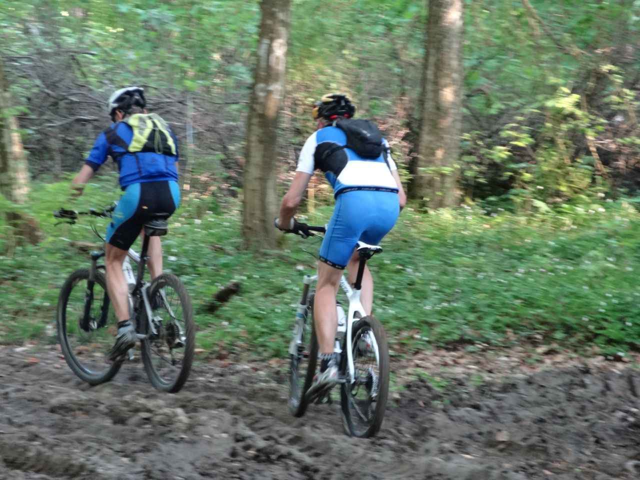
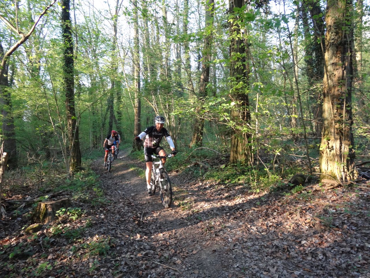
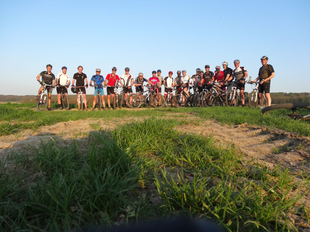
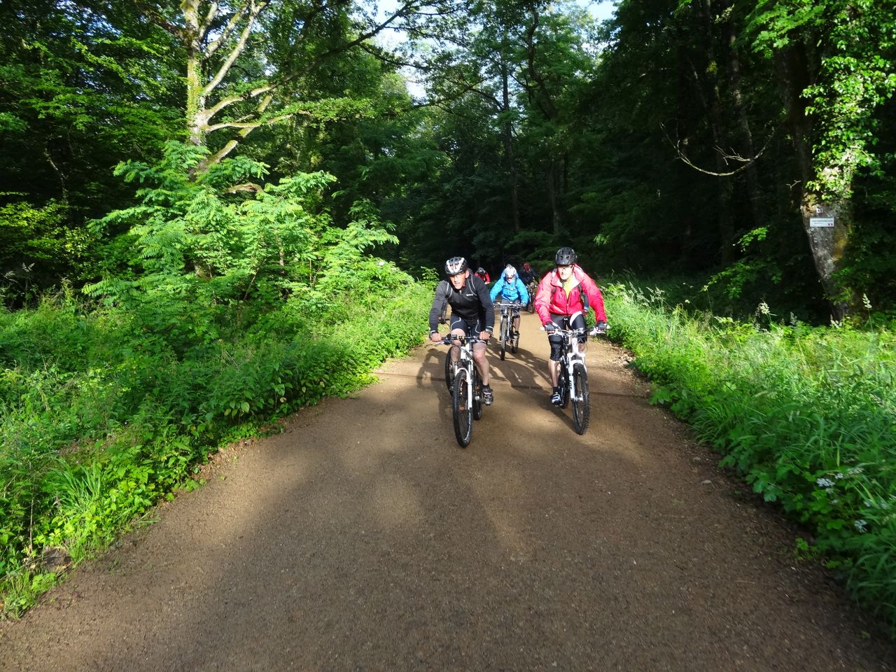
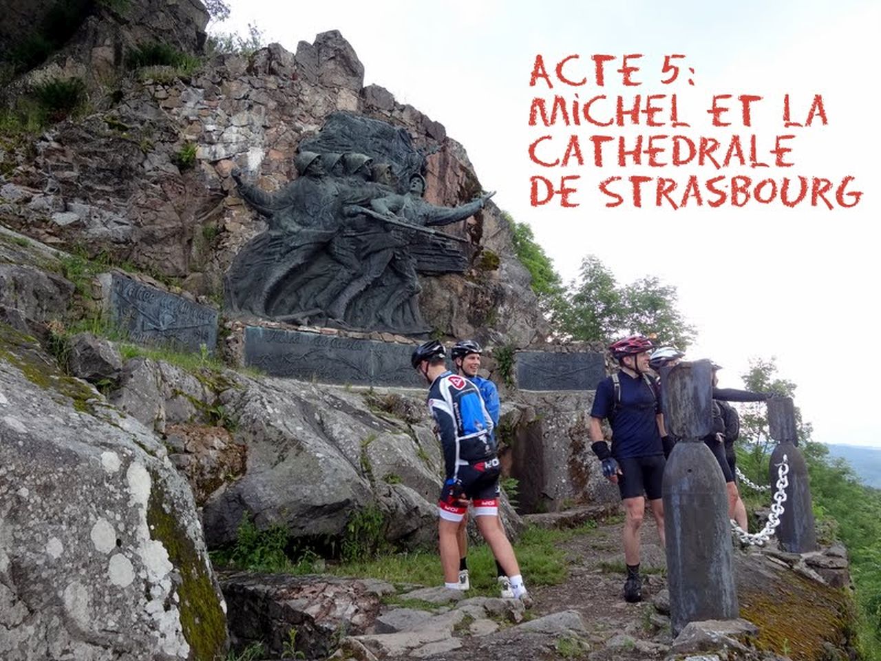
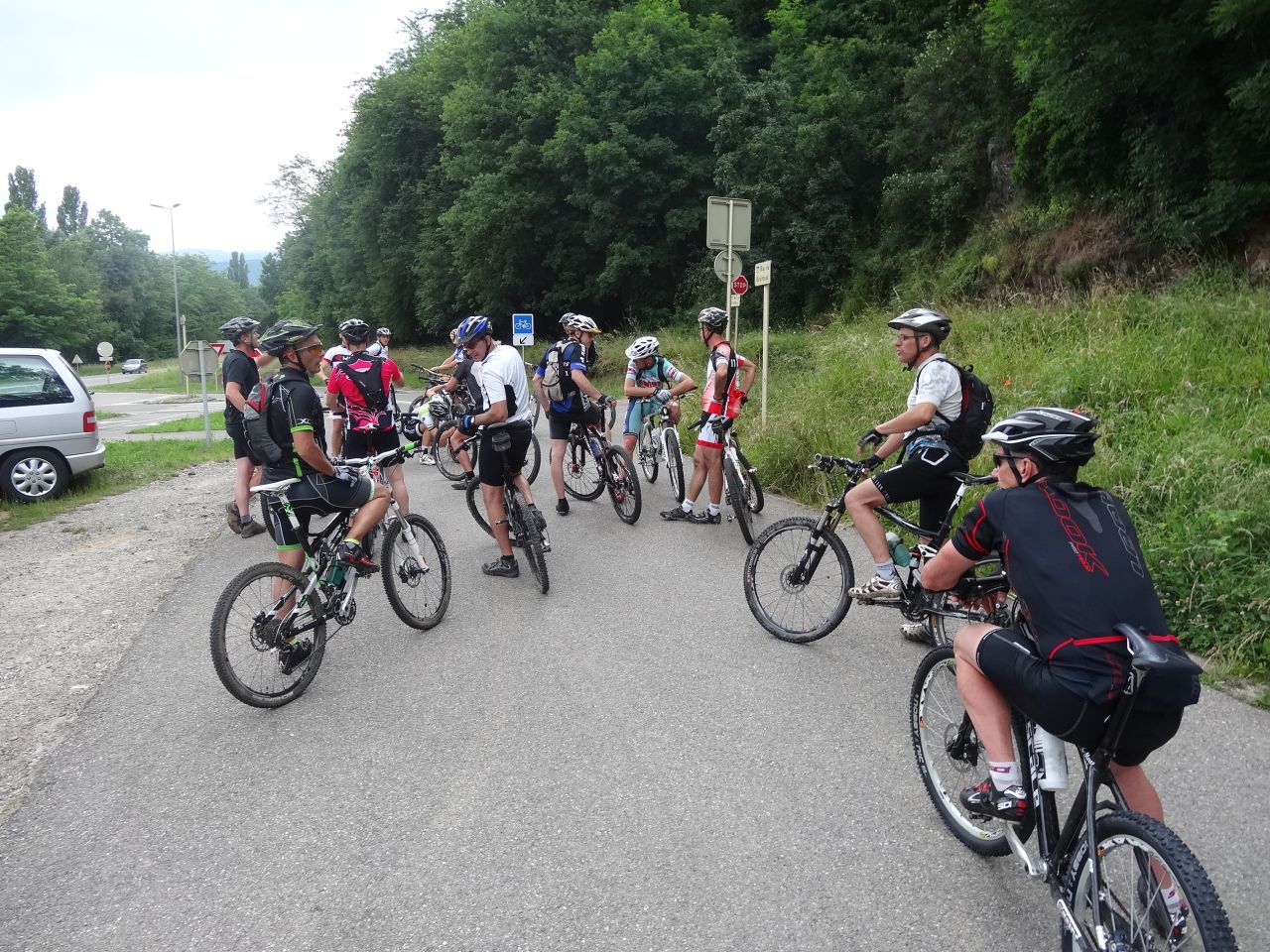
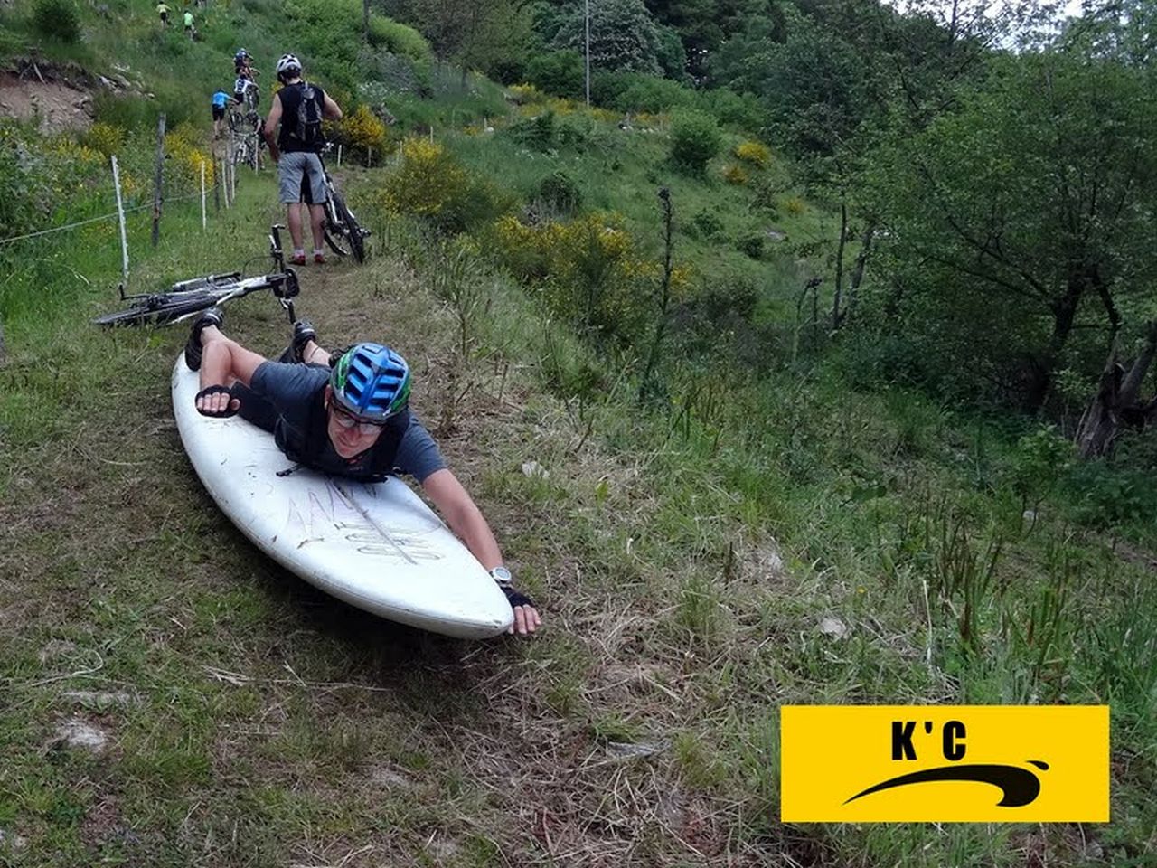
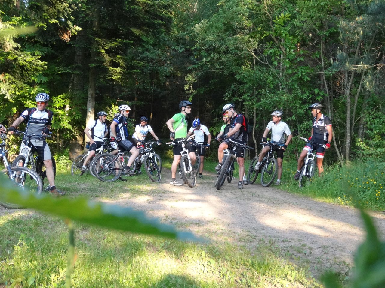
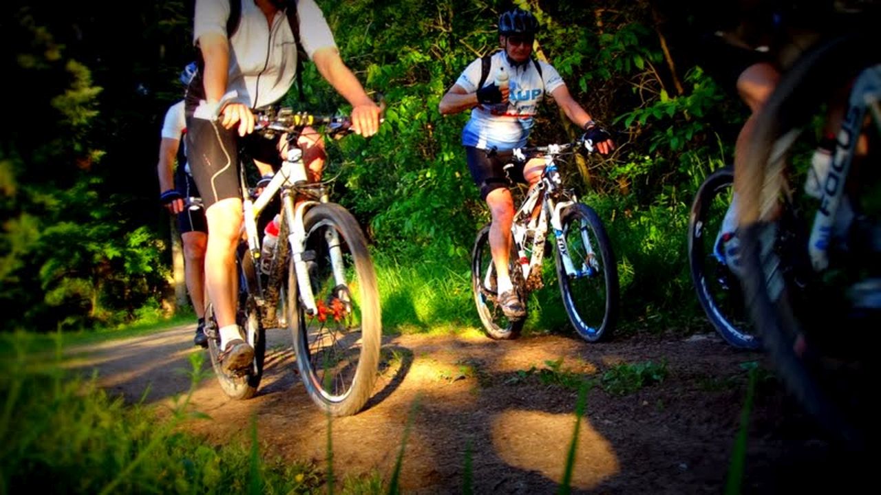
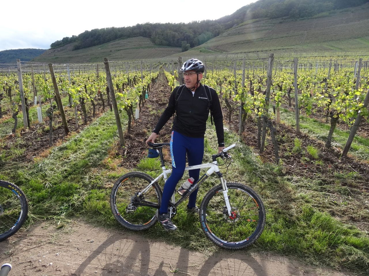
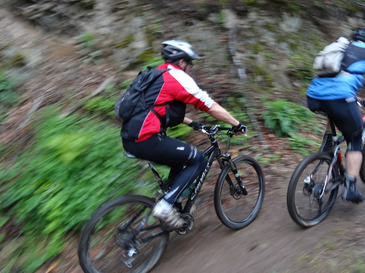
9 MTB (Christophe, Claude, Daniel, Denis, Gilles, Oliver, Romuald, Thierry, Thomas)
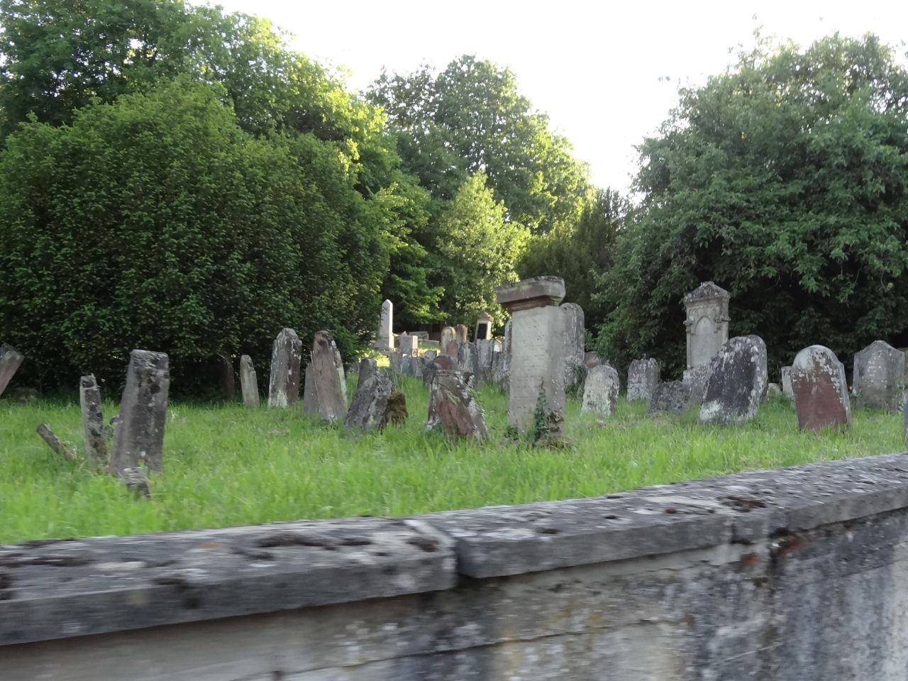
Hartmannswiller - Wattwiller - Cantine Zeller - HWK (= Hartmannswillerkopf) - Silberloch - Freundstein - Wuenheim - Hartmannswiller

 47 pictures (G Photo)
 video
video "VTT au HWK" Youtube (3:17)
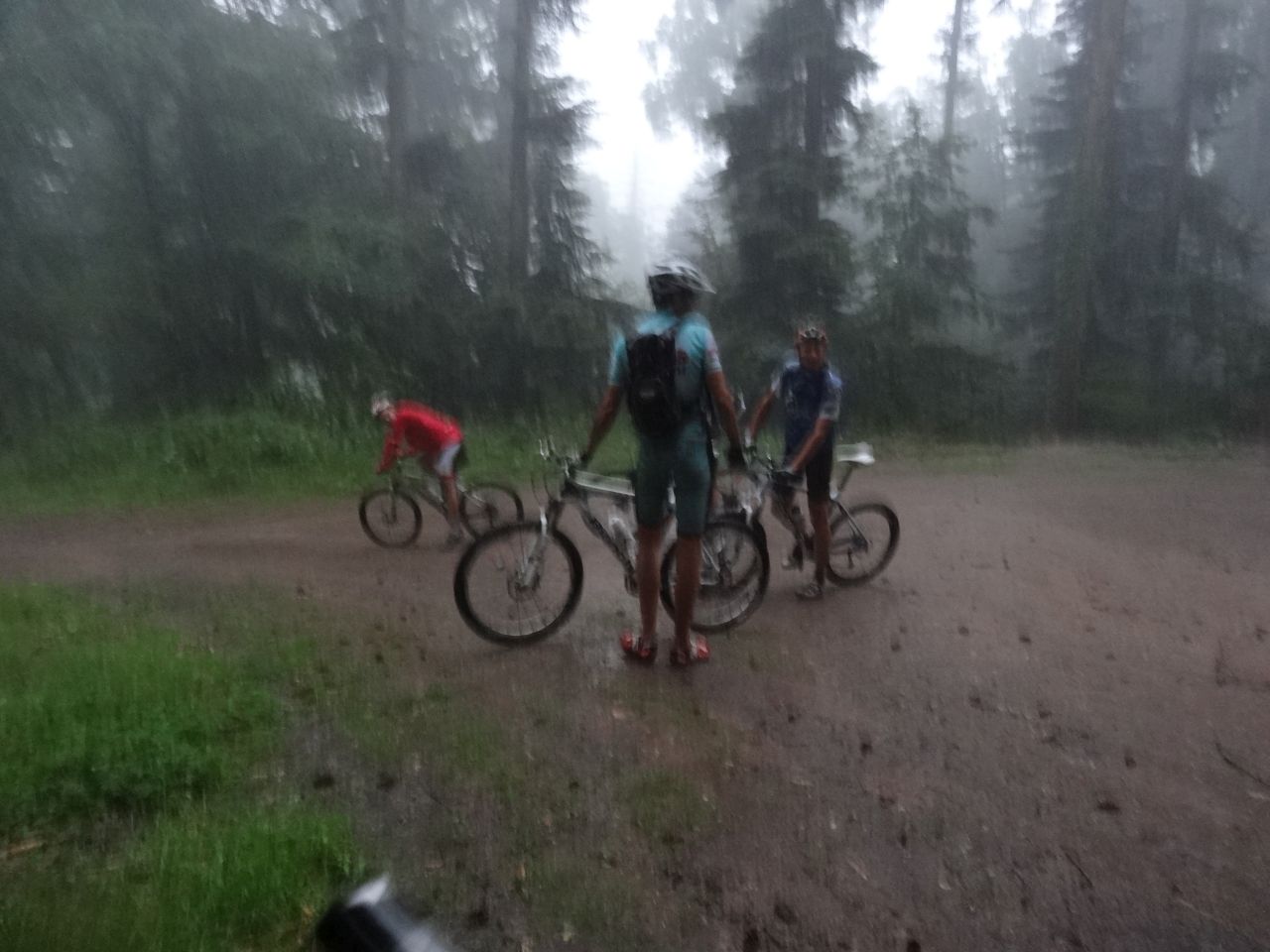
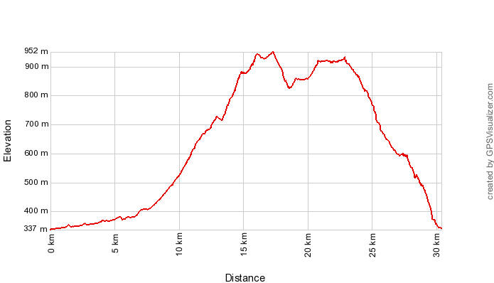
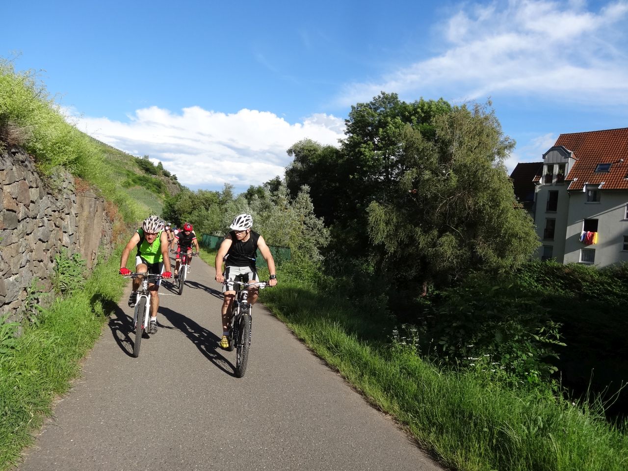
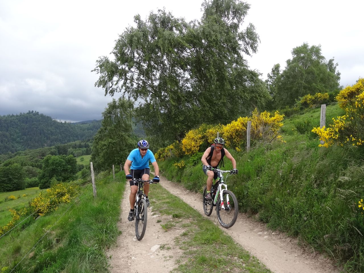
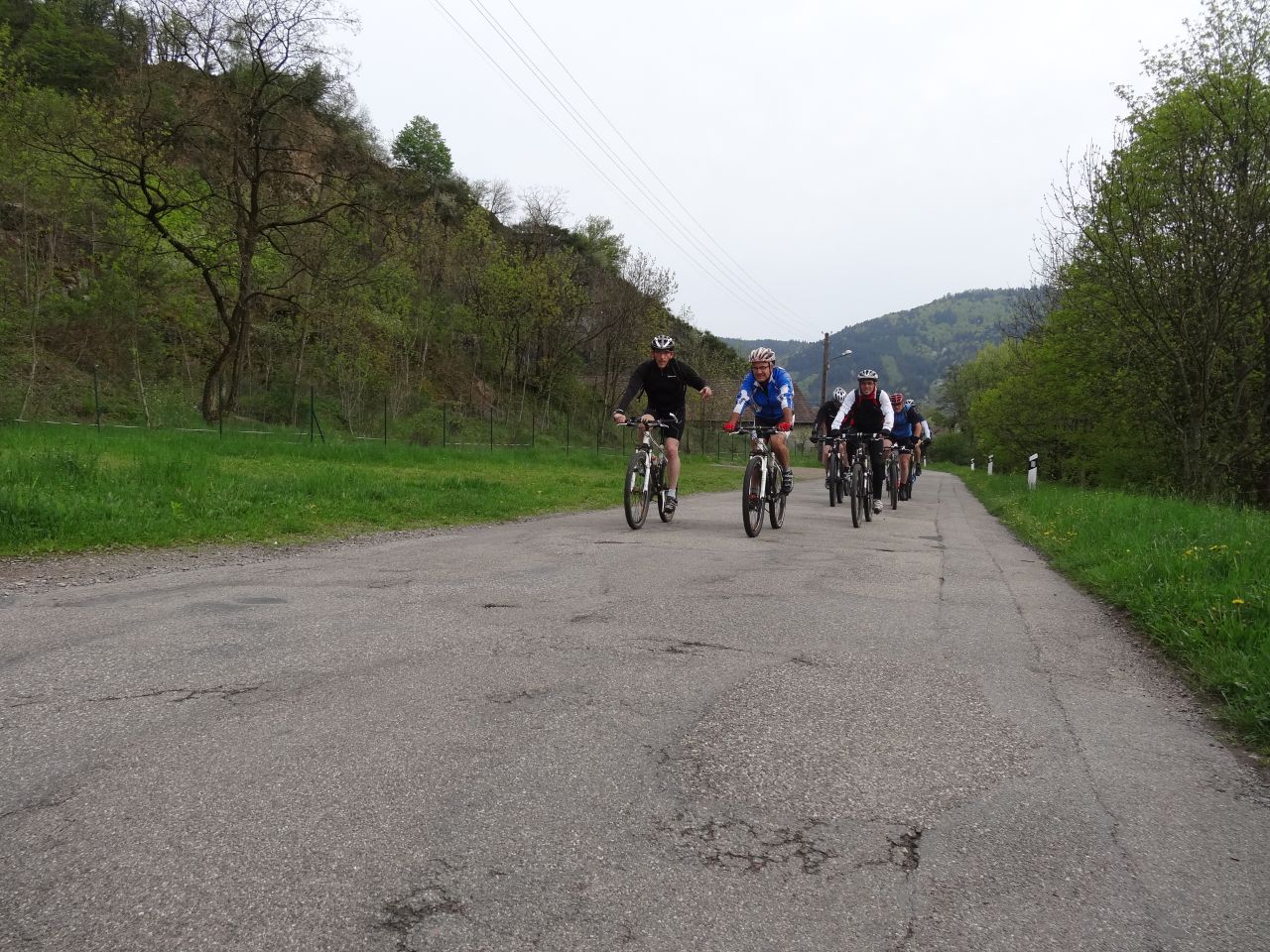
June 20, 2013
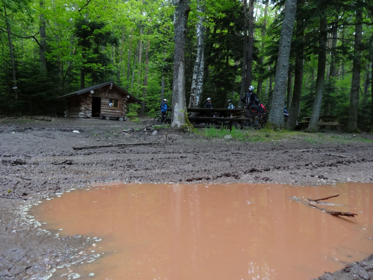
"well wet in the Vallée Noble"
 24-16°C 75-61°F
32 km 20 miles, 2h30 Elev.Gain 900 m 2950 feet
18 MTB (Bernard, Christian, 2 Christophe, Claude, Daniel, Denis, Franck, Georges, Jean-Claude, Laurent, Michel, Oliver, Roger, Sebastien, Thierry, Thomas, +1 )
Tonight we have a guest, from New Zealand
Guebwiller - col du Bannstein - Wintzfelden - Osenbach - Wintzfelden - col du Bannstein

 video
video "orage" Youtube (1:37)

(1) Xterra triathlon: info wikipedia in English - in German
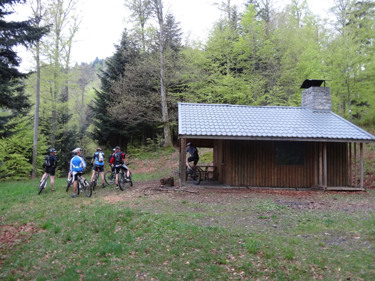
June 13, 2013
"not even wet"
 30-18°C 86-64°F
30 km 18 miles, 2h35 Elev.Gain 750 m 2450 feet
15 MTB (Bernard, Christian, Christophe, Claude, Daniel, Denis, Franck, Georges, Gilles, Jean, Jean-Claude, Julien, Michel, Philippe (Bara), Roger)
Vieux Thann - Willer sur Thur - Altenbach - Firstacker - Freundstein - croix du Rangen
 video
video "film promo pour le vent" Youtube (2:07)
June 06, 2013
"S.U.N." = "S.O.L.E.I.L."
24-22°C 75-71°F22 km 14 miles, 2h00 Elev.Gain 600 m 2000 feet
13 MTB (Bernard, Christian, Christophe, Claude, Denis, Gilles, Jean, Jean-Claude, Julien, Georges, Michel, Romuald, Thierry)
Guebwiller - Rimlishof - Peternit - Rimbach Zell - Thierenbach - Carrefour de l'Heure - Jungholtz - Nez de Soultz - Heindenbuckel - Bildstoeckle - Guebwiller
 video
video "au soleil" Youtube (2:03)
May 30, 2013
"Bollenberg"
14-12°C 57-53°F25 km 15 miles, 2h00 Elev.Gain 500 m 1600 feet
15 MTB (Bernard, Christian, Christophe, Claude, Denis, Daniel, Jean, Jean-Claude, Georges, Michel, Roger, 2 Sebastien, Thierry, Thomas)
Guebwiller - Bergholtz - Bollenberg - Westhalten - Bollenberg - Bergholtz - Guebwiller
 video
video "Bollenberg" Youtube (3:19)
May 23, 2013
"don't stop"
9-8°C 48-46°F23 km 14 miles, 2h00 Elev.Gain 700 m 2300 feet
9 MTB (Christophe, Claude, Franck, Jean-Claude, Georges, Gilles, Laurent, Michel, Sebastien)
Guebwiller - Appenthal - col du Dreibannstein - Croix de Mission- Guebwiller
May 16, 2013
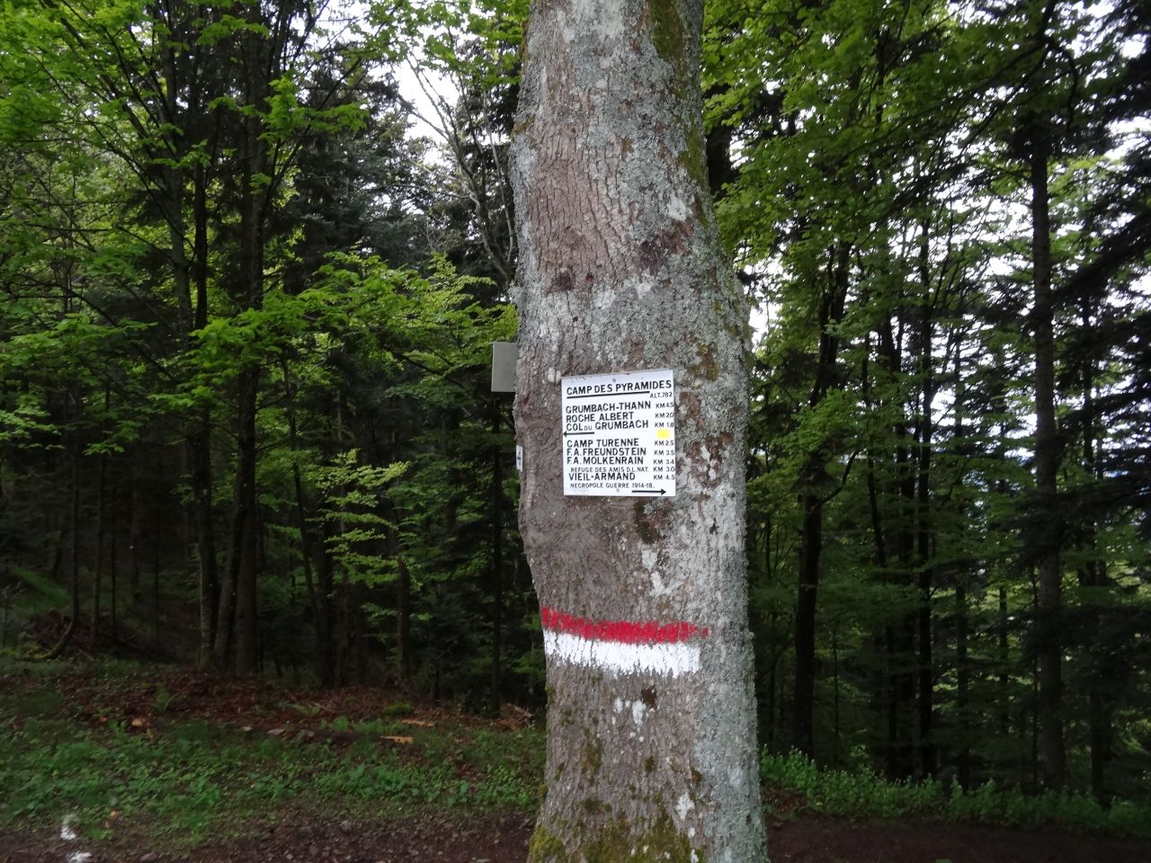
"Camp des Pyramides"
13°C 55°F18 km 11 miles, 1h40 Elev.Gain 650 m 2100 feet
9 MTB (Christophe, Claude, Denis, Georges, Michel, Roger, 2 Sebastien, Thierry )
Vieux Thann - Kattenbachrunz - Col de Grumbach - Camp des Pyramides (782m) - Engelbourg - chapelle St Urbain
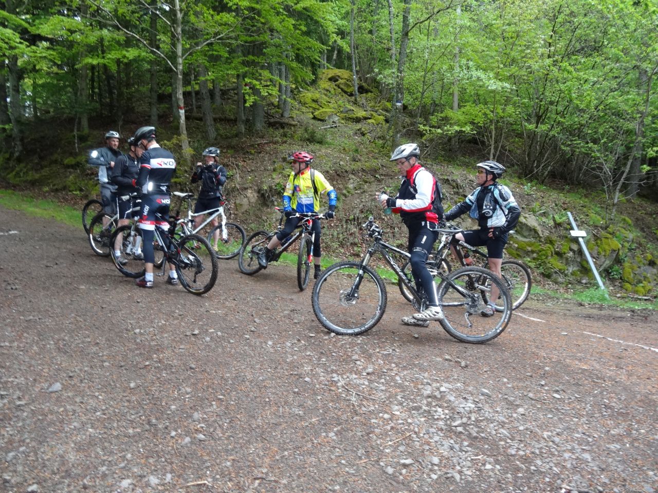

May 02, 2013
"Thann... arid"
16°C 61°F29 km 18 miles, 2h20 Elev.Gain 800 m 2600 feet
8 MTB (Christian, Christophe, Claude, Denis, Georges, Gilles, 2 Sebastien )
Vieux Thann - Willer-sur-Thur - QnF - Vogesapfad Hisla - Hundesruecken - Thann.

April 25, 2013
"the first at the Waldeck"
25-16°C 77-61°F29 km 18 miles, 2h00
20 MTB (Bernard, Christophe, Claude, Denis, Fabien, Franck, Gerald, Jean, Jean-Claude, Julien, Laurent, Luc, 2 Michel, 2 Sebastien, Silvino, Thierry +2)
Waldeck (Mulhouse) - Flaxlanden - Bruebach - Mulhouse.