
active units: miles km °C °F

June 26, 2014
"Michelbach"
 24-18°C 75-64°F
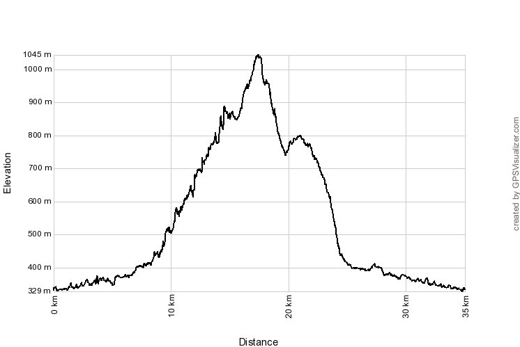
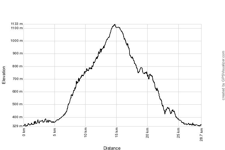
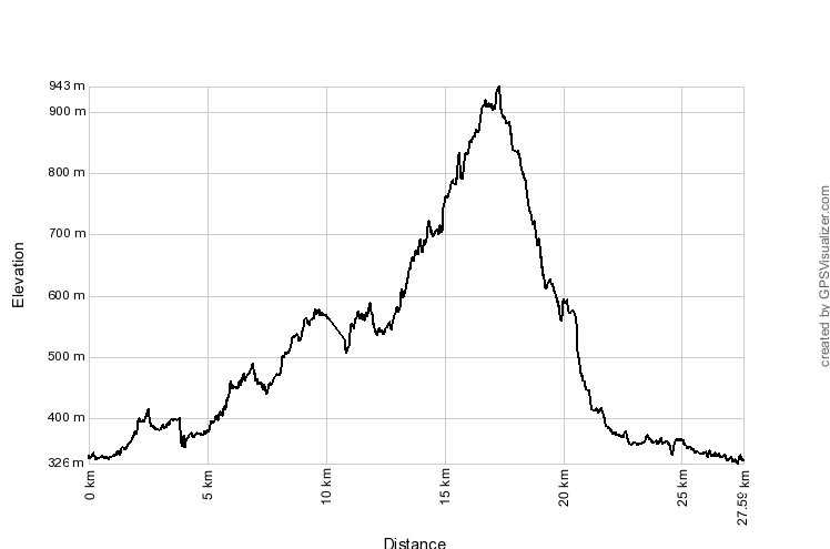
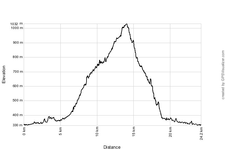
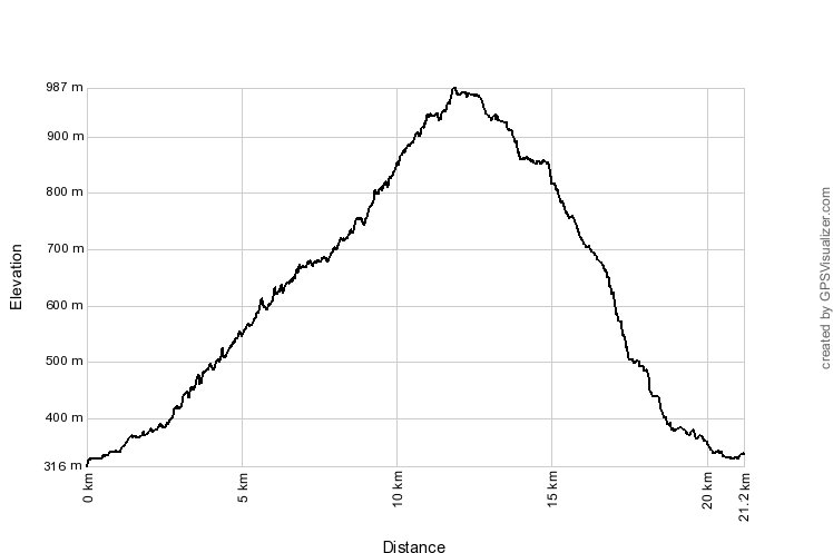
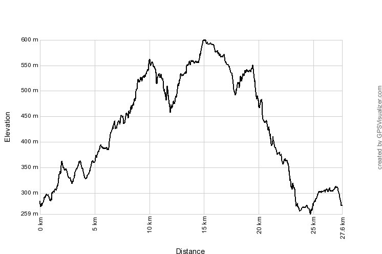
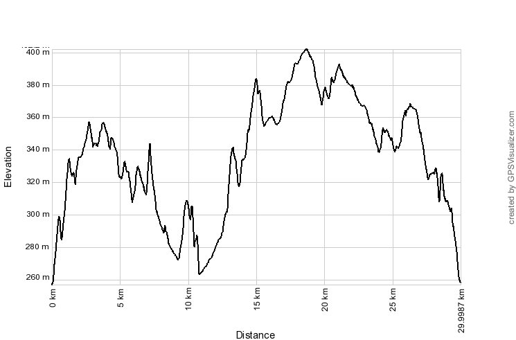
 39 km 24 miles, 2h55 Elev.Gain 600 m 2000 feet

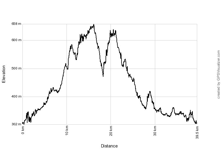

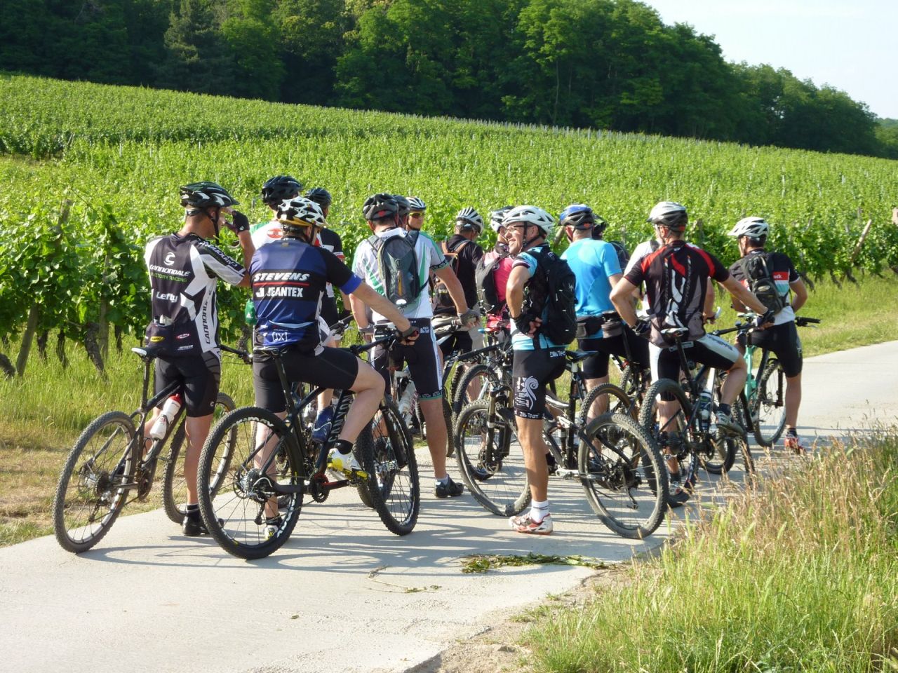
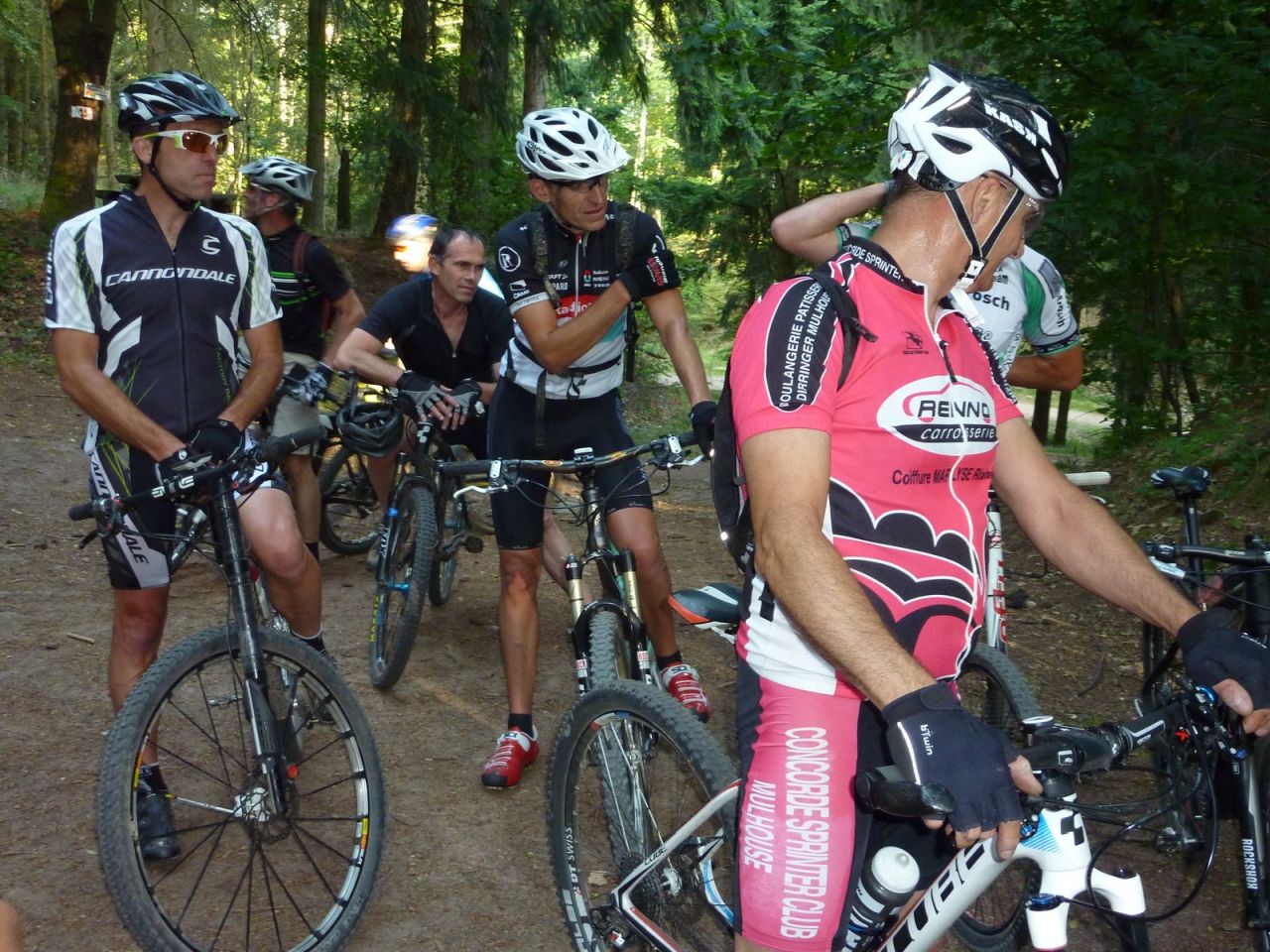
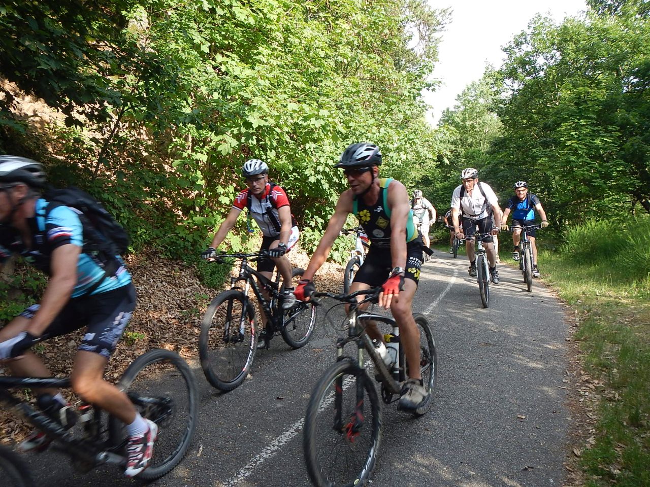
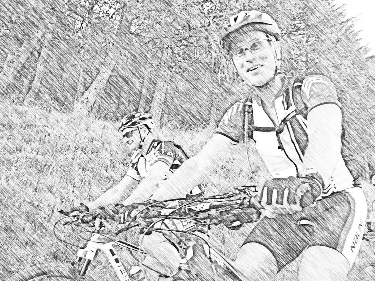
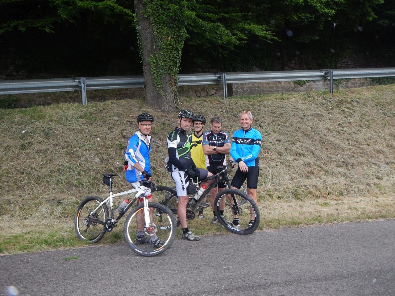
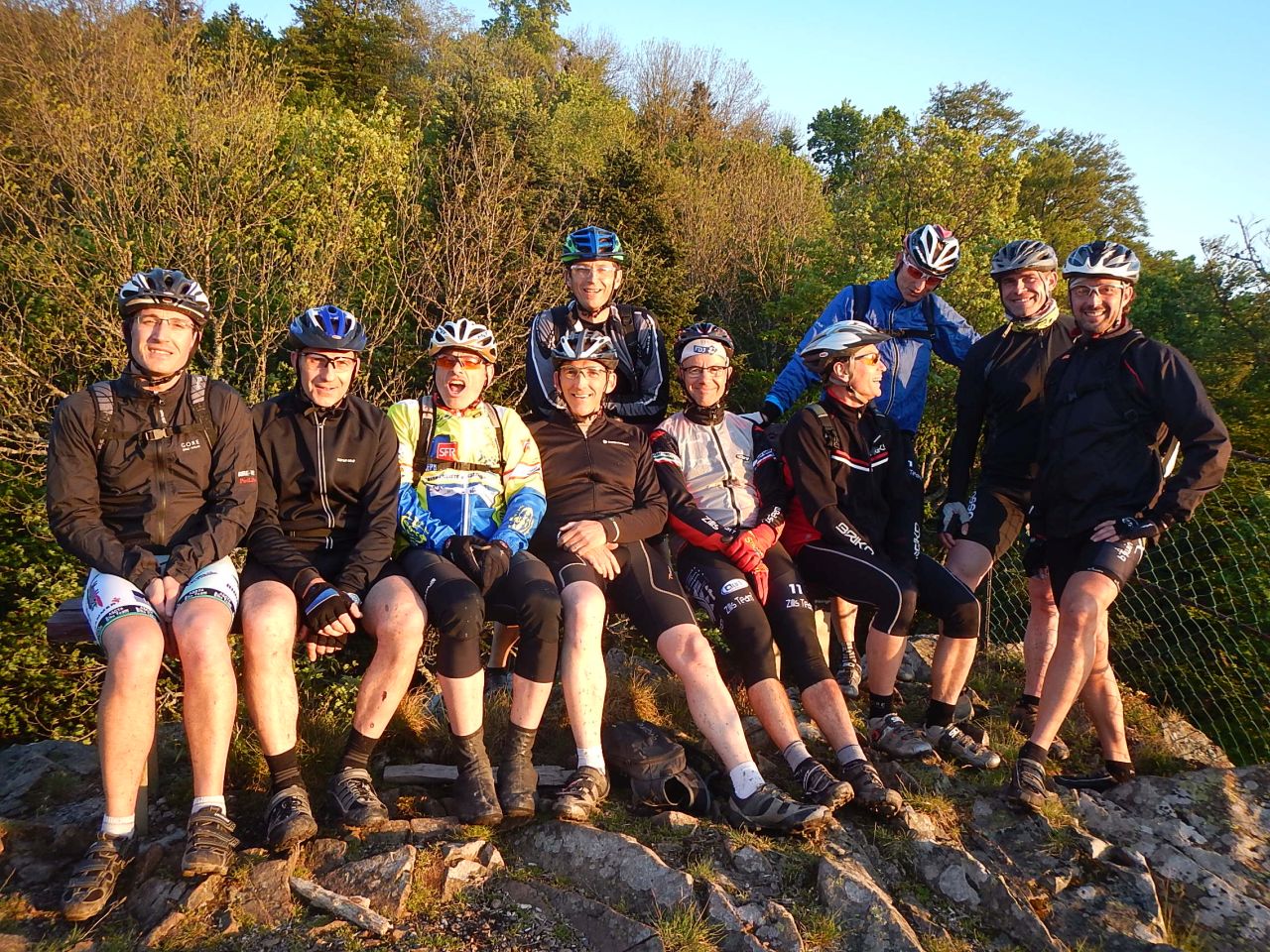
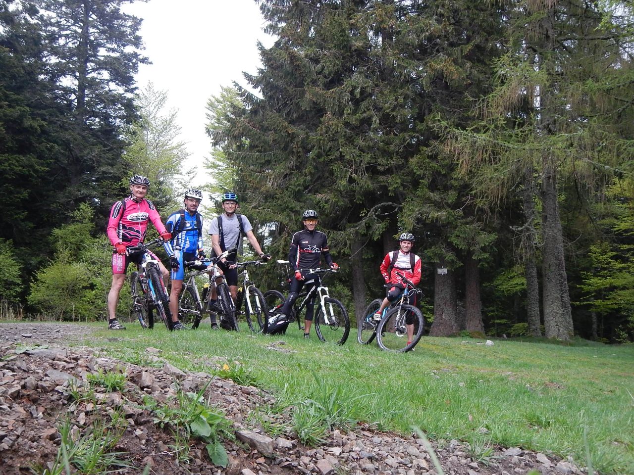
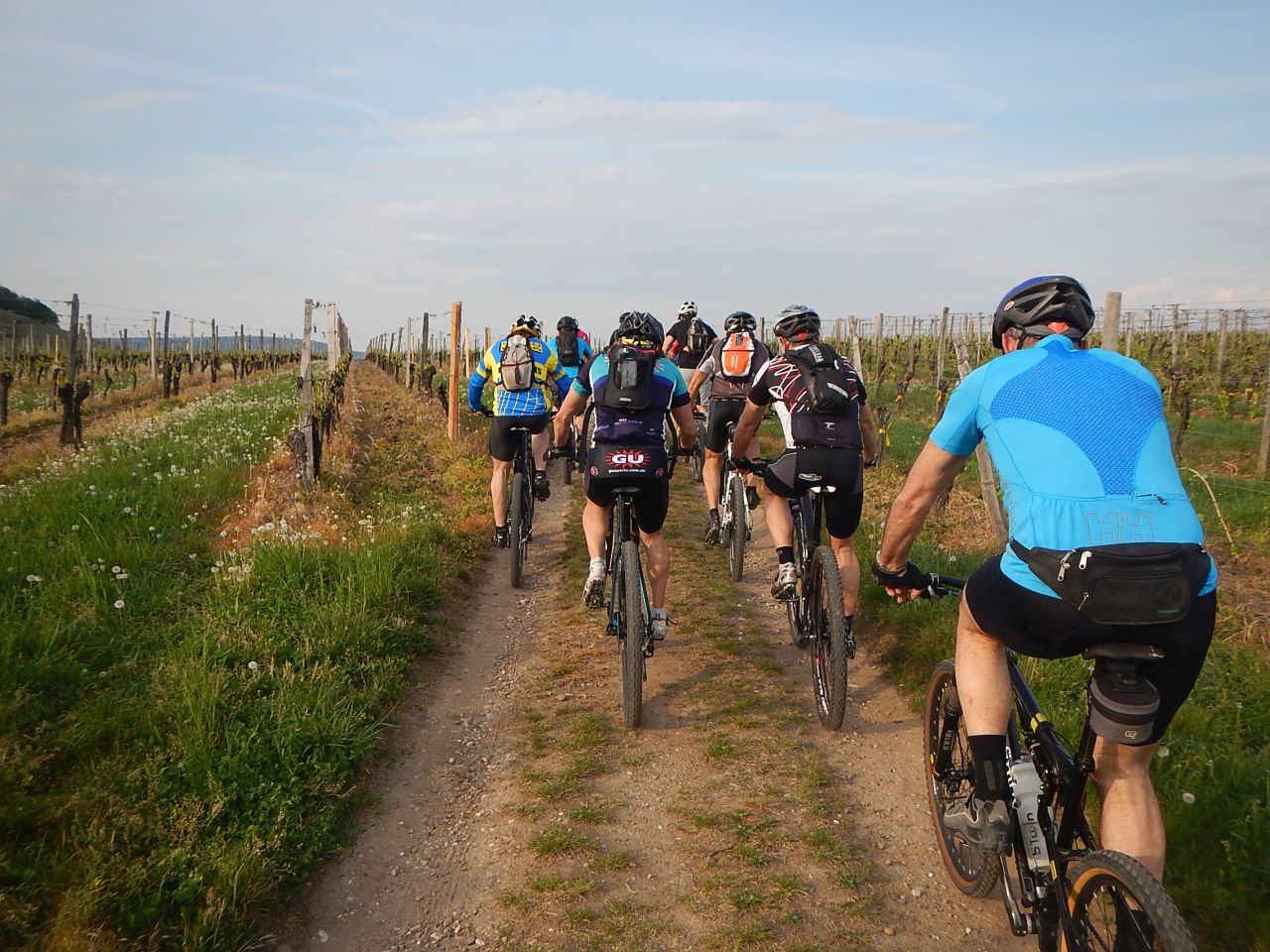
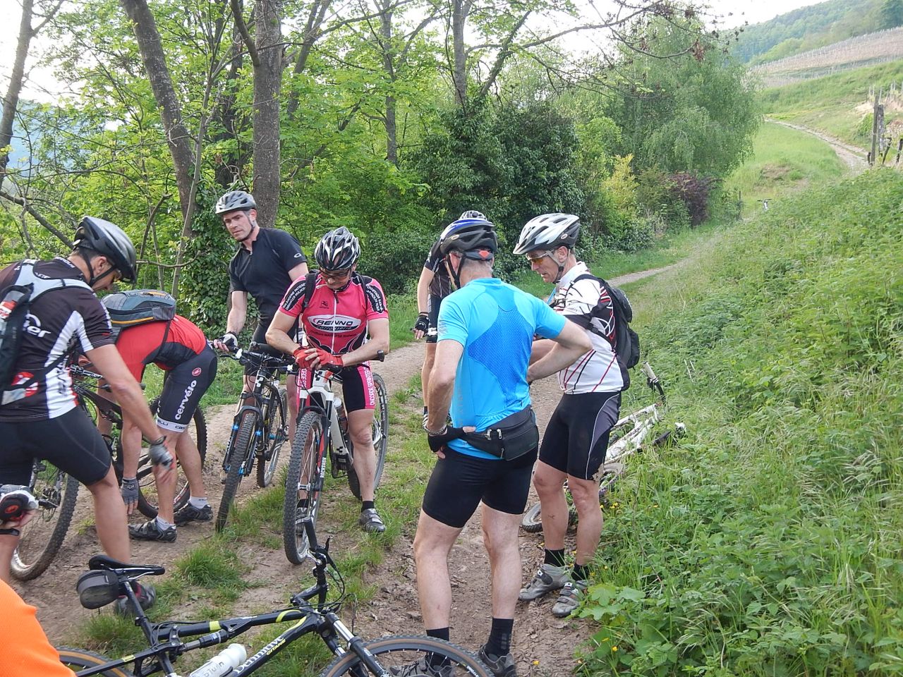
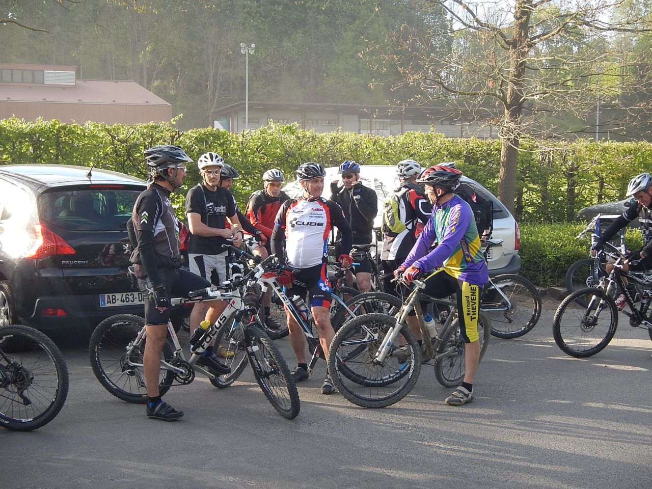
17 MTB (Bara, Belmiro, Bernard, Christophe, Claude, Denis, Daniel, Franck, Fred, Georges, Gilles, Jean-Claude, Laurent, Pascal, Michel, Thierry, Thomas)
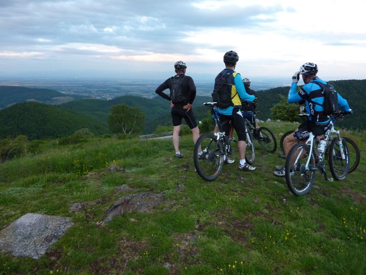
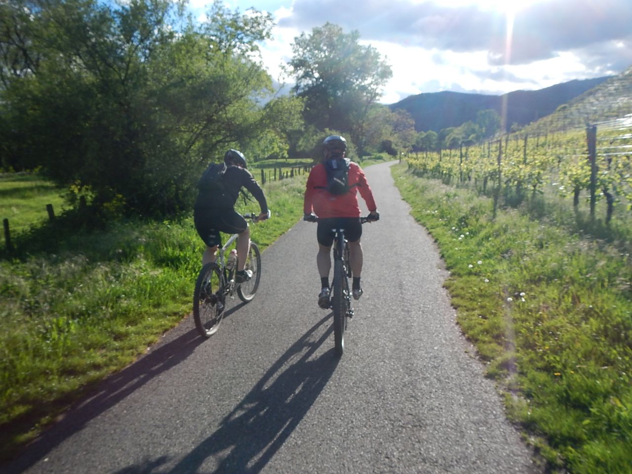
Appointment at 18:30 Schweighouse-Thann. On the highway it's a disaster: everything is blocked! Not everyone can be on time. This is no problem, a call and we will be patient.
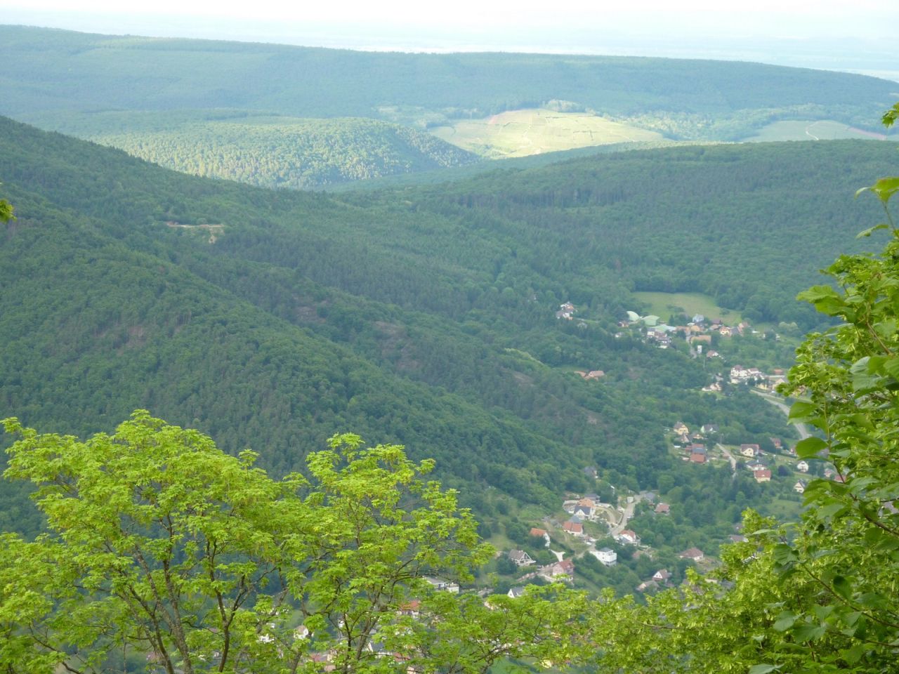
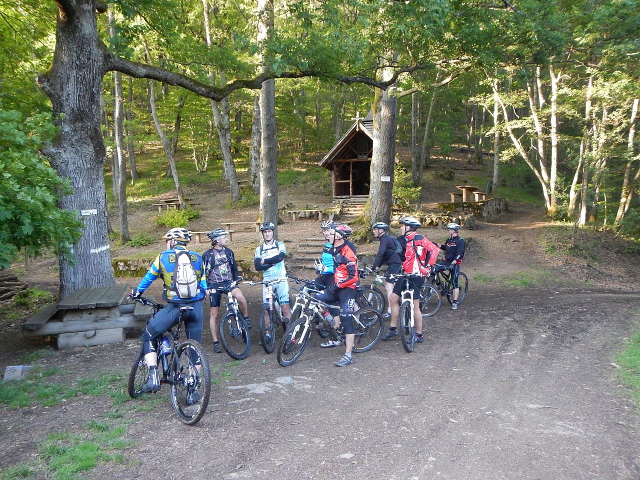
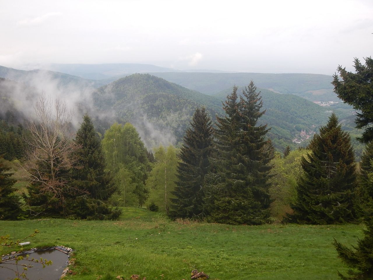
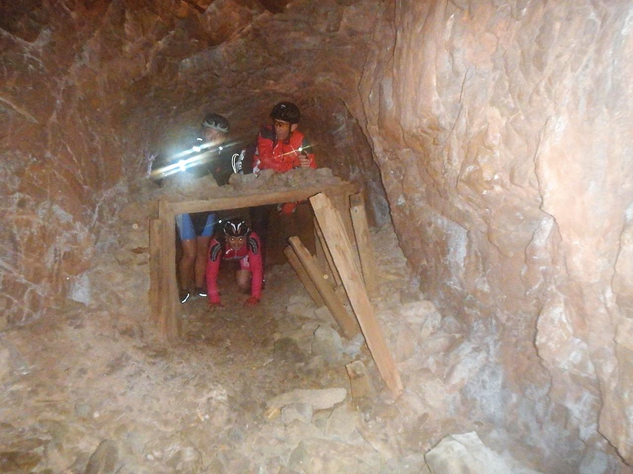
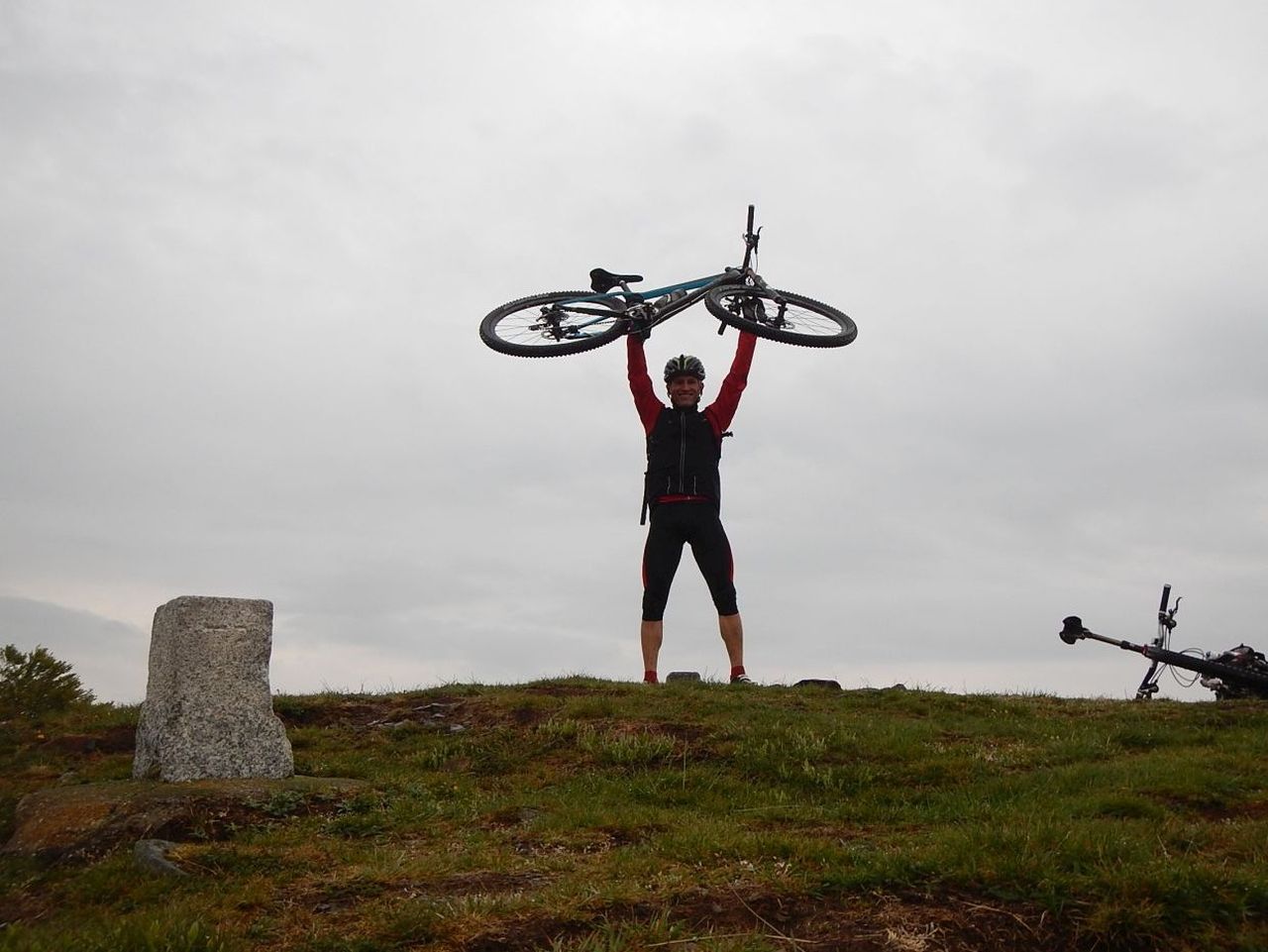
Direction Michelbach, but Daniel did not go far away.... his gear changing cable is broken so he prefers go back to his car. Thank you! We go along the Michelbach's lake then we climb to Rammersmatt.
Really difficult
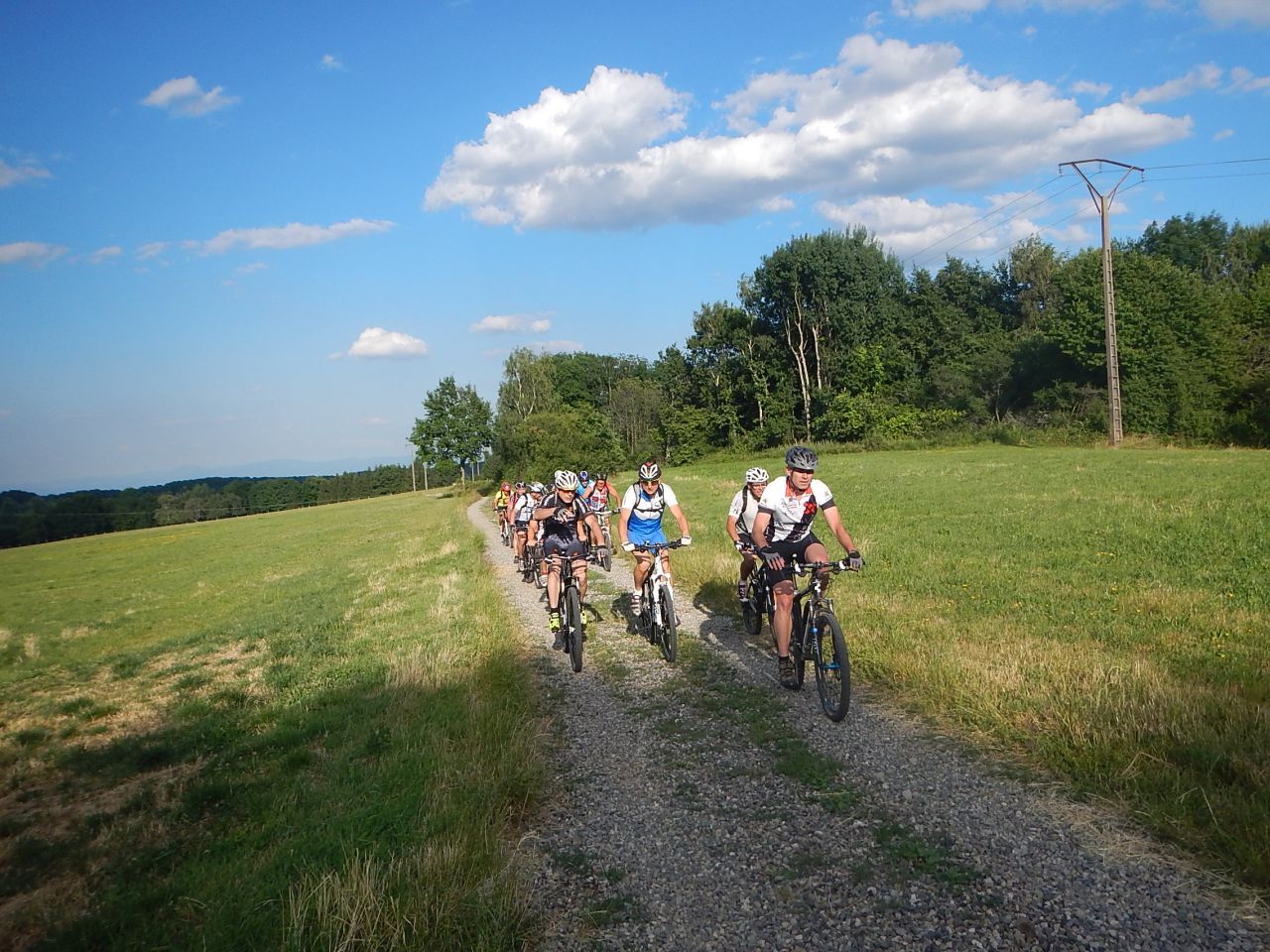
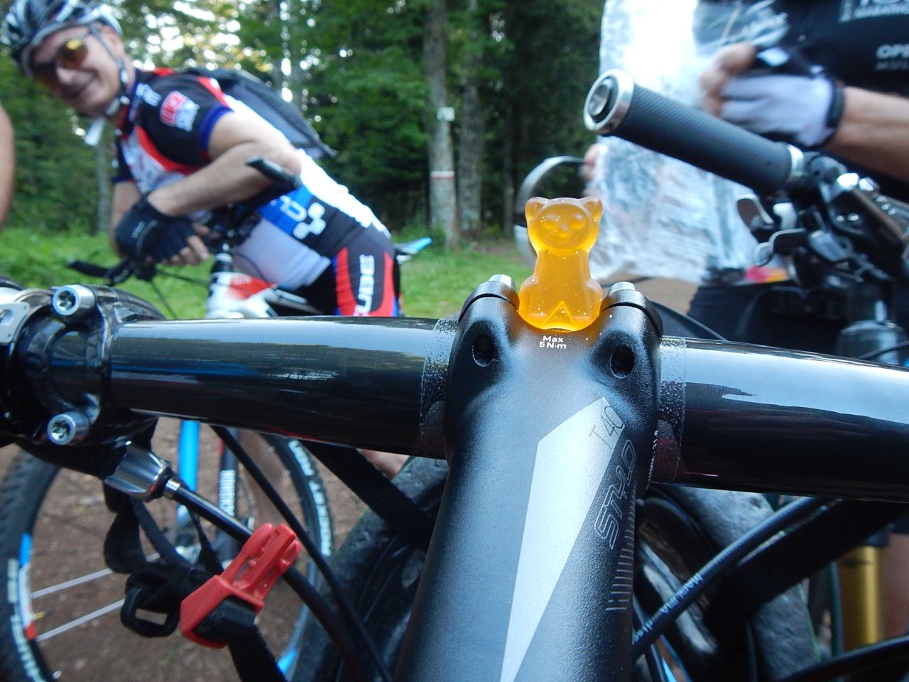
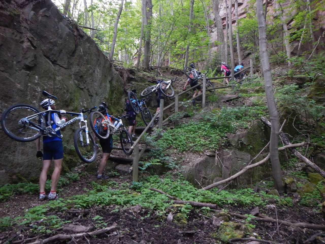
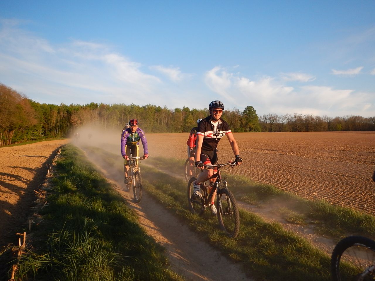
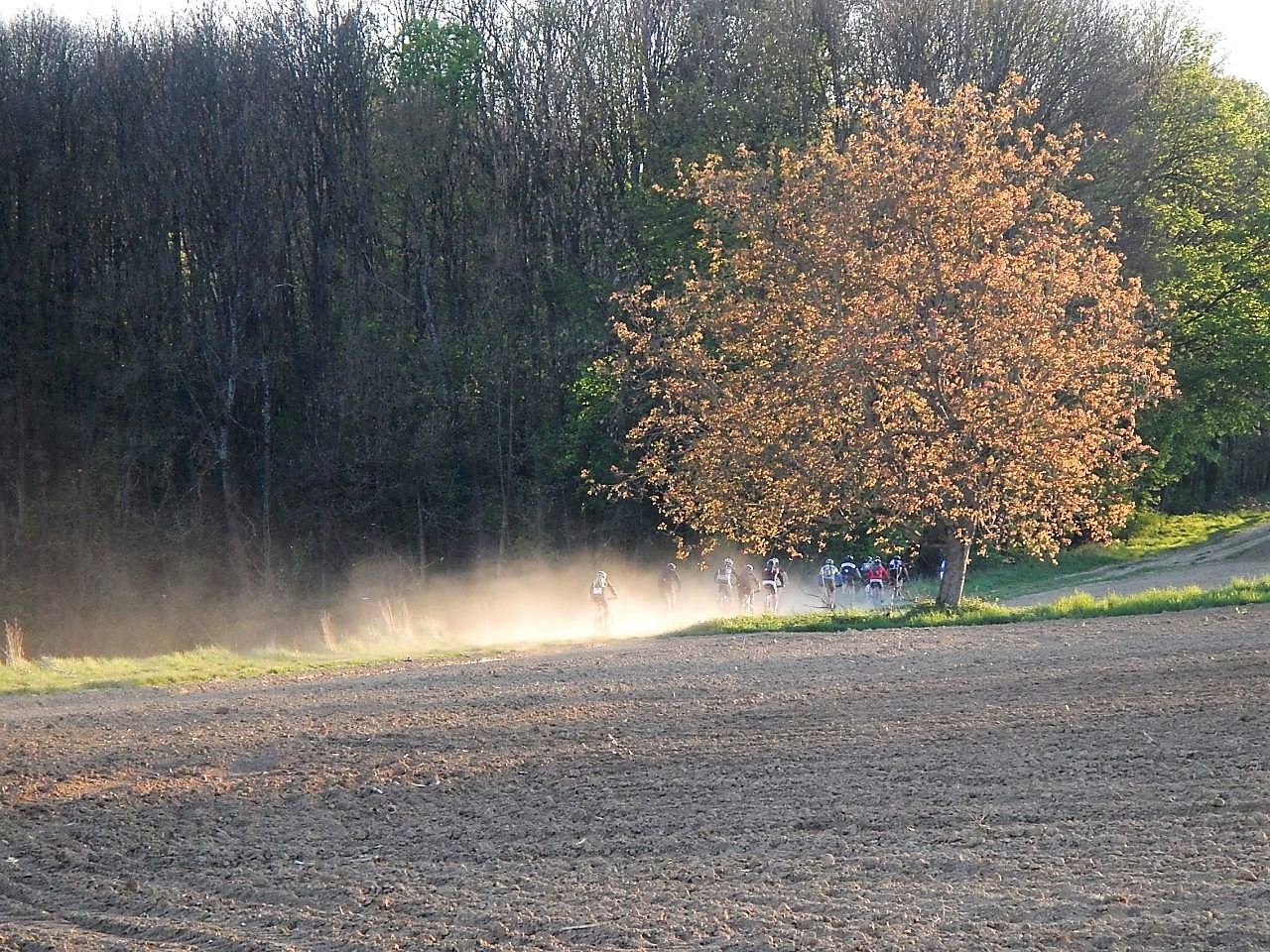
 during 200m 0.1 miles till we reach the hives, but then it's more funny.
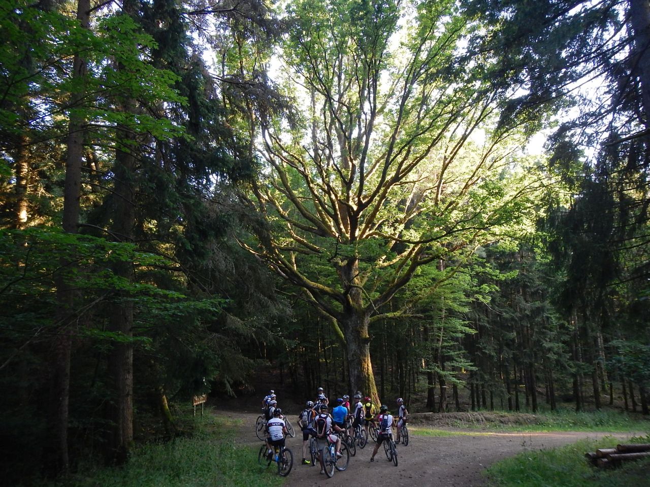
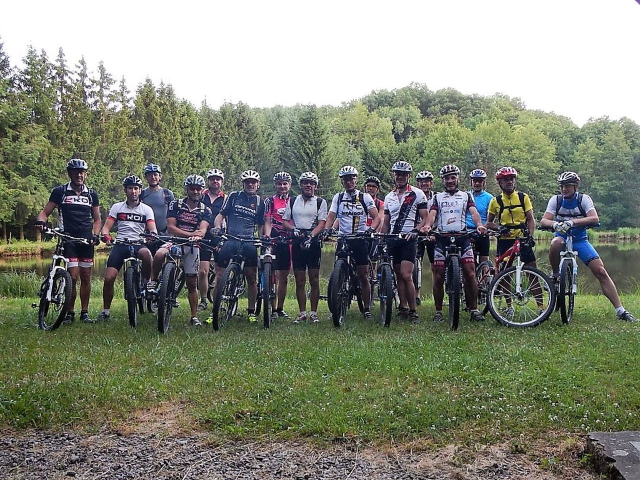
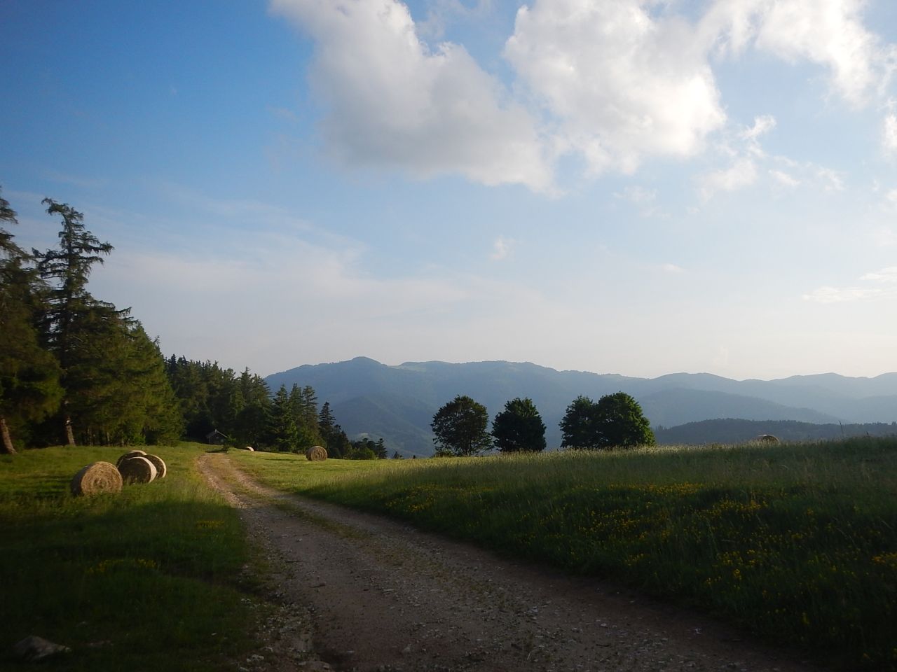
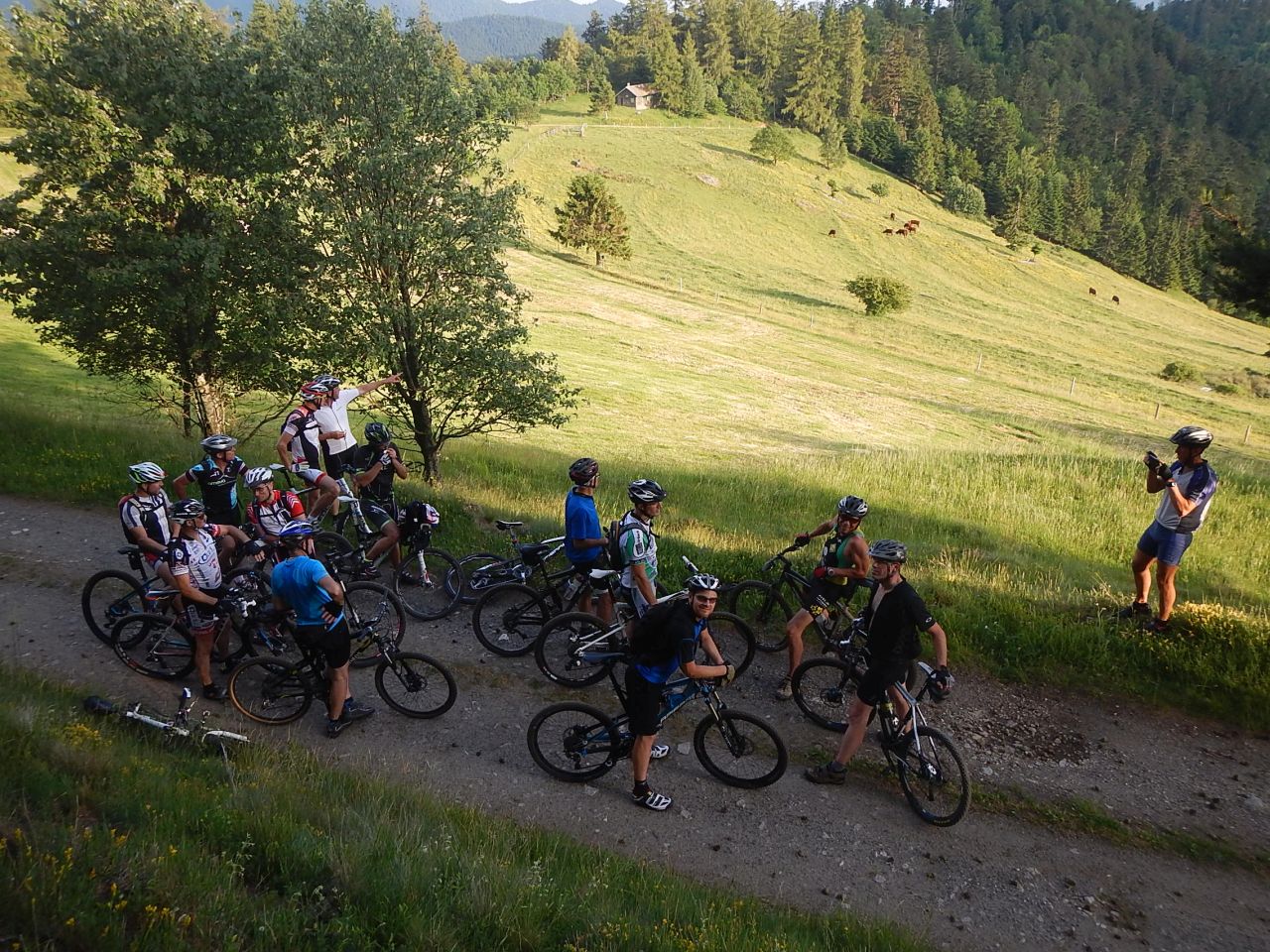
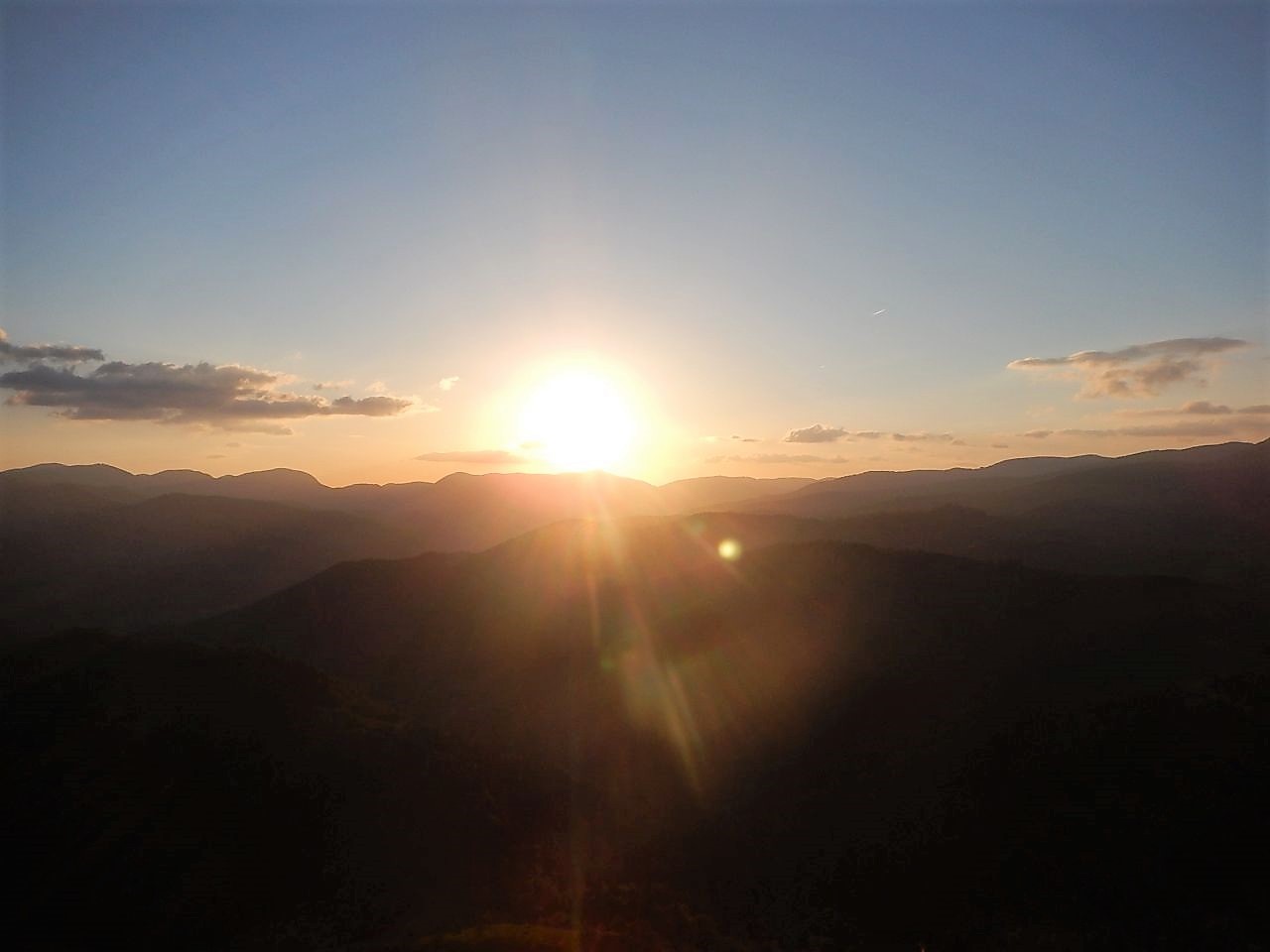
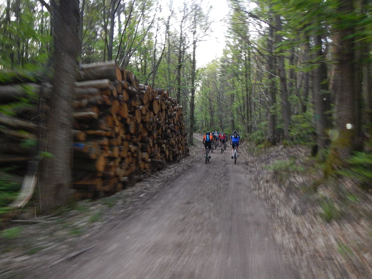
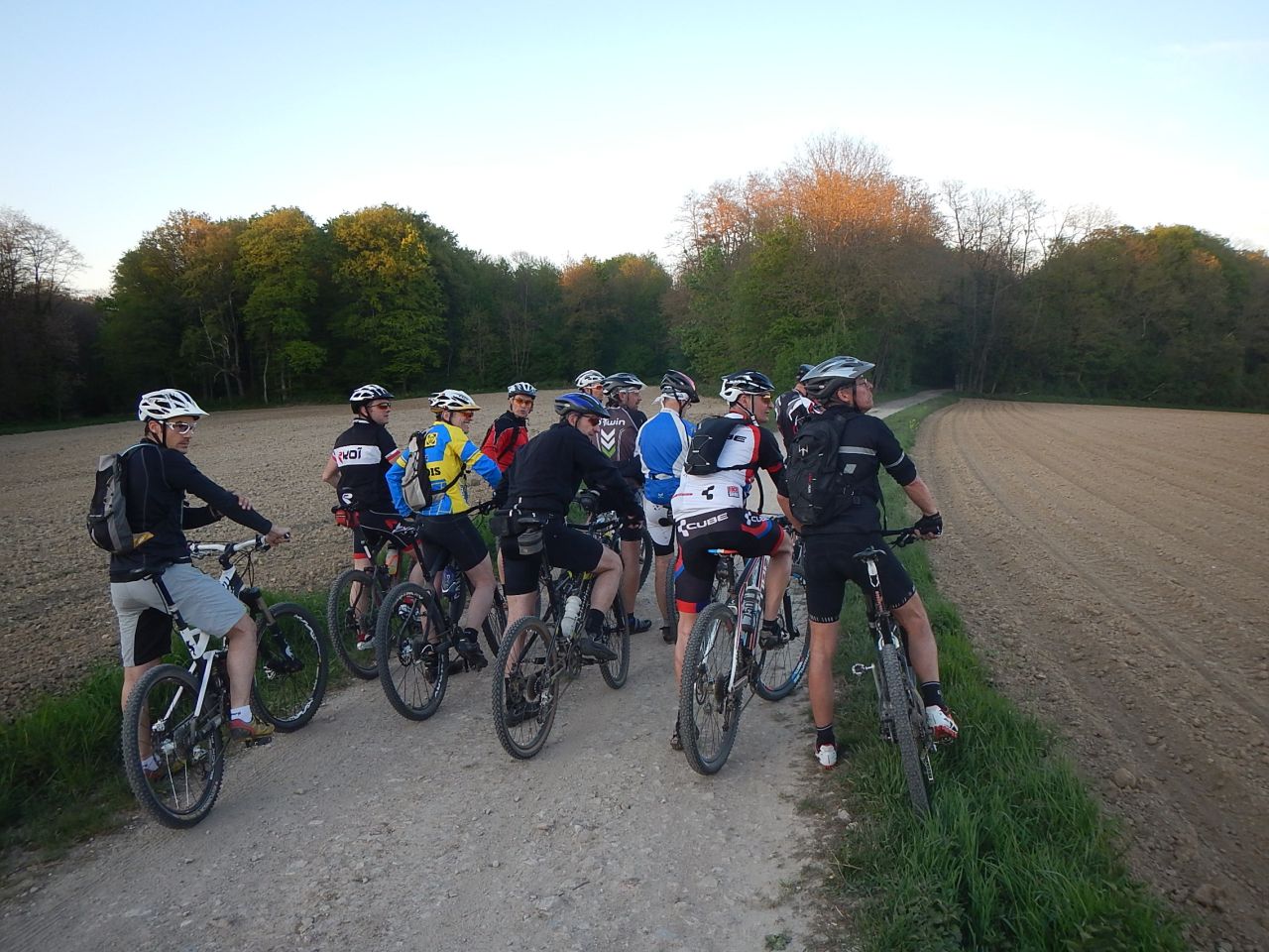
A puncture to do a break (and some pictures) and we start again for the big tour around Bourbach-le-Bas, with the "vierge des chasseurs", the Schirm, the Big Oak ("Wonderful!" with an extraordinary light), a pond where we will do the picture from the team.
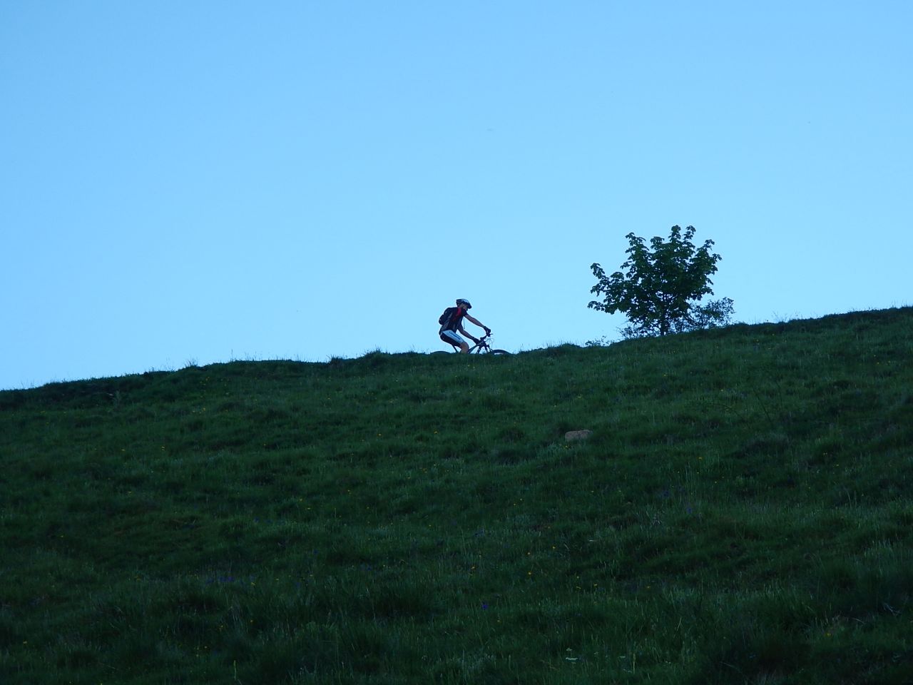
Return way: Sentheim - Michelbach (on the other side of the lake) - Schweighouse-Thann (end at 21:45).
Surprise: on the car park, we found Daniel; he did also a nice tour, but without using his rear gear ;-)
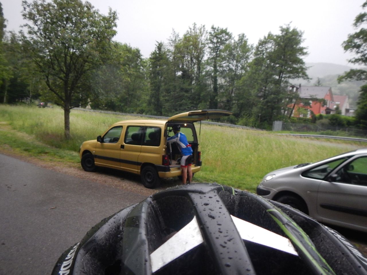
But for some people, it is not enough! they go home with the bike. Yes!!!!

 44 pictures (G Photo)
 video
video "Michelbach" Youtube (1:50)
Comments:
- Congratulations to Pascal. Last week, he finished with position 3 from "Xterra Greece", so he is qualified for "Maui 2014"

June 19, 2014
"castle and knights's table"
23-20°C 73-68°F 35 km 22 miles 2h45 Elev.Gain 800 m 2600 feet
17 MTB (Alain, Bernard, Christian, Christophe , Claude, Denis, Franck, Georges, Gilles, Jean, Jean-Claude, Laurent, Michel, Thierry, Stef, Thomas, Yves)
The famous trip of the summer solstice. Again and again .... so good.
For the first time we reach the (Schauenberg) monastery by the path usually used for the return.
The roads are very dry and a summer fragrance invades our nostrils.
Direction Osenbuch and climb to the Col de Marbach where Michel will try everything to be better than the youngster of the band. Nay, the succession is definitely guaranteed!
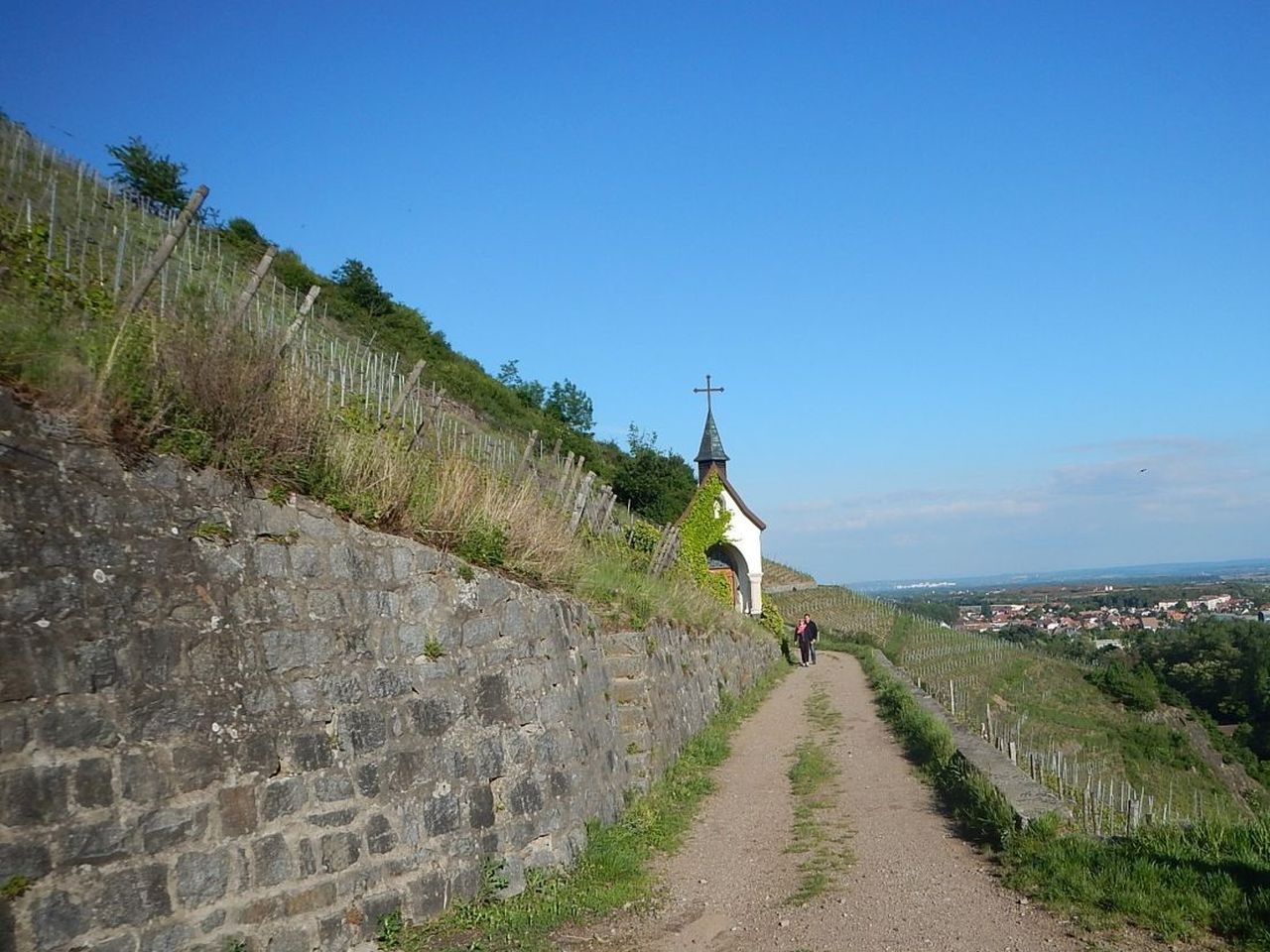
The rest of the route is at full speed and we find ourselves very quickly and smoothly at the top of Hohlandsbourg (castle) where the light and the view is exceptional.
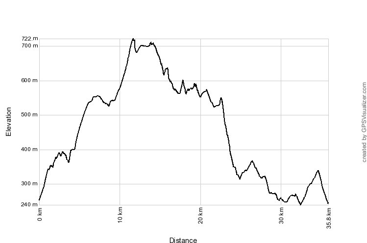
The return will quickfire by heavyweights of the group. Jean prefers a shorter way because a calf pain. Unfortunately he commits an orientation error that will go through the "Firstplan"! (722 m) (2370 feet) Connoisseurs will appreciate. He will join us for a good half hour after the start of the festivities.
In effect, as usual, moult victuals and beverages will fill the sandstone table which became the symbol of this annual trip.

Comments:
- Thanks Thierry for the pictures, I love them!!!
- Thx also to Mike for the text; his pen is better than mine.
June 12, 2014
"Geishouse"
28-25°C 82-77°F 35 km 22 miles, 2h50 Elev.Gain 800 m 2600 feet
15 MTB (Alain, Bernard, Christian, Christophe, Claude, Daniel, Franck, Georges, Gilles, Jean-Claude, Laurent, Michel, Pascal, Simon, Thierry)
Tonight we are fifteen at the start. A number more consistent with the stats of the June's month (we were up to 20).
The weather is finally "summer"-like, with a temperature close to 30°C. No more windbreakers .....
We head on the bicyclepath to Willer-sur-Thur and we leave it to join the road that goes to the Grand Ballon. After a few hundred metres, fork to the left and the great way to Altenbach.
After the break "Teddy strawberries Tagadas" and other candies, we see a magnificent panorama just above Geishouse. Small path uphill at the beginning then wider to reach the Bessayfels.
Descent via a beautiful trail to Geishouse cemetery where Claude will show us the tomb of his deceased great-grandmother a few years earlier.
A tour through the fitness trail and completed the descent with a bit of carrying .... and mud !
Back full throttle from Saint-Amarin to Vieux-Thann.
 video
video "Geishouse" Youtube (1:27)
Comment:
- thanks Michel for the summary
June 05, 2014
"oula oula"
21-17°C 71-62°F 28 km 17 miles, 2h45 Elev.Gain 900 m 3000 feet
10 MTB (Alain, Bernard, Christophe, Denis, Georges, Gilles, Jean-Claude, Michel, Pascal, Thierry)
Thursday 18h30 Vieux-Thann: we are 10 to start!
Direction Bitschwiller then the Thanner Hubel.
As this is not enough, we continue after the auberge towards the refuge (nice gradient of 20% (+50m in 250m)).
We are now in the Sun... Wonderful!
We pass the refuge of the Rossberg (1104 m) (3600 feet) to attack the descent during which Georges performs a stunt.
- no good rating from the jury... because he did it in his corner ;-)
Next position: the Hundsrucken (748 m) (2400 feet) then Baumann's shelter of the Weierle. Gilles has a problem 1 km further. It is at this moment that we ear the story from the "oula oula"
We arrive at the Thann's tennis courts,... and... as usual..., Mr Plus finds an extension ..... the climbing of Riegelsbourg ;-)
After some hesitation, we return along the Thur to reach the car park.

Comments:
- First contact with my new toy: "a treat, but not so easy for the downhill!"
- Courage Claude! I sympathize
May 28, 2014
"Hohrupf - Ebeneck"
 20-15°C 68-59°F
 25 km 15 miles, 2h45 Elev.Gain 850 m 2800 feet
7 MTB (Bernard, Claude, Georges, Gilles, Michel, Romuald, Thierry)
again a wednesday evening!!
Guebwiller - Judenhut - Hohrupf - Ebeneck - Guebwiller
Comments:
- Thank you Thierry for the pictures and the gps track
- orchidées
- tomorrow (Thursday): it's the Florival tour
May 22, 2014
"to be fan"
 16°C 61°F
 0 km 0 miles
6 MTB (Christian, Christophe, Gilles, Michel, Romuald, Stéphane)
Nothing today. Only clouds and rain!!
Everybody go home :-(

May 15, 2014
"rocher Ostein"
13-11°C 55-51°F 27 km 17 miles, 2h15 Elev.Gain 800 m 2600 feet
11 MTB (Alain, Bernard, Christian, Christophe, Claude, Denis, Gilles, Laurent, Luc, Michel, Thierry)
Thann - Waldkapelle - col du Grumbach (580m) (1900 feet) - Pastetenplatz - camp Turenne (908m) (3000 feet) - rocher Ostein - ferme Ostein - Bitschwiller - Thann
 video
video "rocher Ostein" Youtube (1:47)
Comments:
- a big part like the trip done 7 years ago
- cold and a lot of wind
May 07, 2014
"w2 = wet wednesday"
 (15mn) 17-12°C 62-53°F
 24 km 15 miles, 2h15 Elev.Gain 700 m 2300 feet
3 MTB (Christophe, Claude, Gilles)
Still a Wednesday evening, and only 3 MTB.
From Thann direction Bitschwiller-les-Thann on the bicycle path along the Thur -
the usual way to go to the Thanner Hubel (1050 m) (3500 feet), but with a bit of rain.
We put on more clothes, discuss a little with Mr Zussy then the descent .... on a wet terrain.
Even with these conditions, it goes too quickly. The small single leads us to Bitschwiller-les-Thann and we continue the trip till Thann.


Comment:
My (new) rear tire, a Hutchinson Cobra is not reassuring; but perfect for the drift!!
April 30, 2014
"wednesday: Judenhut and Ebeneck"
(10mn) 13-8°C 55-46°F 22 km 14 miles, 2h10 Elev.Gain 650 m 2100 feet
5 MTB (Christophe, Jean-Claude, Luc, Pascal, Thierry)
Guebwiller: this wednesday evening, we are 5 to start a ride around Murbach.
The weather is not terrible but it could be ok.
Direction Rimlishof and then Wolfsgrube. There: we are stopped! Heavy equipment (excavator and crusher) are waiting! A lot of stones are blocking the path; with a MTB it is ok but not with a car (even a 4WD).
We continue the climb to the Judenhut, but the path is not pleasant. Everything has been expanded and the field is not stabilized.
For the descent, we must put jackets because we lost a few degrees (8°C 46°F at the Judenhut).
Short stop to do a cave exploration, we see then a deer (not a big rabbit!) and we arrive at the EBENECK ... even in these wet conditions, Pascal loves the place!
What a pity for the descent, the ground is really too wet ...
Comment:
Everyone like it, we probably redo this tour this year!
April 24, 2014
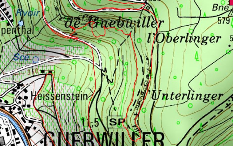
"superbe exploration du coté de Gueb"
22-17°C 71-62°F 27 km 17 miles, 2h30 Elev.Gain 550 m 1800 feet
 :IGN:
:IGN:
15 MTB (Alain, Bernard, Christophe, Claude, Denis, Gilles, Jean Z, Jean-Claude, Julien, Laurent, Luc, Michel, Pascal, Romuald, Thierry)
Guebwiller - .... - col du Bannstein - Val du Patre - Orschwihr - Bergholtz-Zell - Guebwiller.
April 17, 2014
"Belle balade avant un WE mouillé"
17°C 62°F (i) 30 km 19 miles, 2h00 Elev.Gain 550 m 1800 feet
18 MTB (Belmiro, Bernard, Christian, Christophe, Claude, Denis, 2 Eric, Fabien, Franck, Georges, Gilles, Jean, Jean-Claude, Julien, Luc, Michel, Thierry )
Waldeck (Mulhouse) - Waldeck - Flaxlanden - Zillisheim - Bruebach - Waldeck.

