
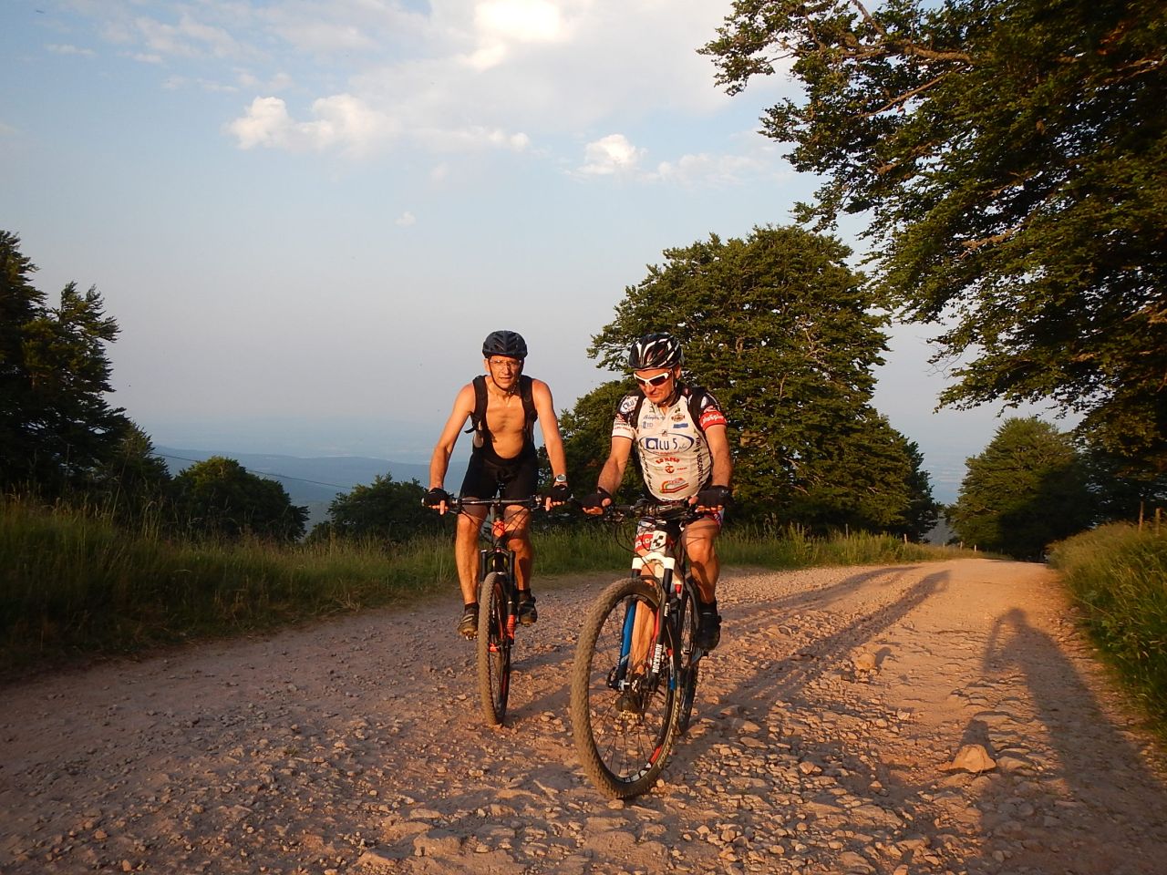
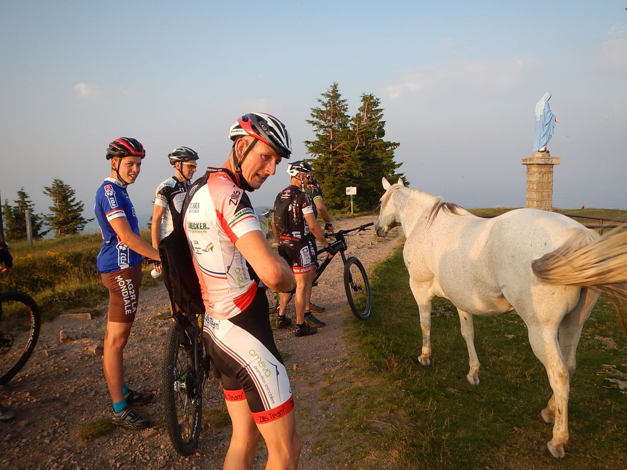
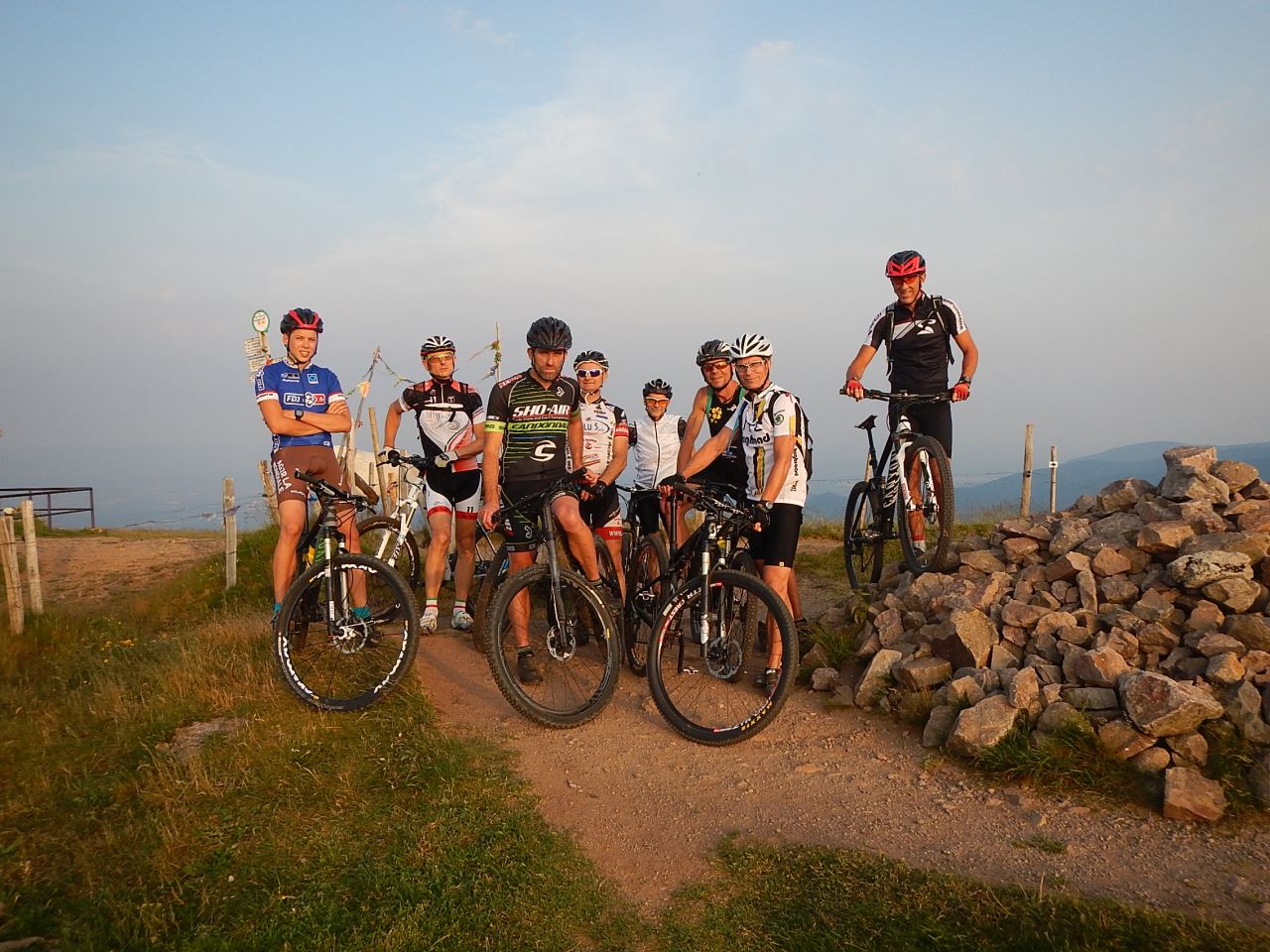
03/09/2015
"die Letzte - dernière"
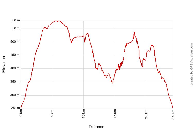
 21-19°C
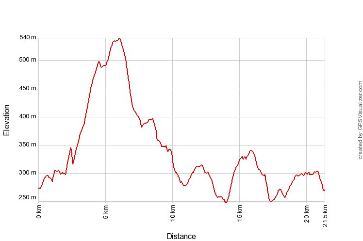
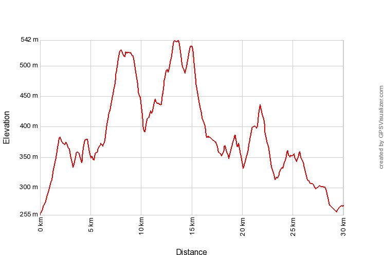
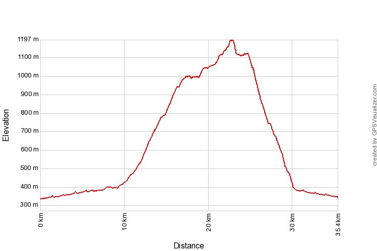
21 km, 1h50 Hm 550 m


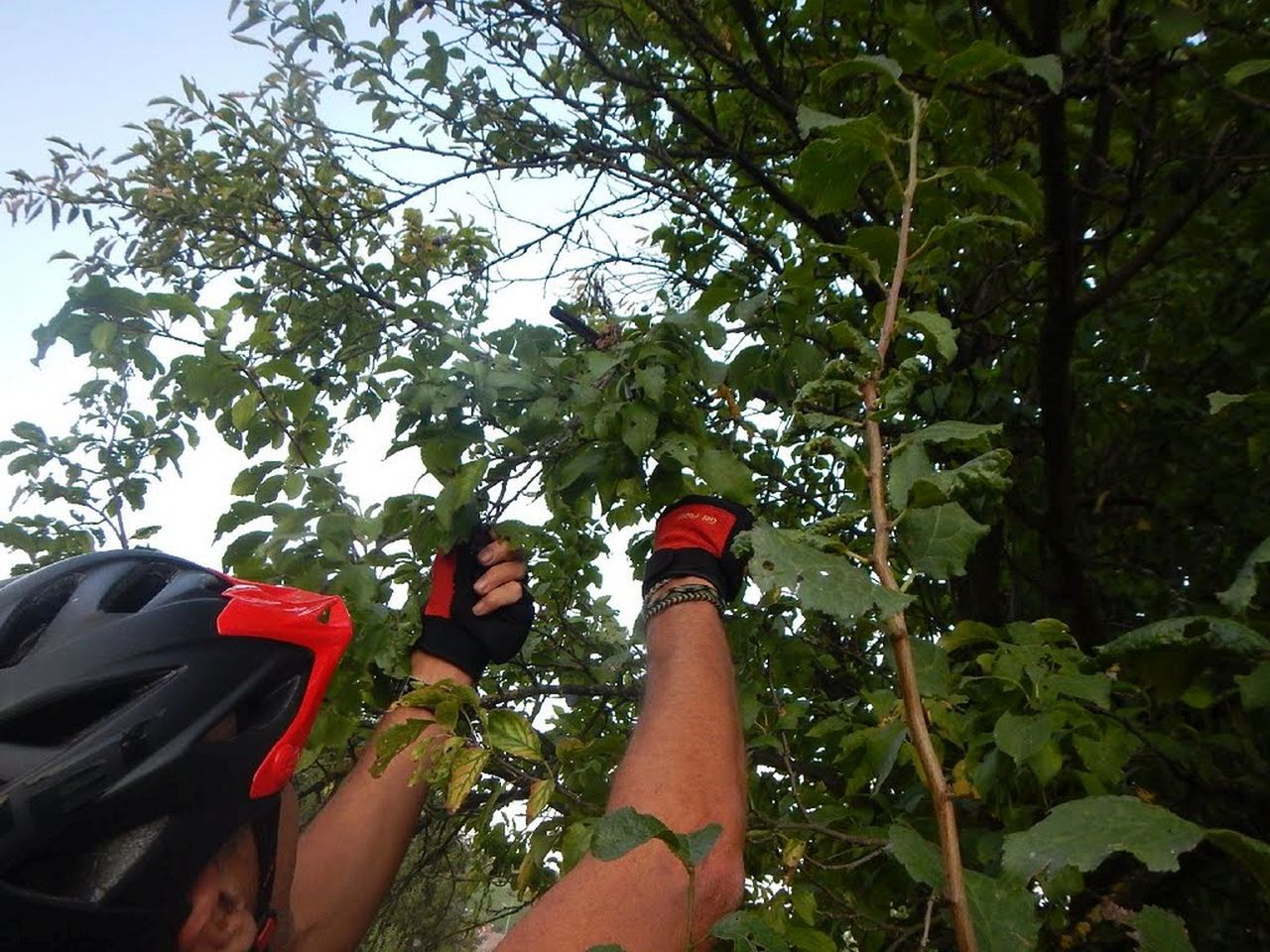
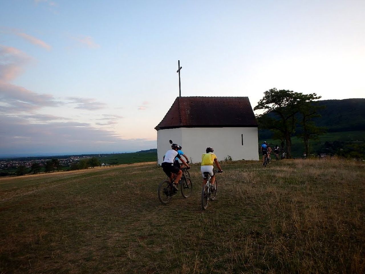
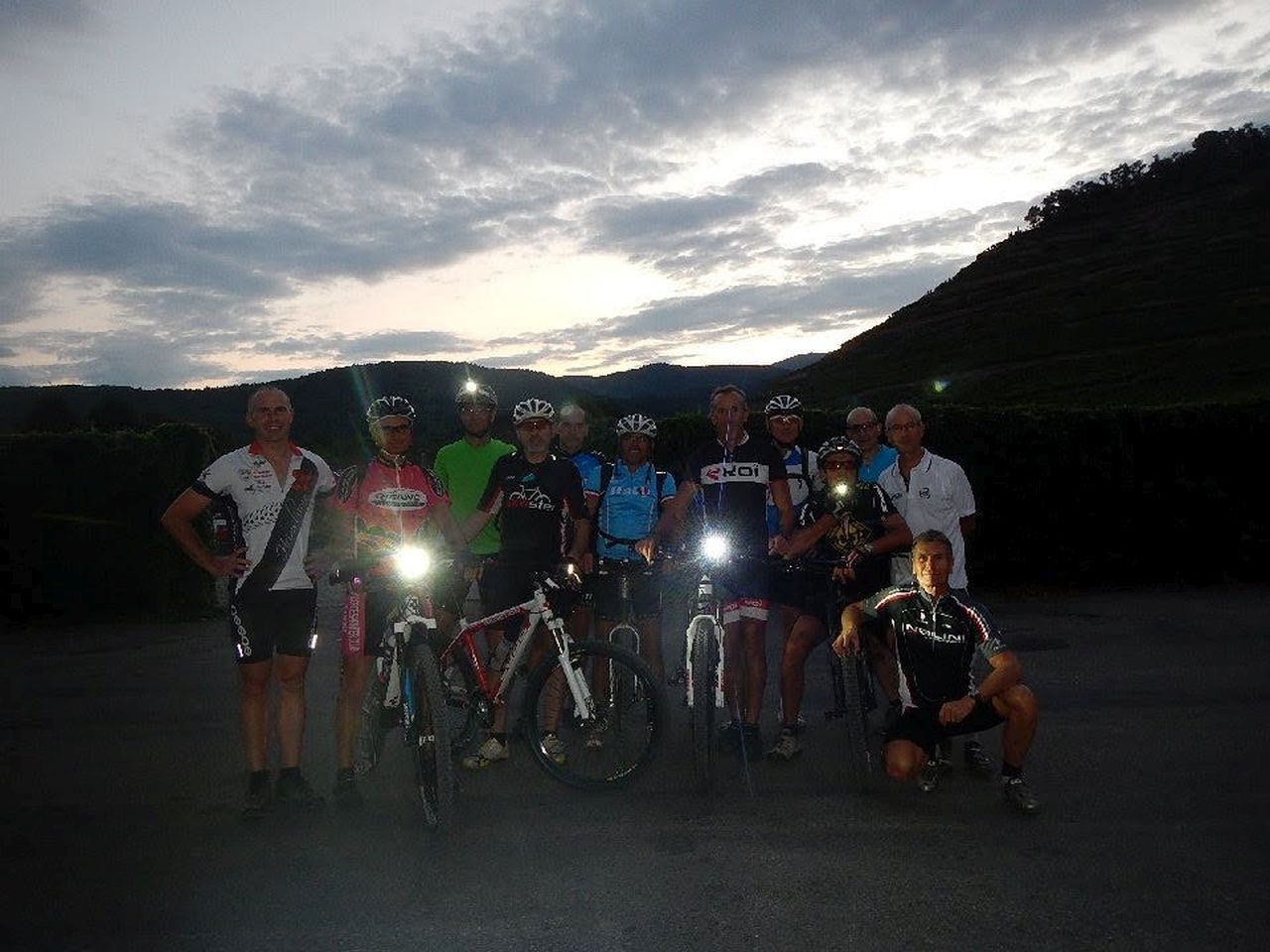
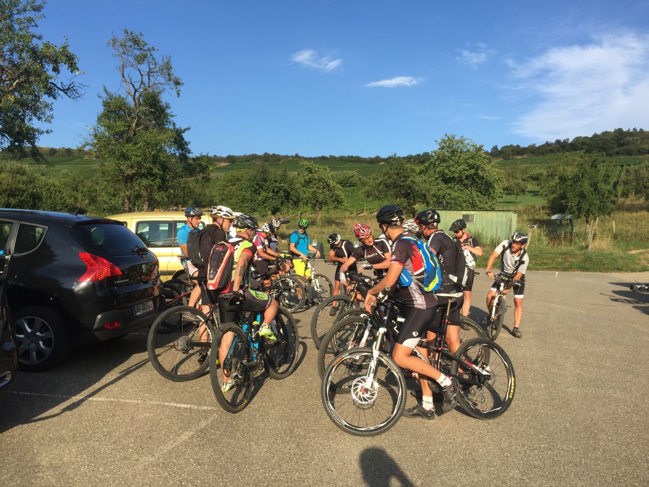
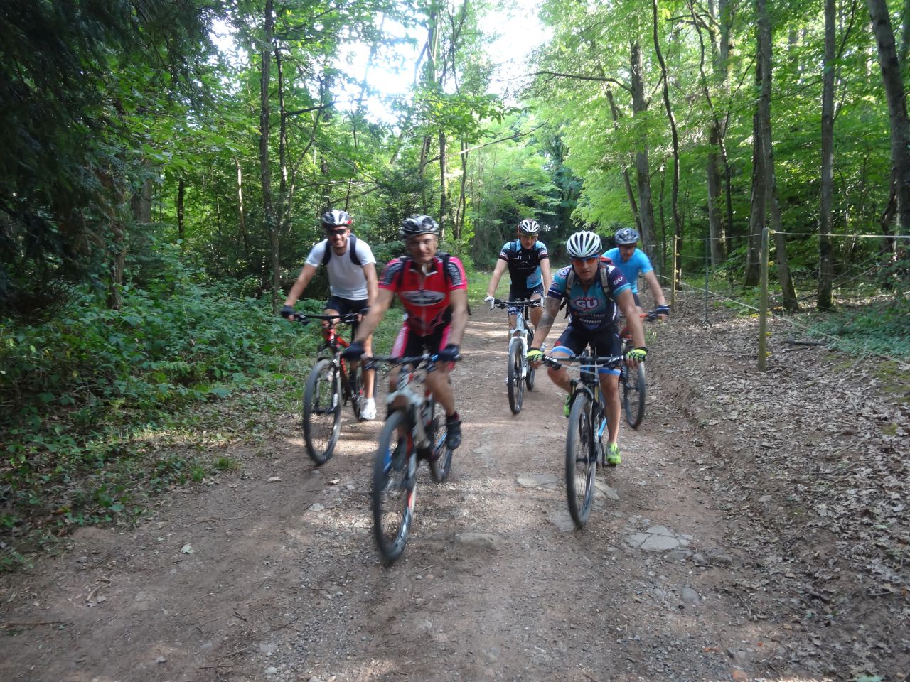
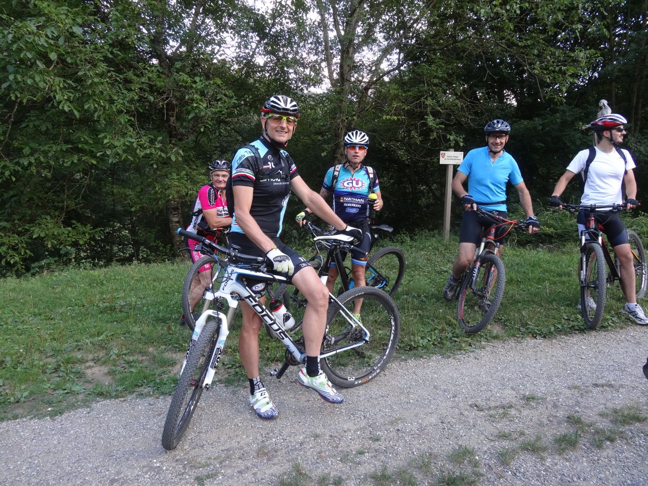
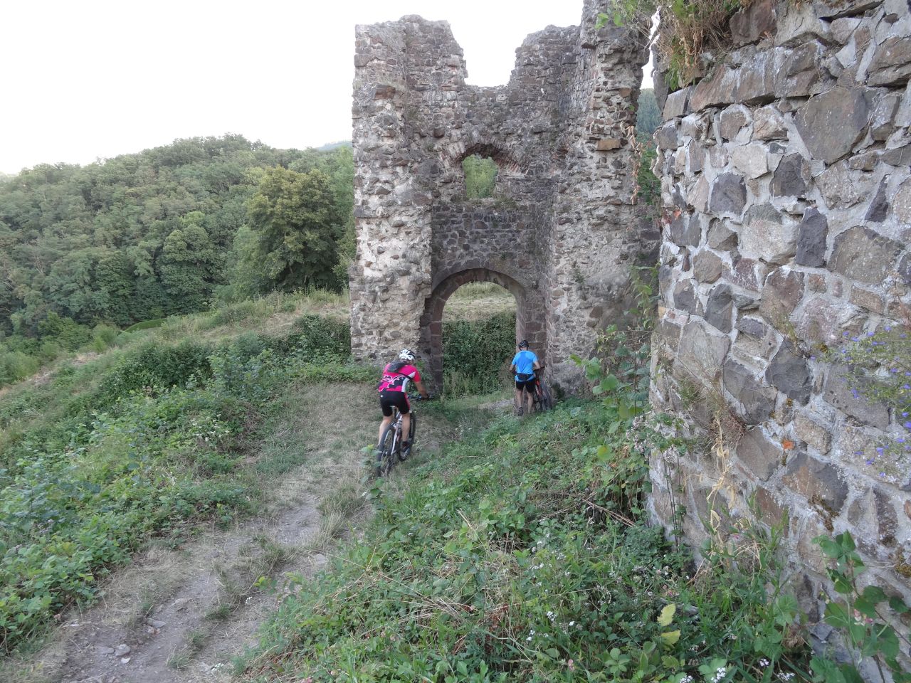
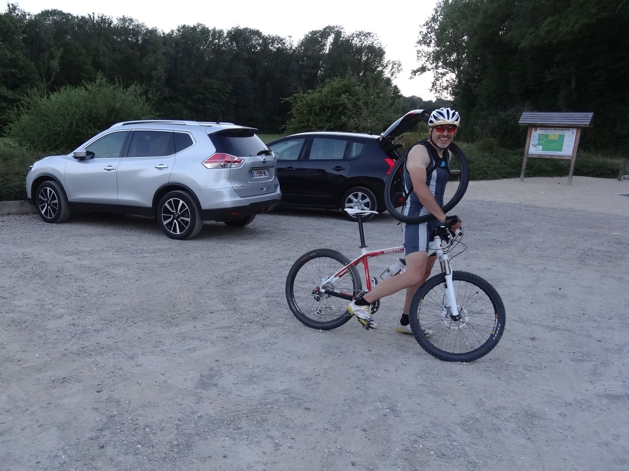
12 MTB (Bernard, Christian, Christophe, Daniel, Denis, Georges, Gilles, Jean-Claude, Laurent, Michel, Thierry, Yves)
Guebwiller - Val du Patre (= Schaeferthal) - chapelle St Wolfgang (Orschwihr) - "Pfingstberg" Soultzmatt - Bollenberg - Orschwihr - Bergholtz-Zell - Guebwiller

 32 Fotos (G Photo)
27/08/2015
"Denis's Rhythmus - au train de Denis"
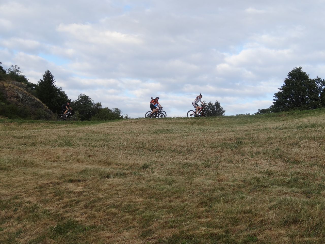
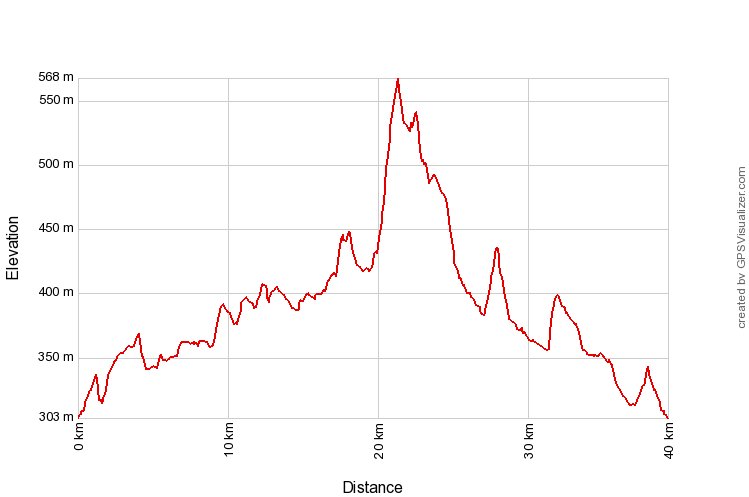
30-25°C40 km, 2h10 Hm 300 m
15 MTB (Bernard, Christophe, Claude, Denis, Eric, Fabrice, Fred, Georges, Gilles, Jean Z, Jean-Claude, Laurent, Michel, Thierry, Yves)
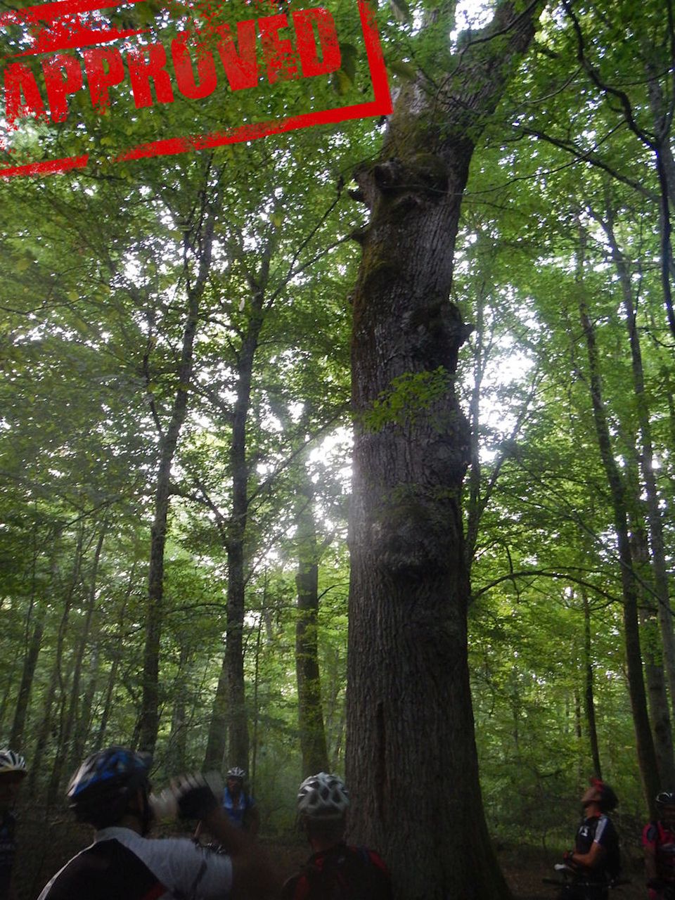
Lutterbach - Pfastatt - Reiningue - Heimsbrunn - Chêne St Louis (700 ans) - Rittweiher - Morschwiller - Reiningue - Lutterbach
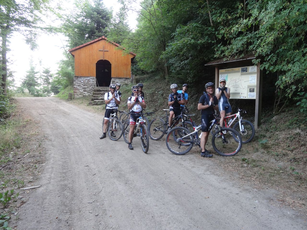
20/08/2015
"ruhig - parcours tranquille"
24-22°C24 km, 2h00 Hm 670 m
17 MTB (Bernard, Christophe, Claude, Denis, 2 Eric, Fred, Georges, Gilles, Jean Z, Jean-Claude, Laurent, Michel, Pascal, Romuald, Thierry, Thomas)
Westhalten - Heiliger Baum (575m) - Gueberschwihr - abbaye de Marbach (Voegtlinshoffen) - Gueberschwihr - ND de Schauenberg - Westhalten

06/08/2015
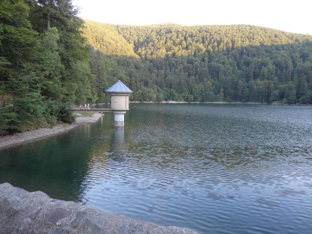
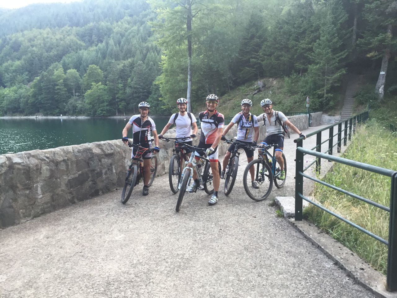
"Belchensee - lac du Ballon"
36-28°C28 km, 2h30 Hm 750 m
6 MTB (Bernard, Christophe, Gabriel, Gilles, Michel, Pascal)
Guebwiller - Schweighouse - Lautenbach - Lautenbach Zell - Gustiberg - lac du Ballon - Gustiberg - Sengern - Lautenbach Zell - Buhl - Guebwiller

30/07/2015
"Hugstein"
 22-17°C
30 km, 2h30 Hm 800 m
6 MTB (Bernard, Christophe, Gabriel, Jean-Claude, Michel, Pascal)
Hartmannswiller - Thierenbach - Sainte-Anne - Rimbach-Zell - Bildstoeckle - St Barnabé - Hugstein - Nez de Soultz - Wuenheim - Hartmannswiller.
23/07/2015
"Alles Gute zum Geburtstag, Claude - bon anniversaire Claude"
26-24°C28 km, 2h30 ? Hm 650 m
8 MTB (Bernard, Claude, Christophe, Fred, Georges, Gilles, Jean Z, Michel)
Vieux-Thann - Bitschwiller - Willer-sur-Thur - Freundstein - Camp Turenne - Waldkapelle - croix du Rangen - chapelle St Urbain - Vieux-Thann

Kommentar:
- wie am 26.05.2005
- Danke Fred für die Datei (.fit)
- Schöne Ferien!!!
16/07/2015
"Dürre im Elsass - sécheresse en Alsace"
34-27°C40 km, 2h30 Hm 550 m
9 MTB (Bernard, Claude, Christophe, Denis, Fred, Gilles, Jean Z, Jean-Claude, Michel)
18h30 Schweighouse - Michelbach - Guewenheim - Lauw - Masevaux - Gros Chêne - Knapphutte - Bourbach-le-Bas - Sentheim - Guewenheim - Michelbach - Aspach-le-Bas - Schweighouse

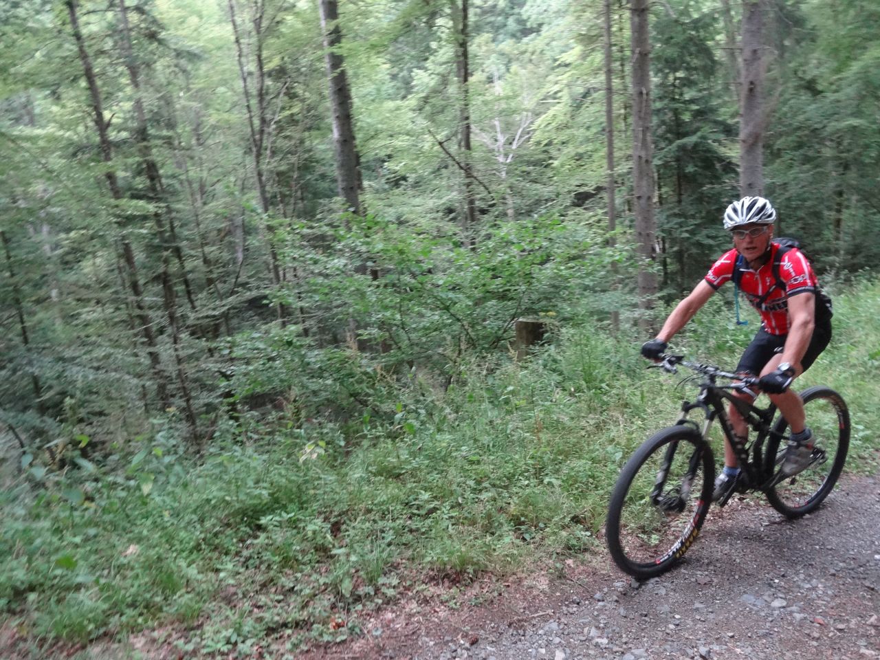
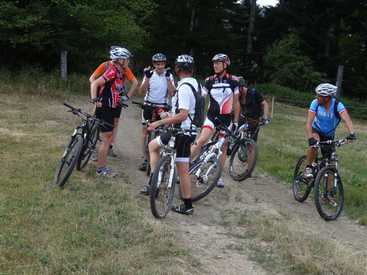
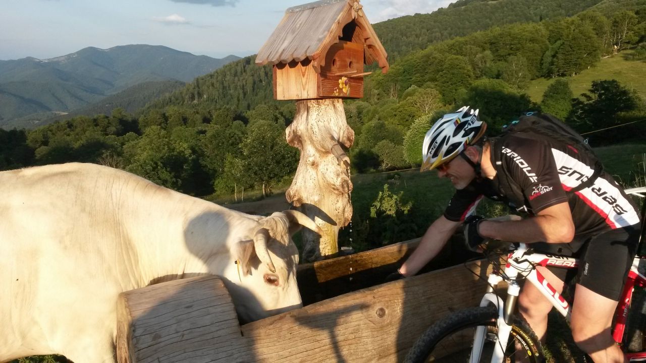
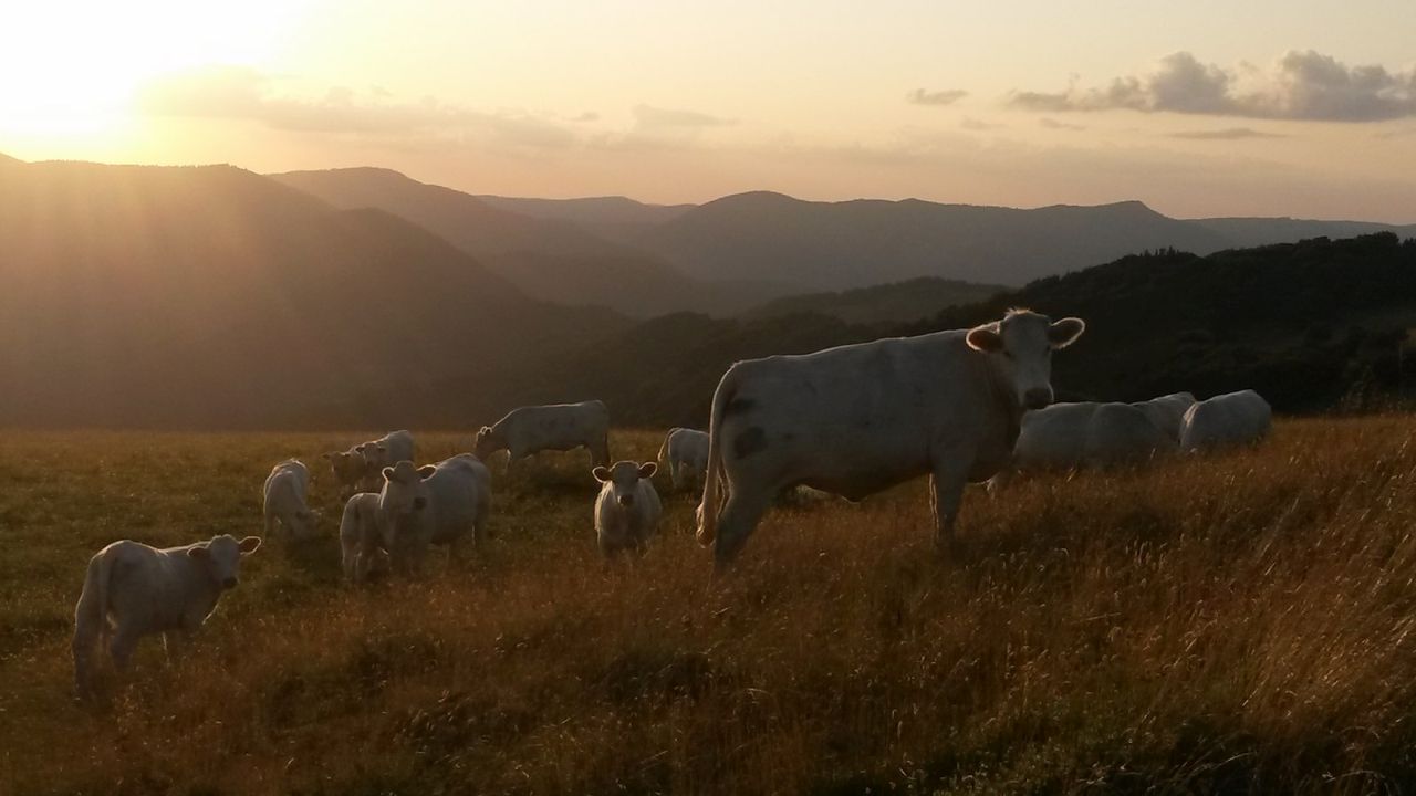
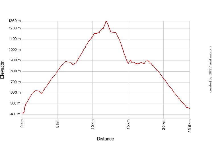
09/07/2015
"Belacker, Gsang und Rossberg"
22-19°C34 km, 3h00 Hm 950 m
10 MTB (Claude, Christophe, Denis, Georges, Gilles, Jacques, Jean-Claude, Michel, Thierry, Thomas)
Thann - Bitschwiller-les-Thann - Willer-sur-Thur - Moosch - Dreimarkstein - Belacker - Gsang - Rossberg - Thanner Hubel - Bitschwiller-les-Thann - Thann.
Christophe:

Thierry:


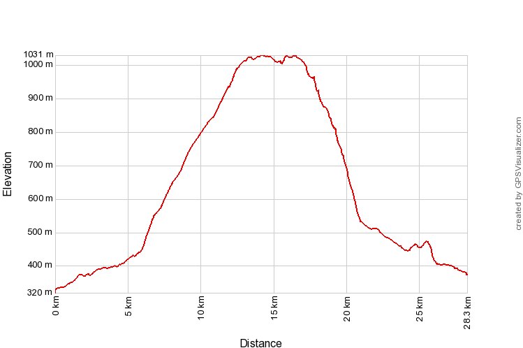
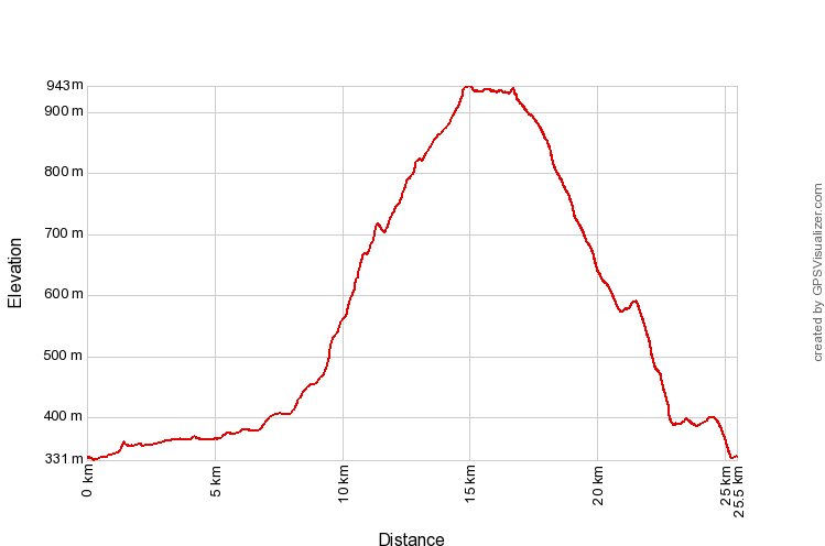
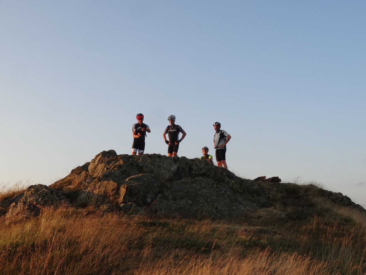
02/07/2015
"38°C heute Abend - 38°C le soir"
38-31°C22 km, 2h25 Hm 950 m
9 MTB (Christophe, Daniel, Gilles, Jacques, Jean-Claude, Michel, Stef, Thierry, Yves)
Lautenbach - Boenlesgrab - Strohberg - Petit Ballon - Strohberg - Drei Schoepf - Boenlesgrab - Lautenbach

 und vorher?